
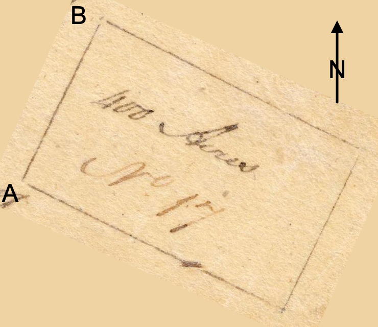
On 17 Jan 1783, John Handley surveyed 400 acres for Jesse Rude along Long Lick Creek. Rude received a deed to the tract on 16 Feb 1785. The plat drawing has been rotated to more correctly orient it. A discussion of the relationship of this survey with adjacent ones may be found on another page.
Jesse Rude's heirs would sell this land to Adam Shepherd in 1792.
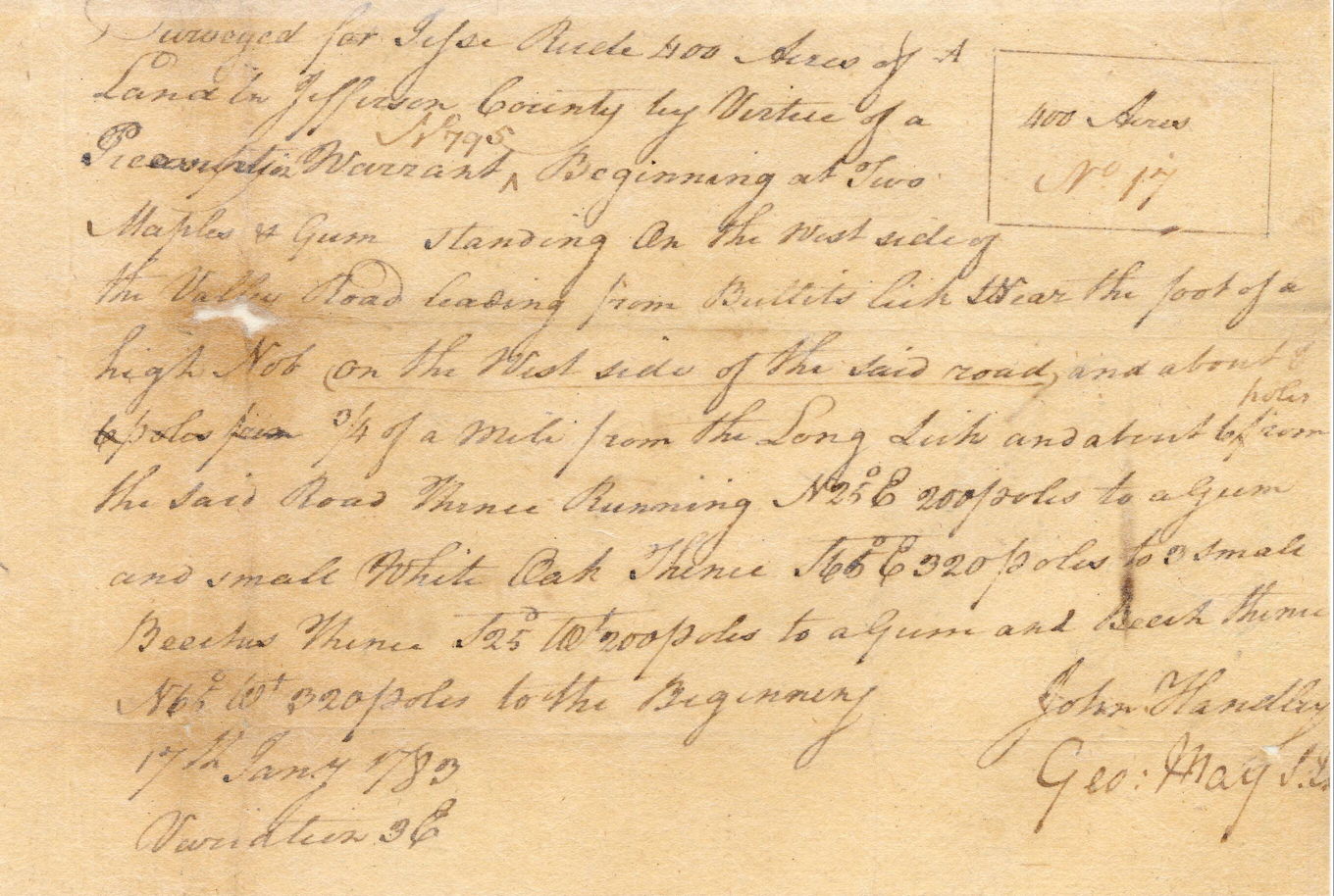
Survey
"Surveyed for Jesse Rude 400 acres of land in Jefferson County by virtue of a presumption warrant No. 795. Beginning at two maples & gum standing on the west side of the Valley Road leading from Bullits Lick near the foot of a high nob on the west side of the said road and about 3/4 of a mile from the Long Lick and about 6 poles from the said road thence running N 25 E 200 poles to a gum and small white oak, thence S 65 E 320 poles to 3 small beeches, thence S 25 W 200 poles to a gum and beech, thence N 65 W 320 poles to the beginning. 17 Jan 1783. John Handley, surveyor.
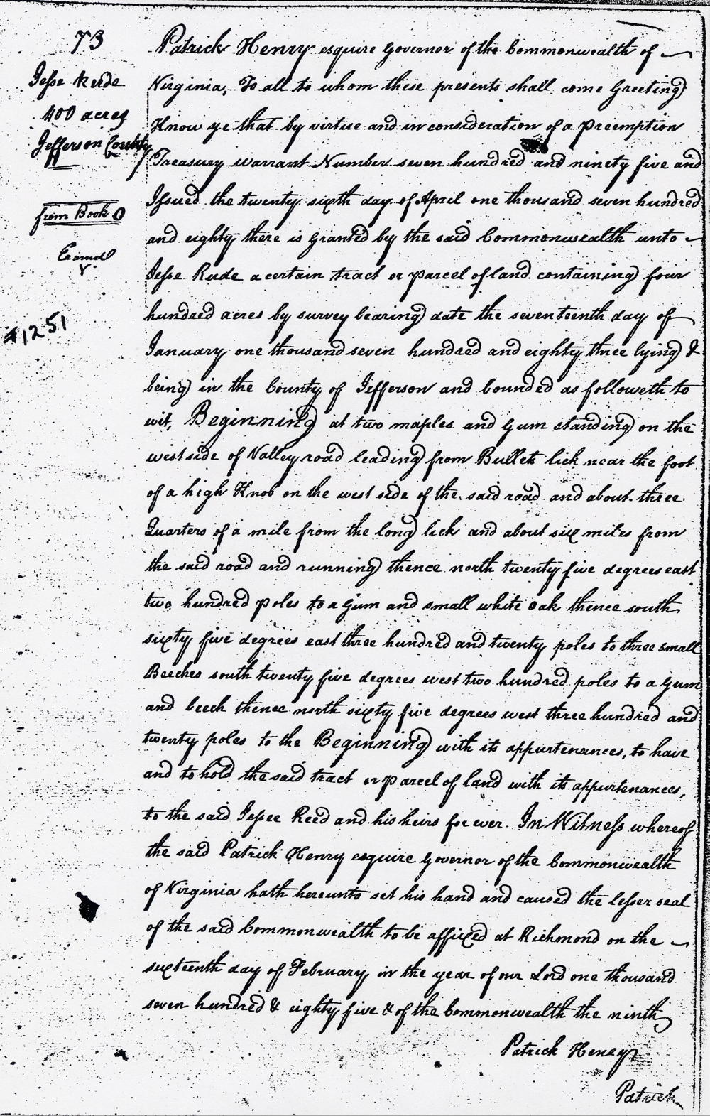
Deed
Virginia Grant Book 5, Page 73
Patrick Henry Esquire, Governor of the Commonwealth of Virginia, to all to whom these presents shall come, greeting. Know ye that by virtue and in consideration of a presumption treasury warrant number seven hundred and ninety five and issued the twenty sixth day of April one thousand seven hundred and eighty there is granted by the said Commonwealth unto Jesse Rude a certain tract or parcel of land containing four hundred acres by survey bearing date the seventeenth day of January one thousand seven hundred and eighty three lying and being in the county of Jefferson and bounded as followeth to wit. Beginning at two maples and gum standing on the west side of Valley road leading from Bullets lick near the foot of a high knob on the west side of the said road and about three quarters of a mile from the long lick and about six miles [poles] from the said road and running thence north twenty five degrees east two hundred poles to a gum and small white oak, thence south sixty five degrees east three hundred and twenty poles to three small beeches, south twenty five degrees west two hundred poles to a gum and beech, thence north sixty five degrees west three hundred and twenty poles to the Beginning with its appurtenances, to have and to hold the said tract or parcel of land with its appurtenances to the said Jessee Reed and his heirs forever. In witness whereof the said Patrick Henry Esquire, Governor of the Commonwealth of Virginia hath hereunto set his hand and caused the lesser seal of the said Commonwealth to be affixed at Richmond on the sixteenth day of February in the year of our Lord one thousand seven hundred and eighty five and of the Commonwealth the ninth. (signed) Patrick Henry
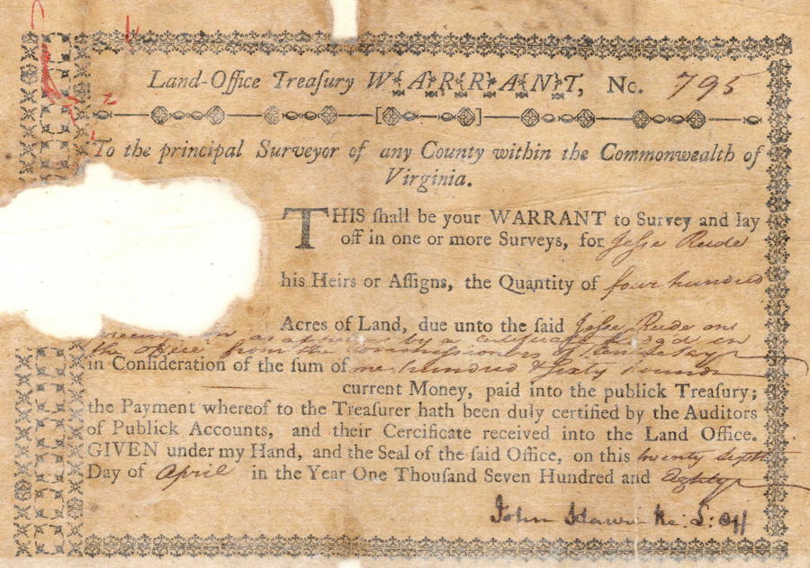
Warrant
If you, the reader, have an interest in any particular part of our county history, and wish to contribute to this effort, use the form on our Contact Us page to send us your comments about this, or any Bullitt County History page. We welcome your comments and suggestions. If you feel that we have misspoken at any point, please feel free to point this out to us.
The Bullitt County History Museum, a service of the Bullitt County Genealogical Society, is located in the county courthouse at 300 South Buckman Street (Highway 61) in Shepherdsville, Kentucky. The museum, along with its research room, is open 10 a.m. to 4 p.m. Monday through Friday. Saturday appointments are available by calling 502-921-0161 during our regular weekday hours. Admission is free. The museum, as part of the Bullitt County Genealogical Society, is a 501(c)3 tax exempt organization and is classified as a 509(a)2 public charity. Contributions and bequests are deductible under section 2055, 2106, or 2522 of the Internal Revenue Code. Page last modified: 04 Sep 2025 . Page URL: bullittcountyhistory.org/bchistory/jessereede400.html