
On 7 May 1792, John Ray surveyed 400 acres for himself along Crooked Creek adjacent to Thomas Collings' tract. He received a deed for the tract on 16 Aug 1798. In 1811, the eastern half of the tract was sold to William Ray who proceeded to sell part of it to Royal Glass and the other part to Henry Hart. Then in 1814, Elisha Ray, as executor of the deceased John Ray, and Sarah Ray, John's widow sold part of the remaining half to William Shain and the remainder to Henry Hart.
Survey
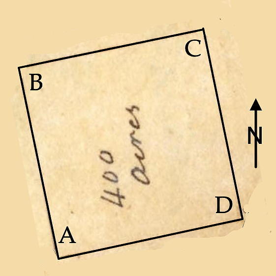
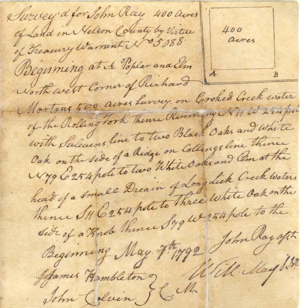
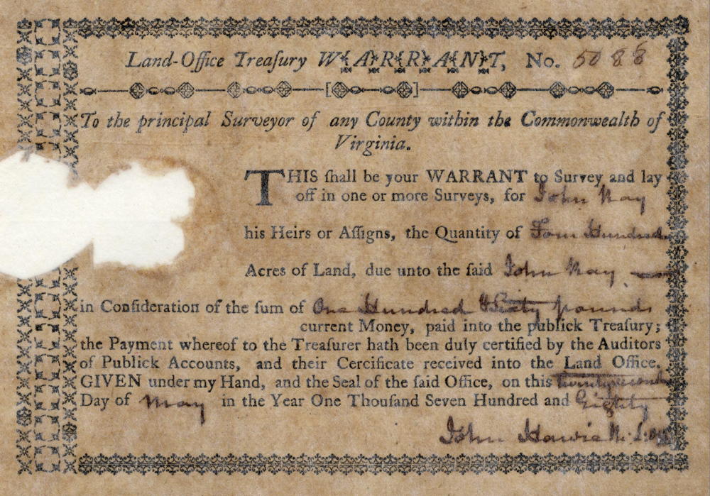
Surveyed for John Ray 400 acres of land in Nelson County by virtue of treasury warrant No. 5088. Beginning at [A] poplar and elm northwest corner of Richard Monton's 500 acre survey on Crooked Creek water of the Rolling Fork, thence running North 11° West 254 poles with Sullivan's line to [B] two black oaks and white oak on the side of a ridge on Collings' line, thence North 79° East 254 poles to [C] two white oaks and elm at the head of a small drain of Long Lick Creek waters, thence South 11° East 254 poles to [D] three white oak on the side of a knob, thence South 79° West 254 poles to the beginning. May 7th 1792. John Ray, surveyor. James Hambleton and John Colvin, chain carriers.
Deed
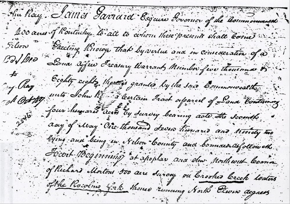
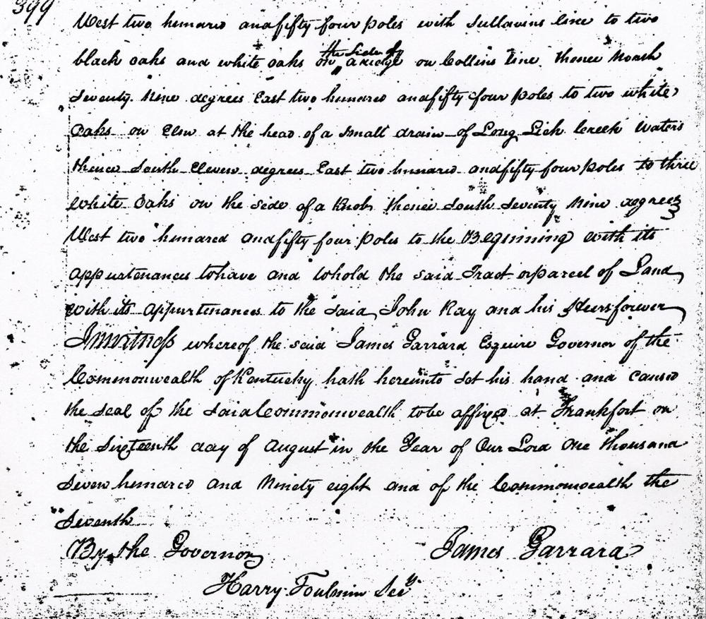
James Garrard Esquire, Governor of the Commonwealth of Kentucky, to all to whom these presents shall come, greeting. Know ye that by virtue and in consideration of a land office treasury warrant No. 5088 there is granted by the said Commonwealth unto John Ray a certain tract or parcel of land containing 400 acres by survey bearing date the 7th day of May 1792, lying and being in the county of Nelson and bounded as followeth to wit. Beginning at a poplar and elm northwest corner of Richard Monton's 500 acre survey on Crooked Creek water of the Rolling Fork, thence running North 11° West 254 poles with Sullivan's line to two black oaks and white oak on the side of a ridge on Collins' line, thence North 79° East 254 poles to two white oaks and elm at the head of a small drain of Long Lick Creek waters, thence South 11° East 254 poles to three white oak on the side of a knob, thence South 79° West 254 poles to the beginning with its appurtenances to have and to hold the said tract or parcel of land with its appurtenances to the said John Ray and his heirs forever. In witness whereof the said James Garrard Esquire, Governor of the Commonwealth of Kentucky, hath hereunto set his hand and caused the seal of the said Commonwealth to be affixed at Frankfort on the 16th day of August in the year of our Lord 1798 and of the Commonwealth the 7th. (signed) James Garrard
Warrant
If you, the reader, have an interest in any particular part of our county history, and wish to contribute to this effort, use the form on our Contact Us page to send us your comments about this, or any Bullitt County History page. We welcome your comments and suggestions. If you feel that we have misspoken at any point, please feel free to point this out to us.
The Bullitt County History Museum, a service of the Bullitt County Genealogical Society, is located in the county courthouse at 300 South Buckman Street (Highway 61) in Shepherdsville, Kentucky. The museum, along with its research room, is open 10 a.m. to 4 p.m. Monday through Friday. Saturday appointments are available by calling 502-921-0161 during our regular weekday hours. Admission is free. The museum, as part of the Bullitt County Genealogical Society, is a 501(c)3 tax exempt organization and is classified as a 509(a)2 public charity. Contributions and bequests are deductible under section 2055, 2106, or 2522 of the Internal Revenue Code. Page last modified: 21 Apr 2026 . Page URL: bullittcountyhistory.org/bchistory/ok2546-john-ray.html