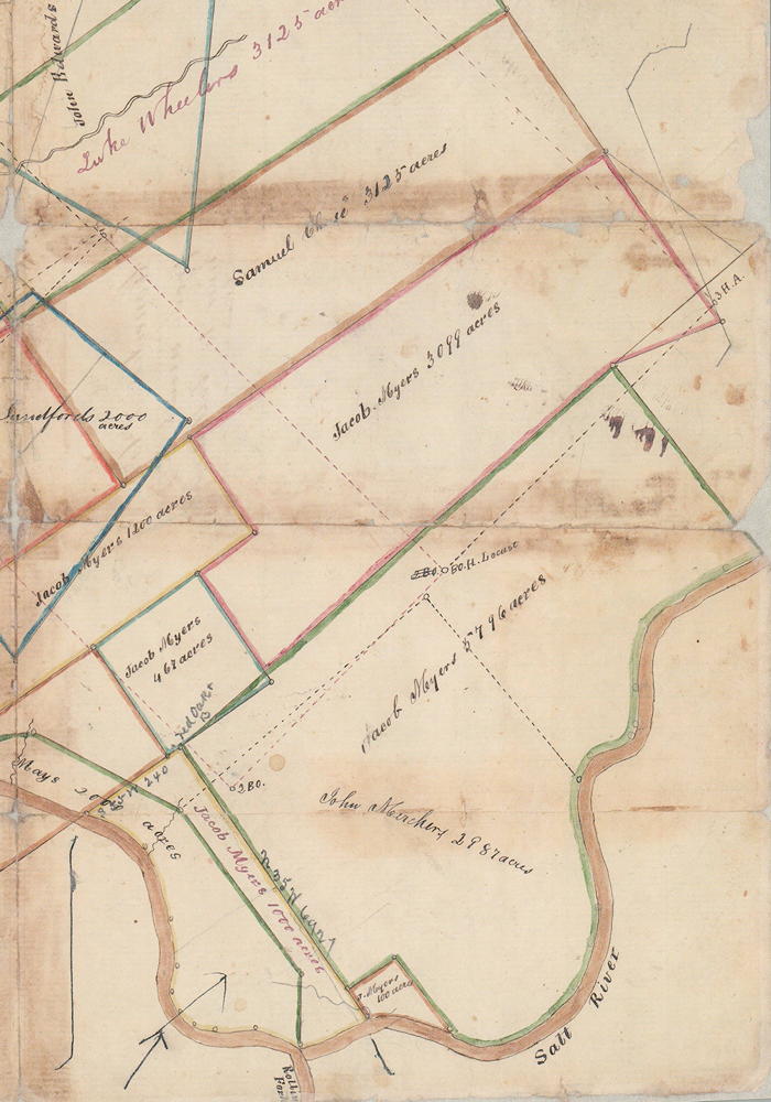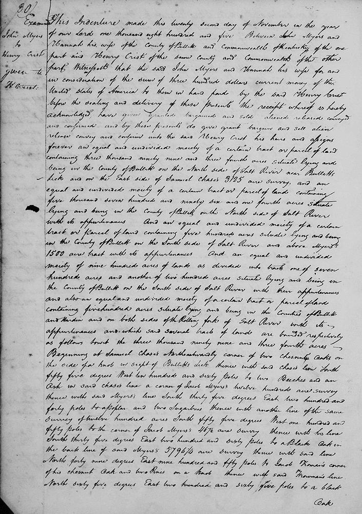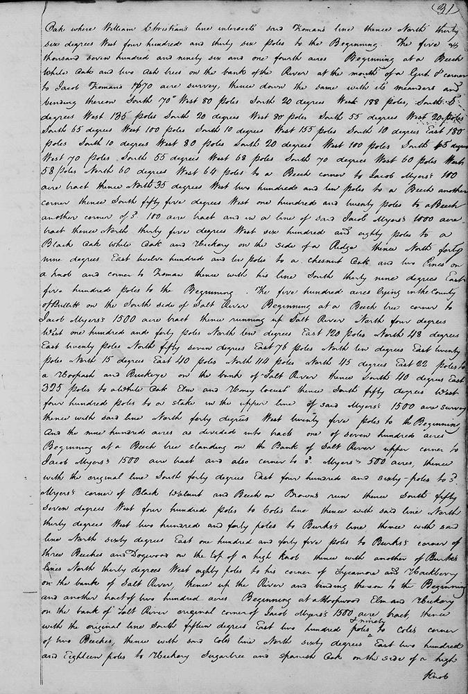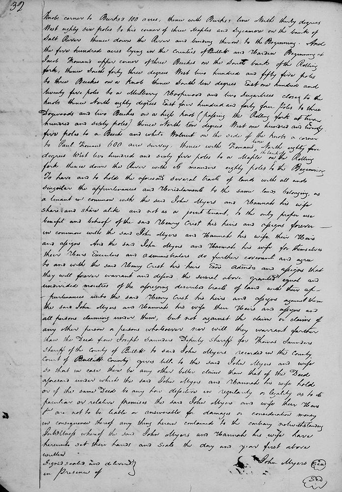
On 22 Nov 1805, Henry Crist and John Myers entered into a arrangement whereby Myers sold equal ownership of multiple sites to Crist, as described below. These tracts of land were scattered another the county, one even crossing the Rolling Fork into Hardin County. This excerpt from T.C. Carroll Plat 259-25b should be useful as you read the deed transcription below it.

Bullitt County Deed Book B, Pages 30-33
This indenture made this 22nd day of November in the year of our Lord 1805 between John Myers and Hannah his wife of the county of Bullitt and Commonwealth of Kentucky of the one part and Henry Crist of the same county and Commonwealth of the other part.
Witnesseth that the said John Myers and Hannah his wife for and in consideration of the sum of $300 current money of the United States of America to them in hand paid by the said Henry Crist before the sealing and delivery of these presents, the receipt whereof is hereby acknowledged, have given, granted, bargained and sold, aliened, released, conveyed and confirmed, and by these presents do give, grant, bargain and sell, alien, release, convey and confirm unto the said Henry Crist, his heirs and assigns forever an equal and undivided moiety of a certain tract or parcel of land containing 3099 3/4 acres situate lying and being in the county of Bullitt on the north side of Salt River near Bullitt's Lick, and on the east side of Samuel Chase's 3125 acre survey, and an equal and undivided moiety of a certain tract or parcel of land containing 5796 1/4 acres situate lying and being in the county of Bullitt on the north side of Salt River with its appurtenances. And an equal and undivided moiety of a certain tract or parcel of land containing 500 acres situate lying and being in the county of Bullitt on the south side of Salt River and above Myers' 1500 acre tract with its appurtenances. And an equal and undivided moiety of 900 acres of land as divided into tracts, one of 700 acres and another of 200 acres situate lying and being in the county of Bullitt on the south side of Salt Rvier with their appurtenances, and also an equal and undivided moiety of a certain tract or parcel of land containing 500 acres situate lying and being in the counties of Bullitt and Hardin and on both sides of the Rolling Fork of Salt River with its appurtenances, and which said several tracts of land are bounded respectively as follows, to wit.
The 3099 3/4 acres, beginning at Samuel Chase's northwestwardly corner of two chestnut oaks on the side of a knob in sight of Bullitt's Lick, thence with said Chase's line South 55° West 1060 poles to two beeches and an ash in said Chase's line, a corner of Jacob Myers' 1200 acre survey, thence with said Myers' line South 35° East 240 poles to a poplar and two sugar trees, thence with another line of the same survey of 1200 acres South 55° West 150 poles to the corner of Jacob Myers' 467 1/2 acre survey, thence wit his line South 35° East 260 poles to a black oak in the back line of said Myers' 5796 1/4 acre survey, thence with said line North 49° East 950 poles to Jacob Froman's corner of this chestnut oak and two pines on a knob, thence with said Froman's line North 65° East 260 poles to a black oak where William Christian's line intersects said Froman's line, thence North 36° West 436 poles to the beginning.
The 5796 1/4 acres, beginning at a beech, white oak and two ash trees on the bank of the river at the the mouth of a gut and corner to Jacob Froman's 1670 acre survey, thence down the same with its meanders and binding thereon South 70° West 80 poles, South 20° West 188 poles, South 5° West 135 poles, South 20° West 80 poles, South 55° West 20 poles, South 65° West 100 poles, South 10° West 155 poles, South 10° East 180 poles, South 10° West 80 poles, South 20° West 100 poles, South 15° West 70 poles, South 55° West 68 poles, South 70° West 60 poles, West 58 poles, North 60° West 64 poles to a beech, corner to Jacob Myers' 100 acre tract, thence North 35° West 210 poles to a beech, another corner, thence South 55° West 120 poles to a beech, another corner of said 100 acre tract and in a line of said Jacob Myers' 1000 acre tract, thence North 35° West 680 poles to a black oak, white oak and hickory on the side of a ridge, thence North 49° East 1210 poles to a chestnut oak and two pines on a knob and corner to Froman, thence with his line South 39° East 500 poles to the beginning.
The 500 acres lying in the county of Bullitt on the south side of Salt River, beginning at a beech tree, corner to Jacob Myers' 1500 acre tract, thence running up Salt River North 4° West 140 poles, North 10° East 120 poles, North 48° East 20 poles, North 57° East 76 poles, North 10° East 20 poles, North 15° East 40 poles, North 114 poles, North 45° East 22 pols to a hoop ash and buckeye on the bank of Salt River, thence South 40° East 325 poles to a white oak, elm and honey locust, thence South 50° West 400 poles to a stake in the upper line of said Myers' 1500 acre survey, thence with said line North 40° West 25 poles to the beginning.
And the 900 acres as divided into tracts, one of 700 acres, beginning at a beech tree standing on the bank of Salt River, upper corner to Jacob Myers' 1500 acre tract, and also corner to said Myers' 500 acres, thence with the original line South 40° East 460 poles to said Myers' corner of black walnut and beech on Brown's Run, thence South 57° West 400 poles to Cole's line, thence with said line North 30° West 240 poles to Burks' line, thence with said line North 60° East 145 poles to Burks' corner of three beeches and dogwood on the top of a high knob, thence with another of Burks' lines North 30° West 80 poles to his corner of sycamore and hackberry on the bank of Salt River, thence up the river and binding thereon to the beginning.
And another tract of 200 acres beginning at a hoopwood, elm and hickory on the bank of Salt River, original corner of Jacob Myers' 1500 acre tract, thence with the original line South 15° East 290 poles to Cole's corner of two beeches, thecne with said Cole's line North 60° East 218 poles to hickory, sugar tree and Spanish oak on the side of a high knob, corner to Burks' 100 acres, thence with Burks' line North 30° West 86 poles to his corner of three maples and sycamore on the bank of Salt River, thence down the river and binding thereon to the beginning.
And the 500 acres lying in the counties of Bullitt and Hardin, beginning at Jacob Froman's upper corner of three beeches on the south bank of the Rolling Fork, thence South 43° West 255 poles to three beeches on a knob, thence South 10° EAst 125 poles to a mulberry, hoopwood and two sugar trees close to the knobs, thence North 80° East 444 poles to three dogwoods and two beeches on a high knob (passing the Rolling Fork at 260 poles), thence North 10° West 125 poles to a beech and white walnut on the side of the knobs, a corner to Paul Froman's 600 acre survey, thence with Froman's line North 85° West 265 poles to a maple on the bank of the Rolling Fork, thence down the river with its meanders 80 poles to the beginning.
To have and to hold the aforesaid several tracts of land with all and singular the appurtenances and hereditaments to the same lands belonging as a tenant in common with the said John Myers and Hannah his wife, share and share alike, and not as a joint tenant, to the only proper use, benefit and behoof of the said Henry Crist, his heirs and assigns forever in common with the said John Myers and Hannah his wife, their heirs and assigns. And the said John Myers and Hannah his wife for themselves, their heirs, executors and administrators do further covenant and agree to and with the said Henry Crist, his heirs, executors, administrators and assigns that they will forever warrant and defend the several above granted equal and undivided moieties of the aforegoing described tracts of land with their appurtenances unto the said Henry Crist, his heirs and assigns against them the said John Myers and Hannah his wife, their heirs and assigns and all persons claiming under them, but not against the claim or claims of any other person or persons whatsoever, nor will they warrant farther than the deed from Joseph Saunders, Deputy Sheriff for Thomas Saunders, Sheriff of the county of Bullitt to said John Myers, recorded in the county court of Bullitt County gives title to the said John Myers and wife, so that in case there be any other better claim than that of the deed aforesaid under which the said John Myers and Hannah his wife hold, or if the same deed be any how defective in regularity or legality as to its peculiar or relative premises, the said John Myers and wife, their heirs &c are not to be liable or answerable for damages or consideration money in consequence thereof, anything herein contained to the contrary, notwithstanding. In witness whereof the said John Myers and Hannah his wife have hereunto set their hands and seals the day and year first above written. (signed) John Myers


If you, the reader, have an interest in any particular part of our county history, and wish to contribute to this effort, use the form on our Contact Us page to send us your comments about this, or any Bullitt County History page. We welcome your comments and suggestions. If you feel that we have misspoken at any point, please feel free to point this out to us.
The Bullitt County History Museum, a service of the Bullitt County Genealogical Society, is located in the county courthouse at 300 South Buckman Street (Highway 61) in Shepherdsville, Kentucky. The museum, along with its research room, is open 10 a.m. to 4 p.m. Monday through Friday. Saturday appointments are available by calling 502-921-0161 during our regular weekday hours. Admission is free. The museum, as part of the Bullitt County Genealogical Society, is a 501(c)3 tax exempt organization and is classified as a 509(a)2 public charity. Contributions and bequests are deductible under section 2055, 2106, or 2522 of the Internal Revenue Code. Page last modified: 11 Nov 2024 . Page URL: bullittcountyhistory.org/bchistory/myers-henrycrist.html