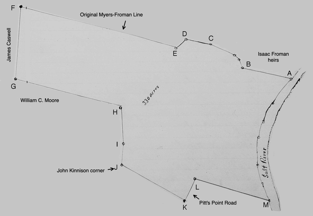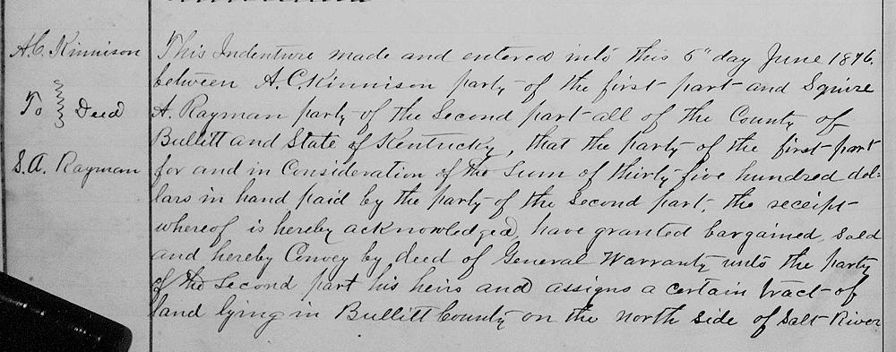
On 5 Jun 1876, A. C. Kinnison deeded 330 acres of his 500 acre tract to Squire A. Rayman, at least partly in payment of the mortgage that Rayman held on his land..
Bullitt County Deed Book V, Pages 54-55
This indenture made and entered into this 5th day June 1876, between A. C. Kinneson, party of the first part, and Squire A Rayman, party of the second part, all of the county of Bullitt and state of Kentucky; that the party of the first part for and in consideration of the sum of $3500 in hand paid by the party of the second part, the receipt whereof is hereby acknowledged, have granted, bargained, sold and hereby conveyed by deed of general warranty unto the party of the second part, his heirs and assigns, a certain tract of land lying in Bullitt County on the north side of Salt River including the improvements where said A. C. Kinnison formerly lived, and bounded as follows.
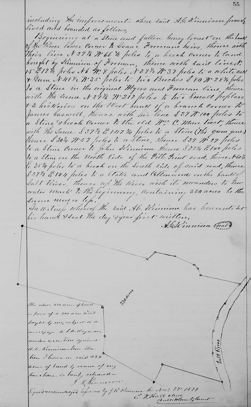
Beginning at [A] a stone and fallen honey Locust on the Bank of the river, lower corner to Isaac Froman's heirs, thence with their line North 39 1/4° West 66 2/3 poles to [B] a beech, corner to land bought by Kinnison of Froman, thence with said line North 15° East 12 2/3 poles, North 6° West 8 poles, North 37 1/2° West 37 poles to [C] a white oak and gum, North 44 1/2° West 35 poles to [D] two beeches, South 80° West 28 1/2 poles to [E] a stone in the original Myers and Froman line, thence with the same North 39 1/4° West 212 poles to [F] two small poplars and two hickory on the West Bank of a branch, corner to James Caswell, thence with his line South 39° West 100 poles to [G] a stone and beech, corner to the old William C. Moore tract, thence with the same South 39 1/2° East 147 3/4 poles to [H] a stone (gum gone), thence South 30 1/4° West 52 poles to [I] a stone, thence South 39° West 29 poles to [J] a stone, corner to John Kinnison, thence South 22 3/4° East 100 poles to [K] a stone on the North side of the Pitt's Point Road, thence North 60 1/4° East 35 1/4 poles to [L] a beech on the South side of side road, thence South 37 1/2° East 104 poles to [M] the stake and cottonwood on the bank of Salt River, thence up the river with it meanders to low water mark to [A] the beginning, containing 330 acres be the same more or less.

In witness, whereof the Kinnison has he set his hand and seal the day and year first written. (signed) A. C. Kinnison
The above 330 acres of land is part of a 500 acre tract, bought by me, subject to a mortgage to S. A. Rayman, under execution against A. C. Kinnison. Now the lien I have on said 330 acres of land by reason of my purchase is hereby released. J. R. Kinnison
Signed and acknowledged before me by J. R. Kinnison this November 27, 1877. E. W. Hall, clerk, Bullitt County Court


If you, the reader, have an interest in any particular part of our county history, and wish to contribute to this effort, use the form on our Contact Us page to send us your comments about this, or any Bullitt County History page. We welcome your comments and suggestions. If you feel that we have misspoken at any point, please feel free to point this out to us.
The Bullitt County History Museum, a service of the Bullitt County Genealogical Society, is located in the county courthouse at 300 South Buckman Street (Highway 61) in Shepherdsville, Kentucky. The museum, along with its research room, is open 10 a.m. to 4 p.m. Monday through Friday. Saturday appointments are available by calling 502-921-0161 during our regular weekday hours. Admission is free. The museum, as part of the Bullitt County Genealogical Society, is a 501(c)3 tax exempt organization and is classified as a 509(a)2 public charity. Contributions and bequests are deductible under section 2055, 2106, or 2522 of the Internal Revenue Code. Page last modified: 04 Sep 2025 . Page URL: bullittcountyhistory.org/bchistory/ackinnison-sarayman2.html