
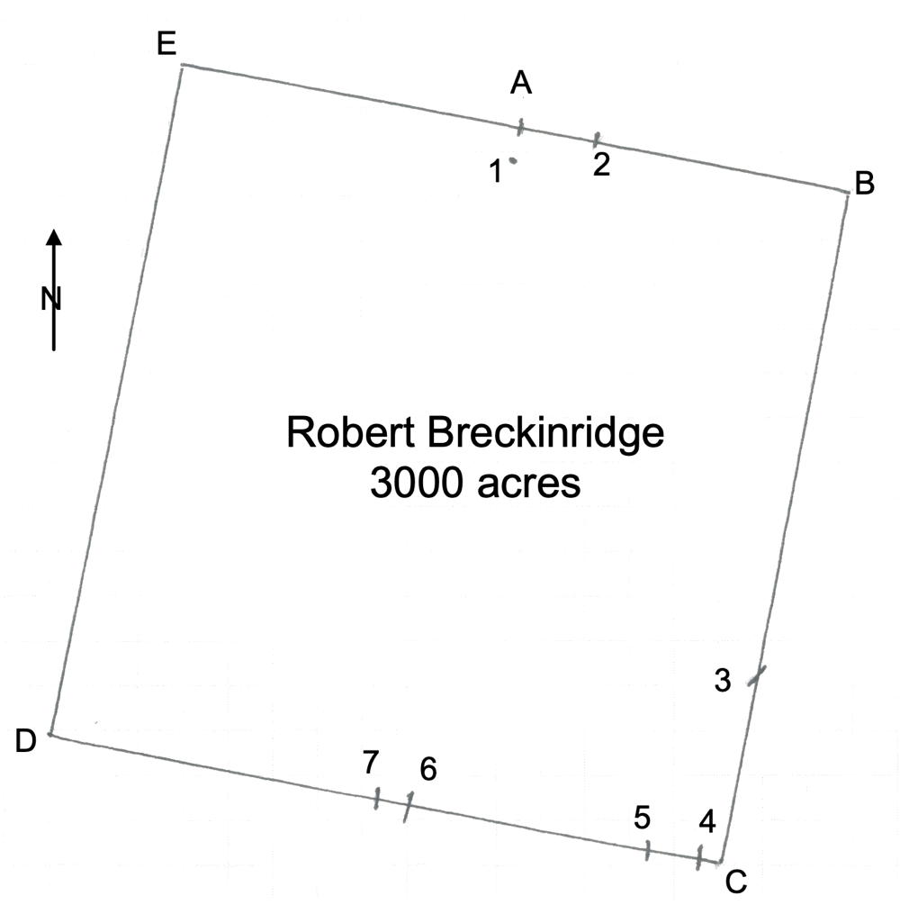
On 30 Oct 1804, James Shanks laid out a 3000 acre tract for Robert Breckinridge that overlay other tracts in the northern part of the county. This survey is historically helpful as it identifies the locations of several features. In the survey transcription below, we have added markers in red print to signify the locations of these features on the plat drawing shown here. Breckinridge received a deed for this tract on 18 Jun 1805.
Breckinridge sold a major part of this tract to Joseph Brooks in 1810.
This was #16 on the 1811 plat drawing by James Shanks, Bullitt County Surveyor, which is described on another page.
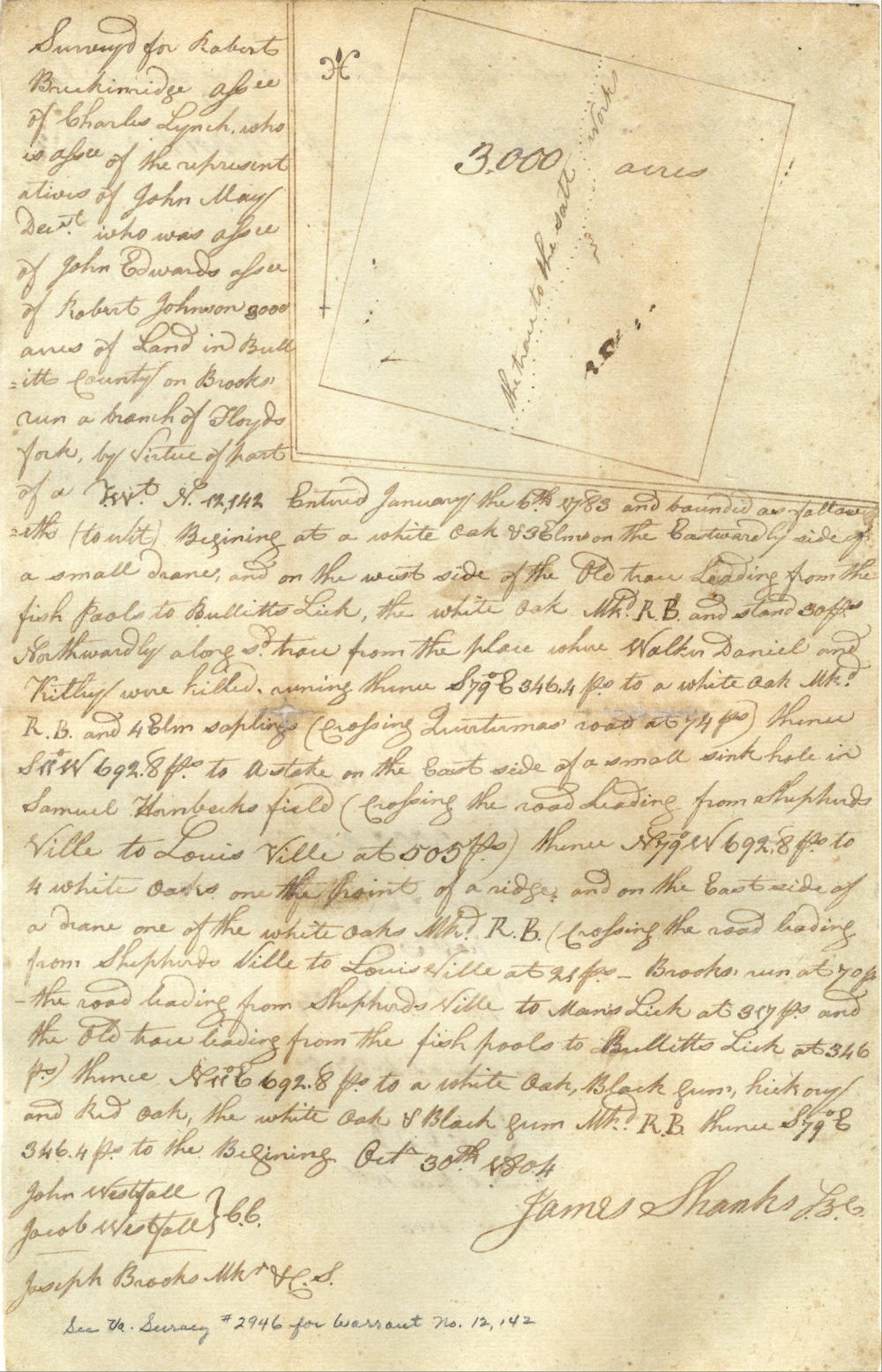
Survey
Surveyed for Robert Breckinridge, assignee of Charles Lynch who is assignee of the representatives of John May deceased who was assignee of John Edwards, assignee of Robert Johnson, 3000 acres of land in Bullitt County on Brooks' Run, a branch of Floyd's Fork, by virtue of part of a treasury warrant No. 12,142 entered January the 6th 1783, and bounded as followeth (to wit) Beginning at [A] a white oak & 3 elms on the eastwardly side of a small drain and on the west side of the old trace leading from the fish pools to Bullitt's Lick, the white oak marked R. B. and stand 30 poles northwardly along said trace from the place [1] where Walker Daniel and Kitley were killed, running thence S 79° E 346.4 poles to [B] a white oak marked R. B. and 4 elm saplings (crossing Quartermas' road [2] at 74 poles) thence S 11° W 692.8 poles to [C] a stake on the east side of a small sink hole in Samuel Hornbeck's field (crossing the road heading from Shepherdsville to Louisville at [3] 505 poles) thence N 79° W 692.8 poles to [D] 4 white oaks on the point of a ridge and on the east side of a drain, one of the white oaks marked R. B., (crossing the road leading from Shepherdsville to Louisville at [4] 21 poles, Brooks' Run [5] at 70 poles, the road leading from Shepherdsville to Man's Lick at [6] 317 poles, and the old trace leading from the fish pools to Bullitt's Lick at [7] 346 poles) thence N 11° E 692.8 poles to [E] a white oak, black gum, hickory and red oak, the white oak and black gum marked R. B., thence S 79° E 346.4 poles to [A] the beginning. October 30th 1804. James Shanks, surveyor for Bullitt County. John Westfall & Jacob Westfall, chain carriers. Joseph Brooks, marker and C.S.
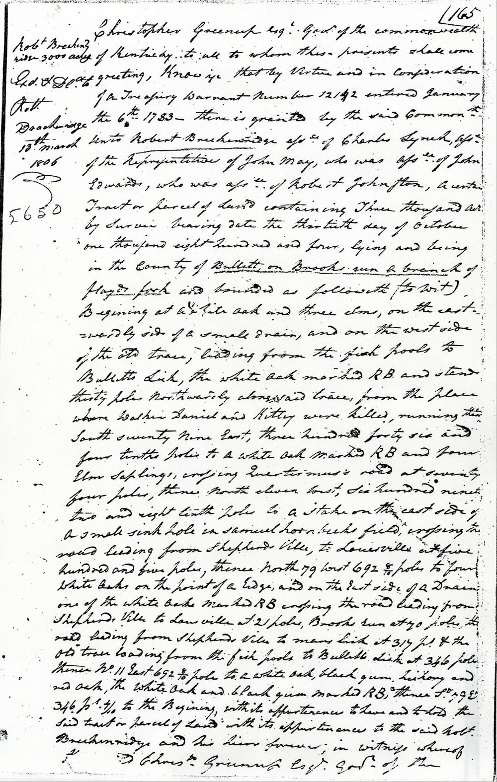
Deed
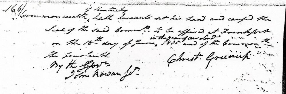
Chistopher Greenup Esquire, Governor of the Commonwealth of Kentucky, to all to whom these presents shall come, greeting. Know ye that by virtue and in consideration of a treasury warrant number 12142 entered January the 6th 1783, there is granted by the said Commonwealth unto Robert Breckinridge, assignee of Charles Lynch, assignee of the representatives of John May, who was assignee of John Edwards, who was assignee of Robert Johnston, a certain tract or parcel of land containing three thousand acres by survey bearing date the thirtieth day of October one thousand eight hundred and four, lying and being in the county of Bullitt on Brooks' Run, a branch of Floyd's Fork and bounded as followeth (to wit) Beginning at a white oak & three elms on the eastwardly side of a small drain and on the west side of the old trace leading from the fish pools to Bullitt's Lick, the white oak marked R. B. and stand thirty poles northwardly along said trace from the place where Walker Daniel and Kitley were killed, running thence South 79° E 346.4 poles to a white oak marked R. B. and 4 elm saplings (crossing Quartermas' road at 74 poles) thence South 11° West 692.8 poles to a stake on the east side of a small sink hole in Samuel Hornbeck's field (crossing the road heading from Shepherdsville to Louisville at 505 poles) thence North 79° West 692.8 poles to 4 white oaks on the point of a ridge and on the east side of a drain, one of the white oaks marked R. B., (crossing the road leading from Shepherdsville to Louisville at 21 poles, Brooks' Run at 70 poles, the road leading from Shepherdsville to Man's Lick at 317 poles, and the old trace leading from the fish pools to Bullitt's Lick at 346 poles) thence North 11° East 692.8 poles to a white oak, black gum, hickory and red oak, the white oak and black gum marked R. B., thence South 79° East 346.4 poles to the beginning with its appurtenances to have and to hold the said tract or parcel of land with its appurtenances to the said Robert Breckinridge and his heirs forever. In witness whereof the said Christopher Greenup Esquire, Governor of the Commonwealth of Kentucky hath hereunto set his hand and caused the seal of the said Commonwealth to be affixed at Frankfort on the 18th day of June in the year of our Lord 1805, and of the Commonwealth the fourteenth. (signed) Christopher Greenup
If you, the reader, have an interest in any particular part of our county history, and wish to contribute to this effort, use the form on our Contact Us page to send us your comments about this, or any Bullitt County History page. We welcome your comments and suggestions. If you feel that we have misspoken at any point, please feel free to point this out to us.
The Bullitt County History Museum, a service of the Bullitt County Genealogical Society, is located in the county courthouse at 300 South Buckman Street (Highway 61) in Shepherdsville, Kentucky. The museum, along with its research room, is open 10 a.m. to 4 p.m. Monday through Friday. Saturday appointments are available by calling 502-921-0161 during our regular weekday hours. Admission is free. The museum, as part of the Bullitt County Genealogical Society, is a 501(c)3 tax exempt organization and is classified as a 509(a)2 public charity. Contributions and bequests are deductible under section 2055, 2106, or 2522 of the Internal Revenue Code. Page last modified: 21 Apr 2026 . Page URL: bullittcountyhistory.org/bchistory/ok5650-breckinridge.html