
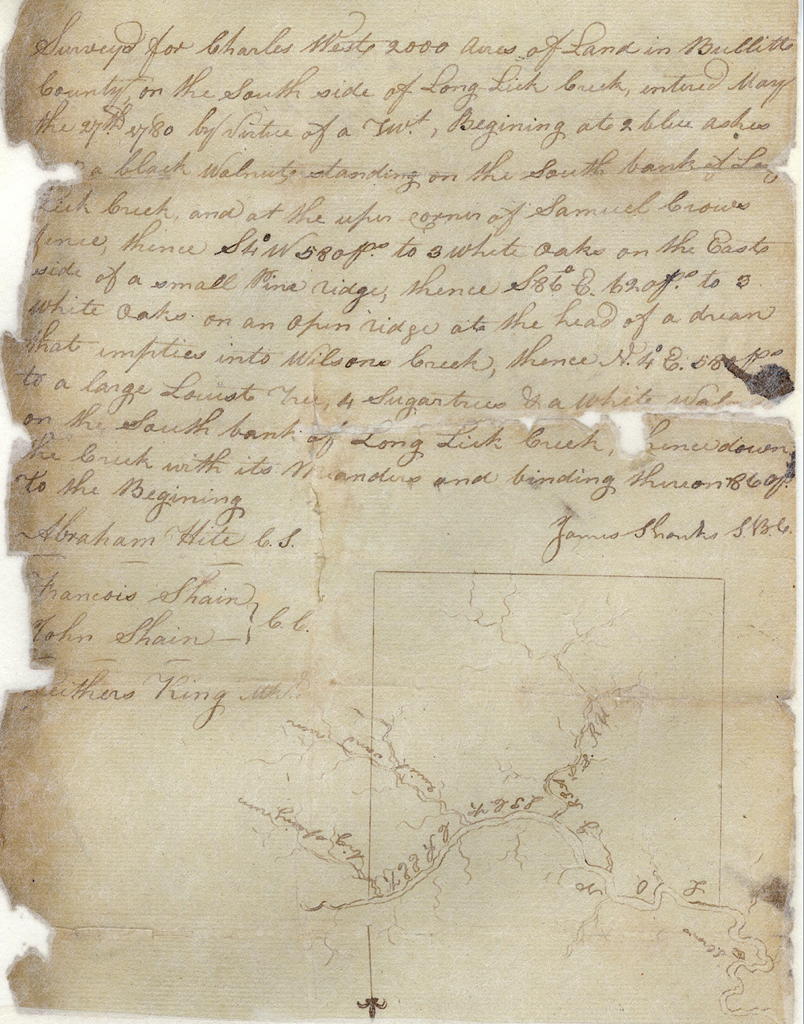
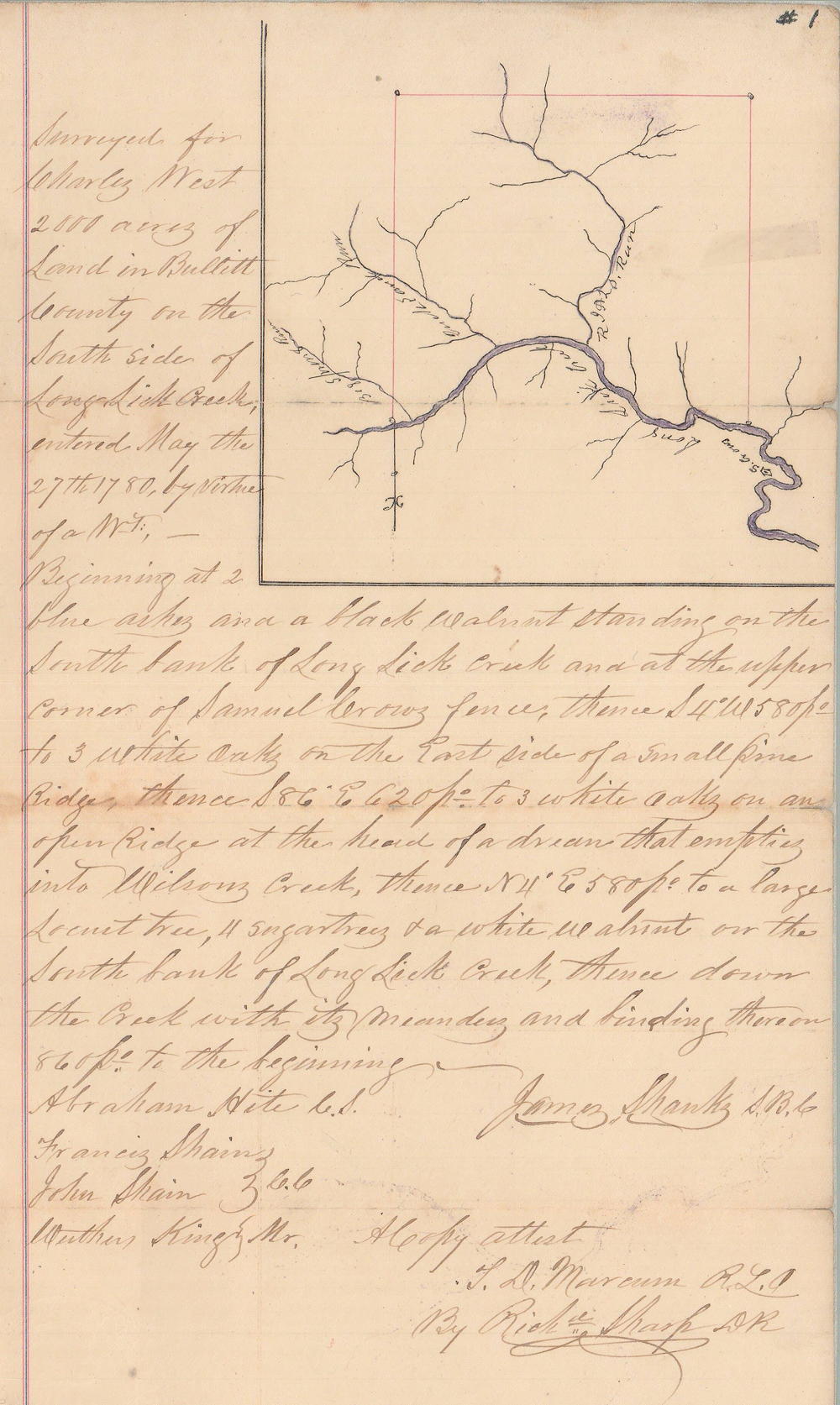
A some point after Bullitt County was established, James Shanks surveyed 2000 acres in the name of Charles West along the south side of Long Lick Creek, as shown below. A deed was issued to West on 11 Feb 1799.
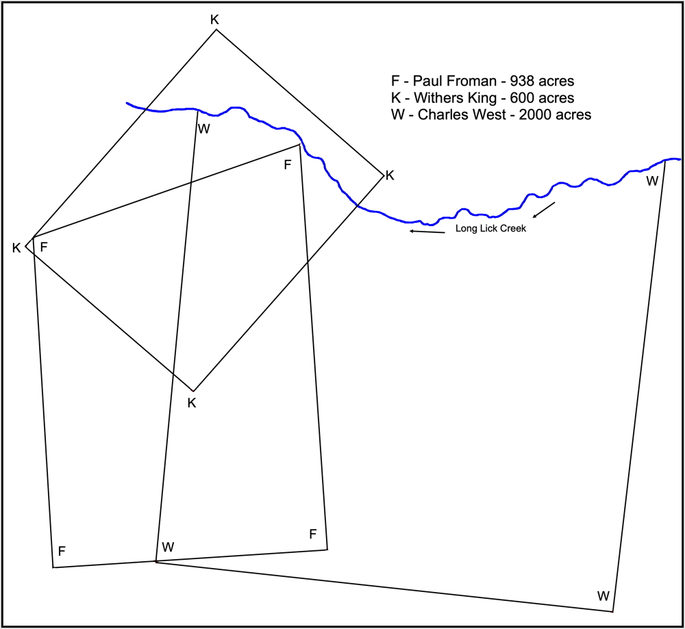
The surveyed tracts of Withers King, Paul Froman and Charles West along the upper reaches of Long Lick Creek overlap as shown on this drawing that is based on a survey conducted by Casper Herps by order of the Bullitt Circuit Court in an 1858 suit between Patterson, Moore and Company as plaintiff against George Magruder, defendant. The original survey is located in the T.C. Carroll plat cabinet in the county clerk's office. By original survey date, the King tract was the earliest surveyed.
Survey
Surveyed for Charles West 2000 acres of land in Bullitt County on the south side of Long Lick Creek, entered May the 27th 1780 by virtue of a treasury warrant. Beginning at 2 blue ashes and a black walnut standing on the south bank of Long Lick Creek and at the upper corner of Samuel Crow's fence, thence S 4° W 580 poles to 3 white oaks on the east side of a small pine ridge, thence S 86° E 620 poles to 3 white oaks on an open ridge at the head of a drain that empties into Wilson's Creek, thence N 4° E 580 poles to a large locust tree, 4 sugar trees and a white walnut on the south bank of Long Lick Creek, thence down the creek with its meanders and binding thereon 860 poles to the beginning.
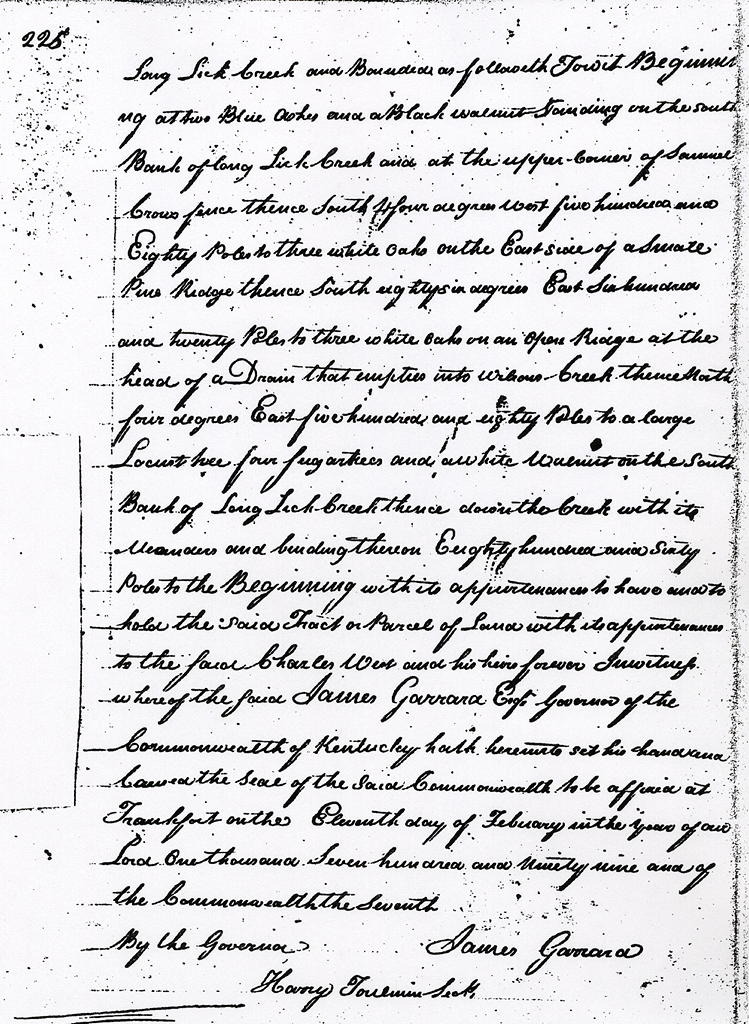
Deed
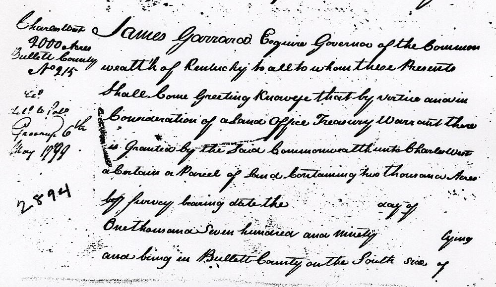
James Garrard Esquire, Governor of the Commonwealth of Kentucky, to all to whom these presents shall come, greeting. Know ye that by virtue and in consideration of a land office treasury warrant there is granted by the said Commonwealth unto Charles West a certain or parcel of land containing two thousand acres by survey bearing date the __ day of __, one thousand seven hundred and ninety __ lying and being in Bullitt County on the south side of Long Lick Creek and bounded as followeth to wit. Beginning at two blue ashes and a black walnut standing on the south bank of Long Lick Creek and at the upper corner of Samuel Crow's fence, thence S 4° W 580 poles to 3 white oaks on the east side of a small pine ridge, thence S 86° E 620 poles to 3 white oaks on an open ridge at the head of a drain that empties into Wilson's Creek, thence N 4° E 580 poles to a large locust tree, 4 sugar trees and a white walnut on the south bank of Long Lick Creek, thence down the creek with its meanders and binding thereon 860 poles to the beginning with its appurtenances to have and to hold the said tract or parcel of land with its appurtenances to the said Charles West and his heirs forever. In witness whereof the said James Garrard Esquire, Governor of the Commonwealth of Kentucky hath hereunto set his hand and caused the seal of the said Commonwealth to be affixed at Frankfort on the eleventh day of February in the year of our Lord one thousand seven hundred and ninety nine and of the Commonwealth the seventh. (signed) James Garrard
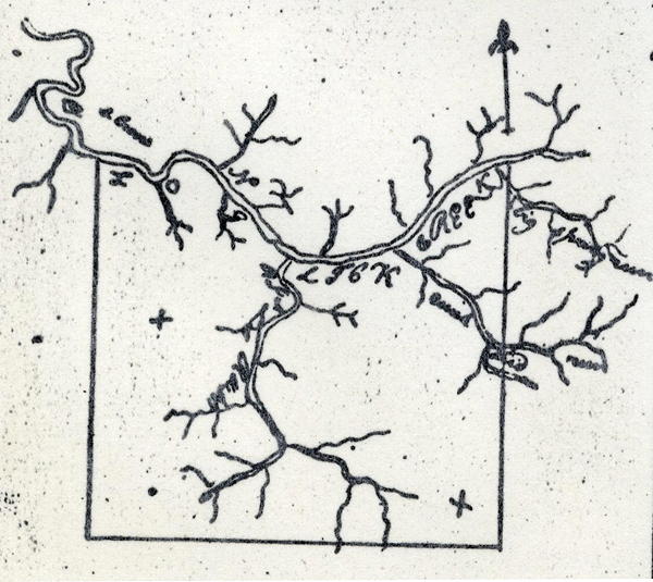
Another copy of this plat was found in the T. C. Carroll plats, and is shown below.
If you, the reader, have an interest in any particular part of our county history, and wish to contribute to this effort, use the form on our Contact Us page to send us your comments about this, or any Bullitt County History page. We welcome your comments and suggestions. If you feel that we have misspoken at any point, please feel free to point this out to us.
The Bullitt County History Museum, a service of the Bullitt County Genealogical Society, is located in the county courthouse at 300 South Buckman Street (Highway 61) in Shepherdsville, Kentucky. The museum, along with its research room, is open 10 a.m. to 4 p.m. Monday through Friday. Saturday appointments are available by calling 502-921-0161 during our regular weekday hours. Admission is free. The museum, as part of the Bullitt County Genealogical Society, is a 501(c)3 tax exempt organization and is classified as a 509(a)2 public charity. Contributions and bequests are deductible under section 2055, 2106, or 2522 of the Internal Revenue Code. Page last modified: 21 Apr 2026 . Page URL: bullittcountyhistory.org/bchistory/ok2894-west.html