
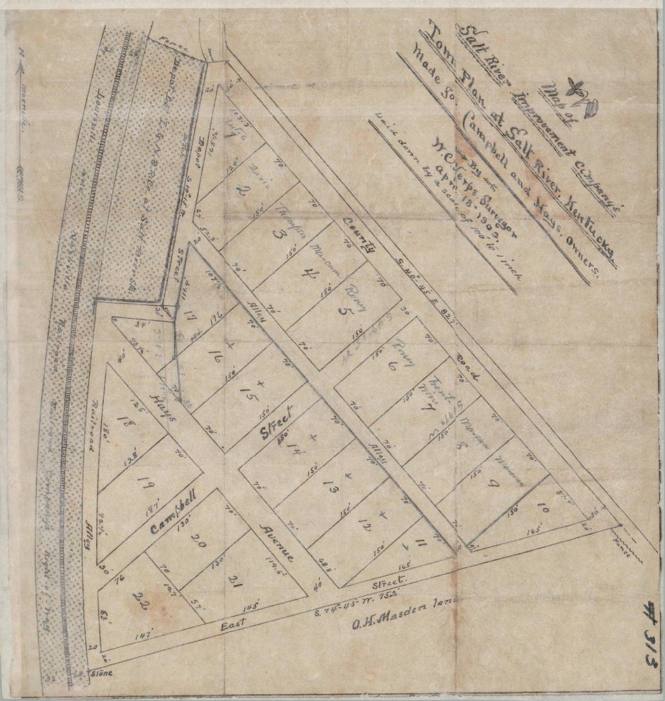
On 3 Feb 1902, O. H. Masden sold a tract next to the railroad tracks south of Salt River to William B. Campbell and Mrs. Katie Hayes who planned to develop a residential community with streets and lots on it. Below is a drawing showing how they planned to develop it.
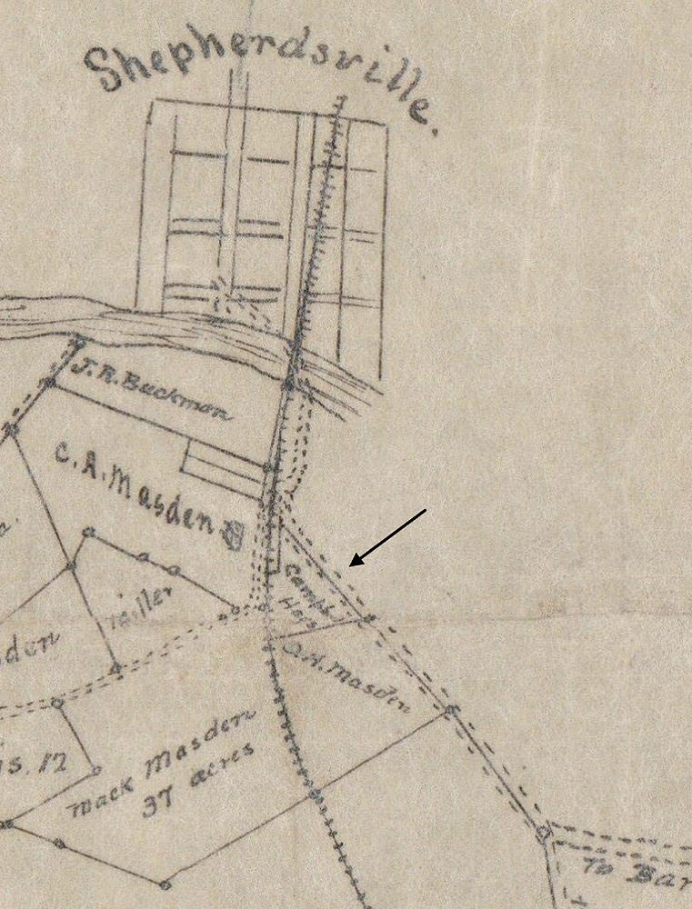
The drawing below, a clip from another plat, shows the location of this tract.
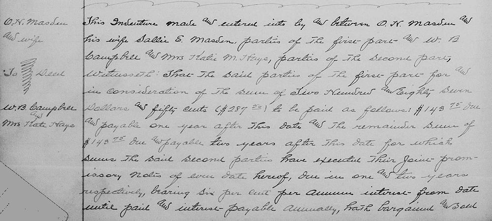
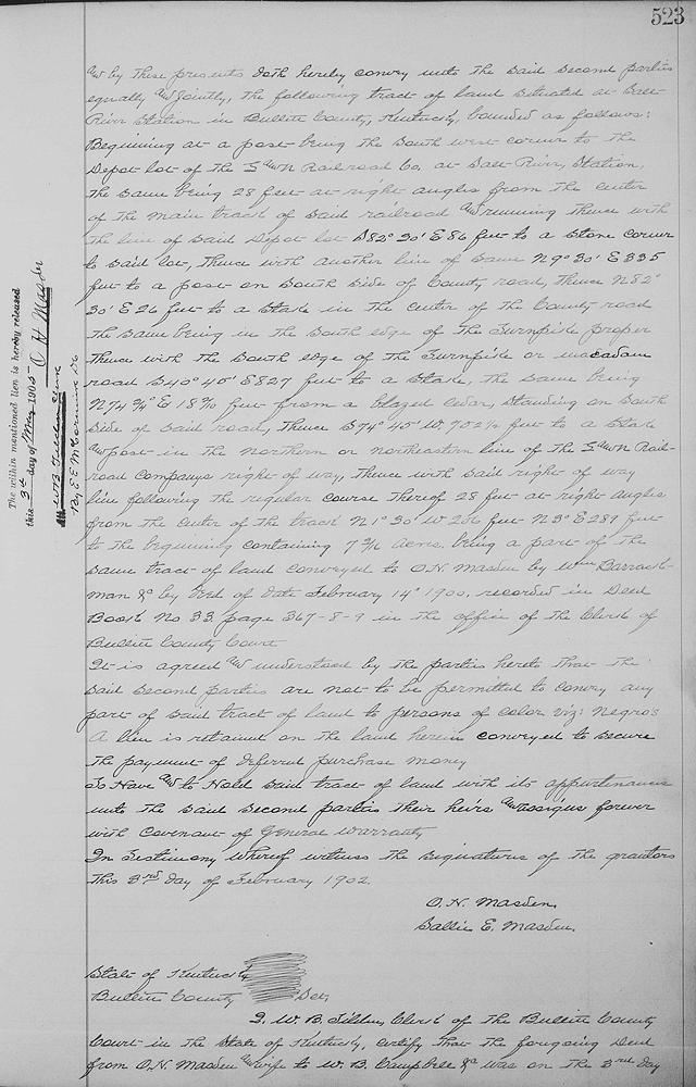
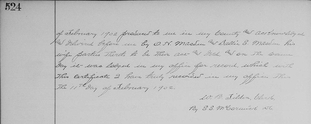
Bullitt County Deed Book 34, Pages 522-524
This indenture made and entered into by and between O. H. Masden and his wife, Sallie E. Masden, parties of the first part, and W. B. Campbell, and Mrs. Katie M. Hayes, parties of the second part.
Witnesseth that the said parties of the first part for and in consideration of the sum of $287.50 to be paid as follows: $143.75 due and payable one year after this date and the remainder sum of $143.75 due and payable two years after this date for which sums the said second parties have executed their joint promissory notes of even date hereof, due in one and two years respectively, bearing 6% per annum interest from date until paid, and interest payable annually, hath bargained and sold, and by these presents doth hereby convey unto the said second parties equally and jointly the following tract of land situated at Salt River Station in Bullitt County, Kentucky, bounded as follows.
Beginning at a post being in the southwest corner to the depot lot of the L & N railroad company at Salt River station, the same being 28 feet at right angles from the center of the main track of said railroad and running thence with the line of said depot South 82°30' East 86 feet to a stone corner to said lot, thence with another line of same North 9°30' East 335 feet to a post on south side of county road, thence North 82°30' East 26 feet to a stake in the center of the county road, the same being in the south edge of the turnpike proper, thence with the south edge of the turnpike or macadam road South 40°45' East 827 feet to a stake, the same being North 74 3/4° East 18 2/10 feet from a blazed cedar standing on south side of said road, thence South 74°45' West 752 1/2 feet to a stake and post in the northern or northeastern line of the L & N railroad company right of way, thence with said right of way line following the regular course thereof 28 feet at right angles from the center of the track North 1°30' West 206 feet, North 3° East 289 feet to the beginning, containing 7 3/16 acres, being a part of the same tract of land conveyed to O. H. Masden by William Barrackman &c by deed of date February 14th 1900, recorded in deed book No. 33, page 367-8-9 in the office of the clerk of Bullitt County court.
If you, the reader, have an interest in any particular part of our county history, and wish to contribute to this effort, use the form on our Contact Us page to send us your comments about this, or any Bullitt County History page. We welcome your comments and suggestions. If you feel that we have misspoken at any point, please feel free to point this out to us.
The Bullitt County History Museum, a service of the Bullitt County Genealogical Society, is located in the county courthouse at 300 South Buckman Street (Highway 61) in Shepherdsville, Kentucky. The museum, along with its research room, is open 10 a.m. to 4 p.m. Monday through Friday. Saturday appointments are available by calling 502-921-0161 during our regular weekday hours. Admission is free. The museum, as part of the Bullitt County Genealogical Society, is a 501(c)3 tax exempt organization and is classified as a 509(a)2 public charity. Contributions and bequests are deductible under section 2055, 2106, or 2522 of the Internal Revenue Code. Page last modified: 04 Sep 2025 . Page URL: bullittcountyhistory.org/bchistory/masden-campbell-hays.html