
On 14 Jul 1841, Lewis Smyser sold this 101 plus acre tract on the waters of Floyd's Fork to Richard James as shown below. On 12 Apr 1854, following Richard James' death, his daughter Elizabeth Jane sold her share of this tract to her brothers Otho B. James, William H. James and John R. James. On 30 Mar 1857, another daughter, Lucy Ann Hall, wife of Nathan Hall, sold her share of this tract to the same three brothers. After Lucy Ann Hall died of consumption in May 1857, Nathan married her sister Ruth Ellen James on 13 Oct 1861. To settle Ellen's share of her father's estate, the other siblings sold a tract of 50 plus acres to her and Nathan on 4 Mar 1870. In exchange for this, the Halls deeded their shares in several tracts, including this one, to the four James brothers. Finally, Otho James sold his share of this tract to his brother William James.
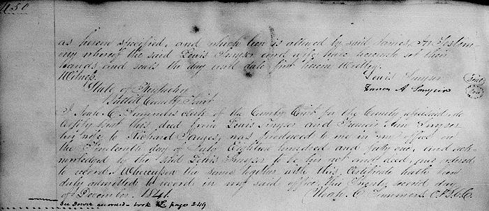
Bullitt County Deed Book I, Pages 449-450
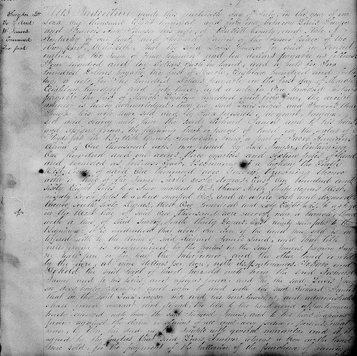
This indenture made this 14th day of July in the year of our Lord 1841 between Lewis Smyser and Frances Ann Smyser his wife of Bullitt County and state of Kentucky of the one part and Richard James of the same place of the other part.
Witnesseth that the said Lewis Smyser for and in consideration of the sum of $910 payable as follows: $410 cash in hand and a note for $200 payable the first of March 1842, a note for $200 payable the first of March 1843, and a not for $100 payable the first of March 1844, the receipt whereof is hereby acknowledged, they the said Lewis Smyser and Frances Ann Smyser his wife have sold and by these presents do grant, bargain, sell and convey unto him the said Richard James and to his heirs and assigns forever the following tract or parcel of land on the waters of Floyd's Fork in Bullitt County, Kentucky, being a part of Jacob Harmon's claim of 1000 acres now owned by said Smyser, containing 101 acres, three-quarters and 16 poles of land and bounded as follows to wit.
Beginning at a hickory the southwest corner of said 1000 acre survey, running thence with a line of the same North 60° East 168 poles to a stone marked R.J., thence North 30° West 97 poles to a stone marked R.J. and a white oak and dogwood, thence South 60° West 168 poles to a stone in the west line of said 1000 acre survey near a branch, thence with a line of said survey South 30° 97 poles to the beginning.
It is understood that about one acre of the land here sold is interfered with by the claim of said Richard James' land, and that title interference is compromised by the parties by the said James paying Smyser half price or for half the interference; and the other land is sold by the acre at $9.00 per acre with its appurtenances.
To have and to hold the said tract of land here sold unto him the said Richard James and to his heirs and assigns forever. And he the said Lewis Smyser does hereby covenant and agree to and with the said Richard James that he the said Lewis Smyser will and his heirs, executors and administrators shall forever warrant and defend the title to the land and appurtenances hereby conveyed unto him the said Richard James and to his heirs and assigns forever against the claim or claims of all and very person or persons whatsoever by this his deed in fee simple with general warranty. And it is agreed by the parties that said Lewis Smyser retains a lien on the land here sold for the payment of the balance of the purchase of money as herein specified, and which lien is allowed by same James. In testimony whereof the said Lewis Smyser and wife have hereunto set their hands and seals the day and date first herein written. (signed by grantors)
If you, the reader, have an interest in any particular part of our county history, and wish to contribute to this effort, use the form on our Contact Us page to send us your comments about this, or any Bullitt County History page. We welcome your comments and suggestions. If you feel that we have misspoken at any point, please feel free to point this out to us.
The Bullitt County History Museum, a service of the Bullitt County Genealogical Society, is located in the county courthouse at 300 South Buckman Street (Highway 61) in Shepherdsville, Kentucky. The museum, along with its research room, is open 10 a.m. to 4 p.m. Monday through Friday. Saturday appointments are available by calling 502-921-0161 during our regular weekday hours. Admission is free. The museum, as part of the Bullitt County Genealogical Society, is a 501(c)3 tax exempt organization and is classified as a 509(a)2 public charity. Contributions and bequests are deductible under section 2055, 2106, or 2522 of the Internal Revenue Code. Page last modified: 11 Apr 2026 . Page URL: bullittcountyhistory.org/bchistory/lewissmyser-richardjames.html