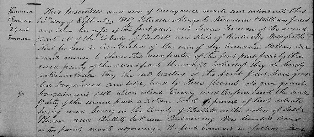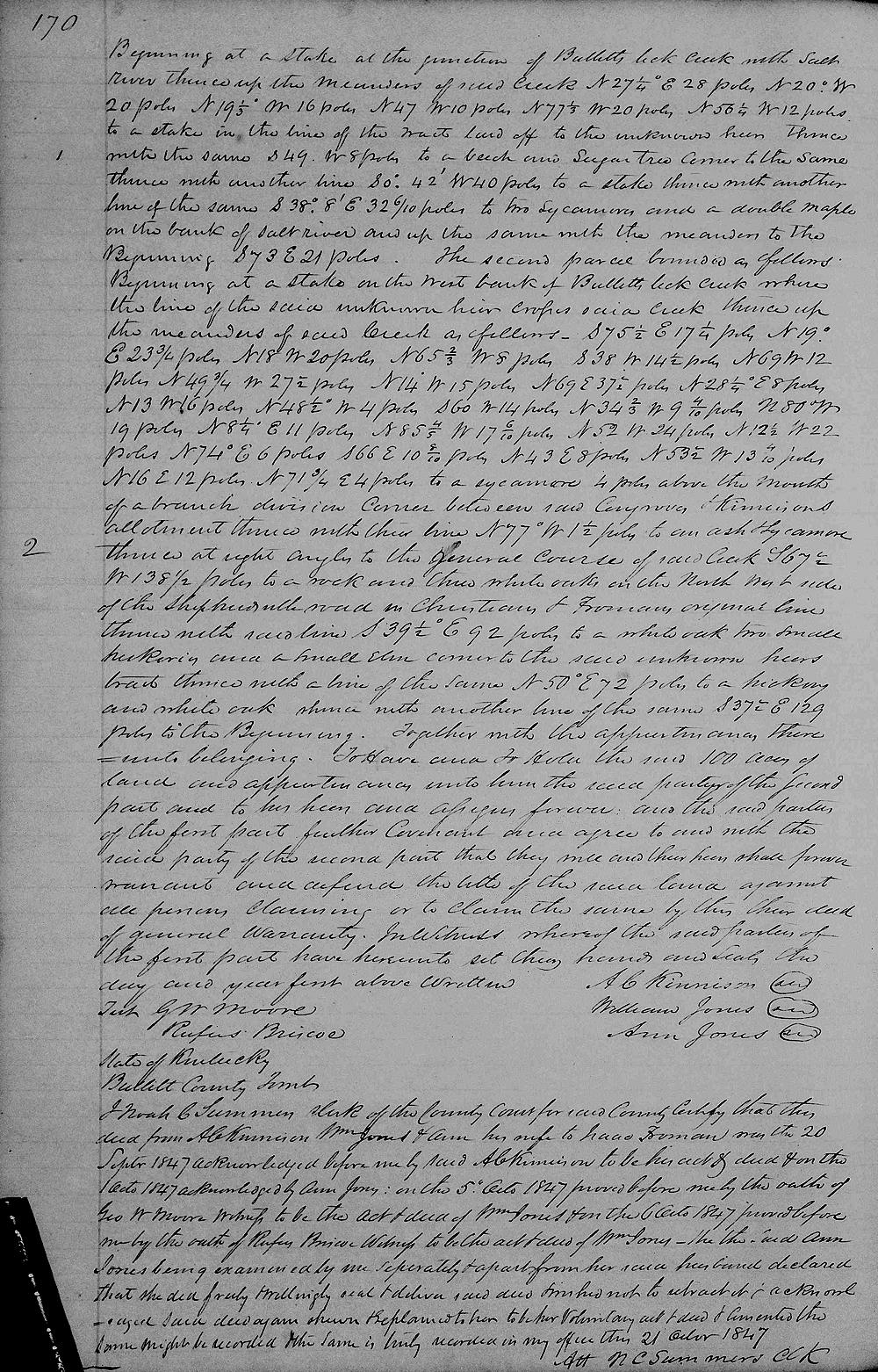
On 15 Sep 1847, A. C. Kinnison and William Jones sold 100 acres of their holdings in the Bullitt's Lick tract to Isaac Froman, as shown below.
Bullitt County Deed Book L, Pages 169-170
This indenture and deed of conveyance made and entered into this 15th day of September 1847 between Alonzo C. Kinnison and William Jones and Ann his wife of the first part, and Isaac Froman of the second part, all of the county of Bullitt and state of Kentucky. Witnesseth that for and in consideration of the sum of $600 current money to them the said parties of the first part, paid by the said party of the second part, the receipt whereof they do hereby acknowledge, they the said parties of the first part granted, bargained, and sold, and by these presents do give, grant, bargain, sell, alien, release, convey and confirm unto the said party of the second part a certain tract or parcel of land situate lying and being in the county of Bullitt on the waters of Salt River and Bullitt's Lick Run containing 100 acres in two parcels nearto adjoining; the first bounded as follows, to wit.
Beginning at a stake at the junction of Bullitt Lick Creek with Salt River thence up the meanders of said Creek North 27 1/4° East 28 poles, North 20° West 20 poles, North 19 1/3° West 16 poles, North 47° West 10 poles, North 77 1/3° West 20 poles, North 56 1/4° West 12 poles to a stake in the line of the tract laid off to the unknown heir, thence with the same South 49° West 8 poles to a beech and sugar tree, corner to the same, thence with another line South 0° 42' West 40 poles to a stake, thence with another line of the same South 38° 8' East 32 6/10 poles to two sycamore and a double maple on the bank of Salt River and up the same with the meanders to the beginning South 73° East 21 poles.
The second parcel bounded as follows: beginning at a stake on the west bank of Bullitt's Lick Creek, where the line of the said unknown heir crosses said creek, thence up the meanders of said creek as follows: South 75 1/2° East 17 1/4 poles, North 19° East 23 3/4 poles, North 18° West 20 poles, North 65 2/3° West 8 poles, South 38° West 14 1/2 poles, North 69° West 12 poles, North 49 3/4° West 27 1/2 poles, North 14° West 15 poles, North 69° East 37 1/2 poles, North 28 1/4° East 8 poles, North 13° West 16 poles, North 48 1/2° West 4 poles, South 60° West 14 poles, North 34 2/3° West 9 4/10 poles, North 80° West 19 poles, North 80 1/4° East 11 poles, North 85 4/5° West 17 6/10 poles, North 52° West 24 poles, North 12 1/2° West 22 poles, North 74° East 6 poles, South 66° East 10 8/10 poles, North 43° East 8 poles, North 53 1/2° West 13 4/10 poles, North 16° East 12 poles, North 71 3/4° East 4 poles to a sycamore four poles above the mouth of a branch, division corner between said .. and Kinnison's allotment, thence with their line North 77° W 1 1/2 poles to an ash and sycamore, thence at right angles to the general course of said creek South 67 1/2° W 138 1/2 poles to a rock and three white oaks on the northwest side of the Shepherdsville Road in Christian's and Froman's original line, thence with said line South 39 1/2° E 92 poles to a white oak, two small hickories and a small elm, corner to the said unknown heirs' tract, thence with a line of the same North 50° East 72 poles to a hickory and white oak, thence with another line of the same South 37 1/2° East 129 poles to the beginning, together with the appurtenances thereunto belonging.
To have and to hold the said 100 acres of land and appurtenances onto him, the said party of the second part, and to his heirs and assigns forever. And the said parties of the first part further covenant and agree to, and with the said party of the second part that they will, and their heirs shall forever warrant and defend the title of the said land against all persons claiming or to claim the same by their deed of general warranty. In witness whereof the said parties of the first part have hereto set their hands and seals the day and year first above written. [signed by grantors]


If you, the reader, have an interest in any particular part of our county history, and wish to contribute to this effort, use the form on our Contact Us page to send us your comments about this, or any Bullitt County History page. We welcome your comments and suggestions. If you feel that we have misspoken at any point, please feel free to point this out to us.
The Bullitt County History Museum, a service of the Bullitt County Genealogical Society, is located in the county courthouse at 300 South Buckman Street (Highway 61) in Shepherdsville, Kentucky. The museum, along with its research room, is open 10 a.m. to 4 p.m. Monday through Friday. Saturday appointments are available by calling 502-921-0161 during our regular weekday hours. Admission is free. The museum, as part of the Bullitt County Genealogical Society, is a 501(c)3 tax exempt organization and is classified as a 509(a)2 public charity. Contributions and bequests are deductible under section 2055, 2106, or 2522 of the Internal Revenue Code. Page last modified: 04 Sep 2025 . Page URL: bullittcountyhistory.org/bchistory/kinnison-jones-froman.html