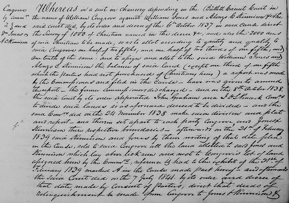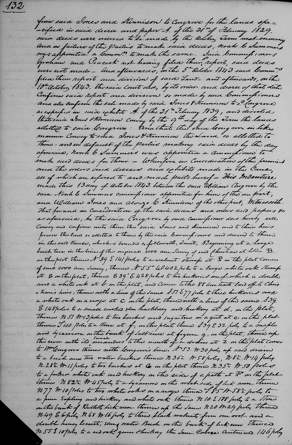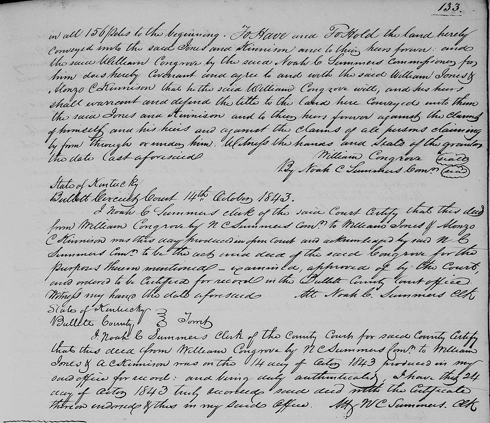
In a Bullitt Circuit Court suit, William Congrove vs A. C. Kinnison and William Jones, the court ordered certain parts of the Bullitt's Lick tract to be transfered to Kinnison and Jones as shown below. The commissioner's report referenced may be viewed on another page.
Bullitt County Deed Book K, Pages 131-133
Whereas in a suit in Chancery depending in the Bullitt Circuit Court in the name of William Congrove against William Jones and Alonzo C. Kinnison &c the said court did by its order and decree of the 6th October 1837 in said cause direct the survey of the 1000 of Christian named in the decree &c, and also the 2000 acres of said Christian to be made so as to allot according to quantity and quality to said Congrove one-half of two-fifths, and one-half of two-thirds of one-fifth, and one-tenth of the same, and to assign and allot to the said William Jones and Alonzo C. Kinnison, the balance of said land (except one-third of one-fifth which the parties had not purchased of Christian's heirs).
A report was made by the commissioners and filed in the cause, leave was given to amend the report, the former commissioners discharged, and on the 8th October 1838 the said court by its order appointed John Graham and J. D. S. Peacock commissioners to divide said lands, so as aforesaid decreed to be divided, and the said commissioners did on the 24th November 1838 made said division and plat and report, and therein set apart to each party, Congrove and Jones and Kinnison their respective boundaries.
Afterwards on the 21st February 1839 said Kinnison and Jones by their writing of that date filed in the cause, sold to said Congrove all the land allotted to said Jones and Kinnison which lay above Lick Run, and next to Congrove's lot of land assigned him by the commissioners, reference is had to the exhibit of the 21st of February 1839 marked A in the cause made part hereof; and afterwards the said court did on the 7th July 1841 by its order and decree of that date made by the consent of parties direct that deeds of relinquishment be made from Congrove to Jones and Kinnison and from said Jones and Kinnison to Congrove for the lands specified in said decree and paper A of the 21st February 1829[sic].
Said deeds were ordered to be made by the October Term next .., and on failure of the parties to make said deeds, Noah C. Summers was appointed a commissioner to make the same. Said commissioners Graham and Peacock not having then filed their said report, said deeds were not made, and afterwards on the 5th October 1843 said commissioners filed their report and division of said lands, and afterwards on the 10th October 1843 the said court did by its order and decree of that date confirm said report and division so made by said commissioners and also confirm the sale made by said Jones and Kinnison to said Congrove as expressed in said exhibit A of the 21st February 1839, and directed that said Jones and Kinnison convey by the 9th day of the term the lands allotted to said Congrove.
And that the said Congrove in like manner convey to said Jones and Kinnison the land so allotted to them, and in default of the parties making said deeds by the day aforesaid, Noah C. Summers was appointed commissioner to make said deeds for them. Wherefore in consideration of the premises and the orders and decrees and exhibits made in the cause, all of which are referred to and made parts hereof, this indenture made this 13th day of October 1843 between the said William Congrove by the said Noah C. Summers, commissioner appointed for him of the one part, and William Jones and Alonzo C. Kinnison of the other part; witnesseth that for and in consideration of the said decrees and orders and papers &c as aforesaid, he the said Congrove by said commissioner does hereby sell convey, and confirm unto them the said Jones and Kinnison and to their heirs forever the lands so allotted to them by the said commissioners and decreed to them in the said cause which is bounded as followeth, to wit.
Beginning at a large beech tree in the line of the original 1000 acre survey of said Christian at letter B on the plat, thence north 39° east 141 poles to a walnut stump at P on the plat corner of said 1000 acres survey, thence north 55° west 402 poles to a large white oak stump at S on the plat, thence south 39° east 428 poles to two hickories, one of which is double, and a white oak at b on the plat and corner to the 88 acre trat laid off to Christian's heirs, thence with a line of the same south 51° east 77 poles to three hickories and a white oak on a ridge at C on the plat thence with a line of the same south 39° east 148 poles to a small crooked elm, hackberry and hickory at d on the plat thence north 51° west 13 poles to two beeches and sugar tree in a gut at e on the plat, thence south 40 poles to a stone at f on the plat, thence south 39° east 32 poles to a maple and sycamore on the bank of Salt River at figure g on the plat thence up the river with its several meanders to the mouth of a drain at Z on the plate corner to William Congrove, thence with Congrove's line north 53° west 30 poles up said drain to a beech and two water beeches, thence north 36 1/2° west 58 poles, north 8 1/2° west 14 poles, north 28 1/2° west 11 poles to two beeches at G on the plat, thence north 35 1/2° west 50 poles to a forked white oak and hickory on the side of a path at F on the plat, thence north 82 1/2° west 45 poles to a sycamore on the west side of Lick Run, thence north 77° west 10 poles to two white oaks on a ridge, thence south 85° west 58 1/2 poles to a pine sapling and hickory and white oak, thence north 10° east 188 poles to a stone on the Bank of Bullitt's Lick Run, thence up the same north 20° west 29 poles, thence north 49° east six poles north 68° west 16 poles to three black walnuts from one root and a double honey locust, elm, water beech on the bank of Lick Run, thence north 55° East 10 poles to a red oak, gum and hickory, the same course continued 146 poles in all 156 poles to the beginning.
To have and to hold the land hereby conveyed unto the said Jones and Kinnison, and to their heirs forever; and the said William Congrove by the said Noah C. Summers, commissioner for him, does hereby covenant and agree to and with the said William Jones and Alonzo C. Kinnison that he the said William Congrove will, and his heirs shall warrant and defend the title to the land here conveyed unto them, said Jones and Kinnison, and to their heirs forever against the claims of himself and his heirs and against the claims of all persons claiming by from through or under him. Witness the hands and seals of the grantors the date last aforesaid.


If you, the reader, have an interest in any particular part of our county history, and wish to contribute to this effort, use the form on our Contact Us page to send us your comments about this, or any Bullitt County History page. We welcome your comments and suggestions. If you feel that we have misspoken at any point, please feel free to point this out to us.
The Bullitt County History Museum, a service of the Bullitt County Genealogical Society, is located in the county courthouse at 300 South Buckman Street (Highway 61) in Shepherdsville, Kentucky. The museum, along with its research room, is open 10 a.m. to 4 p.m. Monday through Friday. Saturday appointments are available by calling 502-921-0161 during our regular weekday hours. Admission is free. The museum, as part of the Bullitt County Genealogical Society, is a 501(c)3 tax exempt organization and is classified as a 509(a)2 public charity. Contributions and bequests are deductible under section 2055, 2106, or 2522 of the Internal Revenue Code. Page last modified: 04 Sep 2025 . Page URL: bullittcountyhistory.org/bchistory/congrove-kinnison-jones.html