In 1930, Clara and George A. Bailey sold the remainder of their Cedar Creek tract to the Girl Scouts for a campground. The organization would add an additional 11.58 acres south of the creek from Addie Norton in 1940.
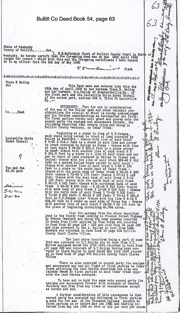
Bullitt County Deed Book 54, pages 63-64
This Deed made and entered into this the 29th day of April 1930 by and between Clara B. Bailey and her husband, G. A. Bailey of Shepherdsville, Ky., of the first part and the Louisville Girls Scout Council of the second part, address 554 S. Third St Louisville Ky..--
WITNESSETH: That for and in consideration of the sum of One Dollar cash and other valuable considerations the receipt of which is hereby acknowledged and the further consideration as hereinafter set forth: The first parties hereby sell grant and convey unto the second party its assigns and successors forever, the following described real estate lying and being in Bullitt County Kentucky, on Cedar Creek:
Beginning at a stake in line of H. P. Hedges, said stake being corner to tract of land conveyed by Bailey to Weathers - thence with line of said tract N 5-40 E 214.1 feet to a stone in said line and corner to tract conveyed by Bailey to Borax - thence with line of last tract S 89-20 E 330.3 feet to a stone corner to same - thence with another line of said tract N 5 E 341.9 feet to a stone in a line of said tract and corner to tract of land conveyed by Bailey to Stoner now Taylor) thence with the line of said tract S 89-49 E 912 feet to a marked hollow beech corner to said tract - thence with another line of said tract N 1-56 E 190 feet to a stake on the south bank of Cedar Creek - thence with the south bank of Cedar Creek N 86-25 E 490 feet - thence S 72-45 E 175 feet - thence S 57-13 E 225 feet - thence with the west bank of said Creek S 5-14 E 165 feet - thence with the north bank of said Creek S 82-15 W 325 feet - thence with northwest bank of said Creek S 54-35 W 455 feet - S 25-26 W 300 feet- thence with west bank of said Creek S 10-26 W 505 feet - thence with the north bank of said Creek S 73-28 W 300 feet - N 71-40 W 490 feet - N 88-12 W 225 feet - N 70-12 W 280.6 feet to H. P. Hedges line - thence with his line N 4-14 E 404.25 feet to a stake on east side of Horse Run - thence with another line of said tract N 25-56 W 80 1/2 feet to the place of beginning containing 40.984 acres.
Also the paseway from the above described land to the County road leading to Preston Street Highway by Hebron Cemetery and being the same paseway reserved in deeds from first parties to Thos Borax etc recorded in Deed Book 43 page 124 - 253 and Deed Book 34 page 266 and also conveyed to Geo A. Bailey by deed from Emma Sanders etc recorded in Deed Book 33 page 304 Bullitt County Court Clerk's Office.
The land above described being a part of same that was conveyed to G. T. Bailey etc by deed from W. T. Morrow assignee dated Dec 27th 1893 recorded in Deed Book 30 page 398 and interest of G. T. Bailey having been conveyed to Clara Bailey by deed dated May 23rd 1905 recorded in Deed Book 37 page 370 Bullitt County Court Clerk's Office.
There is also conveyed to second party its assigns and successors any and all right of first parties to Cedar Creek adjoining the land herein described and also any islands owned by first parties in said Cedar Creek opposite the land herein conveyed.
To have and to hold the same unto second party its assigns and successors forever with covenant of General Warranty and free from any liens or encumbrances except as herein set out.
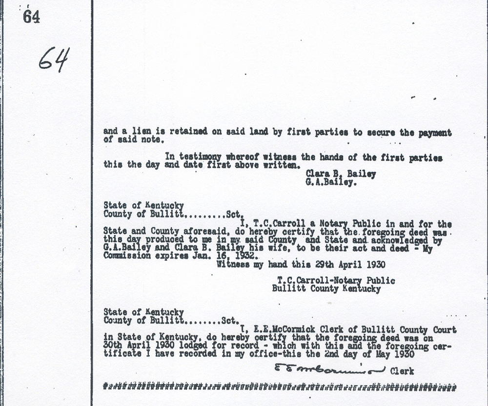
A further consideration of this conveyance is that second party has executed and delivered to first parties a note for the sum of One Thousand Denary payable to first parties on or before May 1st 1931 and bearing interest from May 1st 1930 at rate of six per cent per annum, and a lien is retained on said land by first parties to secure the payment of said note.
In testimony whereof witness the hands of the first parties this the day and date first above written.
Clara B. Bailey
G. A. Bailey.
State of Kentucky
County of Bullitt Sct.
I, T. C. Carroll a Notary Public in and for the State and County aforesaid, do hereby certify that the foregoing deed was this day produced to me in my said County and State and acknowledged by G. A. Bailey and Clara B. Bailey his wife, to be their act and deed - My Commission expires Jan. 16 1932.
Witness my hand this 29th April 1930
T. C . Carroll - Notary Public
Bullitt County Kentucky
State of Kentucky
County of Bullitt Sct.
I, E. E. McCormick Clerk of Bullitt County Court in State of Kentucky, do hereby certify that the foregoing deed was on 30th April 1930 lodged for record - which with this and the foregoing certificate I have recorded in my office - this the 2nd day of May 1930.
E. E. McCormick, Clerk


If you, the reader, have an interest in any particular part of our county history, and wish to contribute to this effort, use the form on our Contact Us page to send us your comments about this, or any Bullitt County History page. We welcome your comments and suggestions. If you feel that we have misspoken at any point, please feel free to point this out to us.
The Bullitt County History Museum, a service of the Bullitt County Genealogical Society, is located in the county courthouse at 300 South Buckman Street (Highway 61) in Shepherdsville, Kentucky. The museum, along with its research room, is open 10 a.m. to 4 p.m. Monday through Friday. Saturday appointments are available by calling 502-921-0161 during our regular weekday hours. Admission is free. The museum, as part of the Bullitt County Genealogical Society, is a 501(c)3 tax exempt organization and is classified as a 509(a)2 public charity. Contributions and bequests are deductible under section 2055, 2106, or 2522 of the Internal Revenue Code. Page last modified: 04 Sep 2025 . Page URL: bullittcountyhistory.org/bchistory/bailey-girlscouts.html