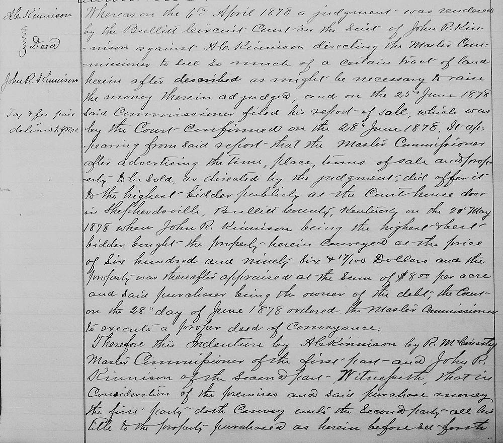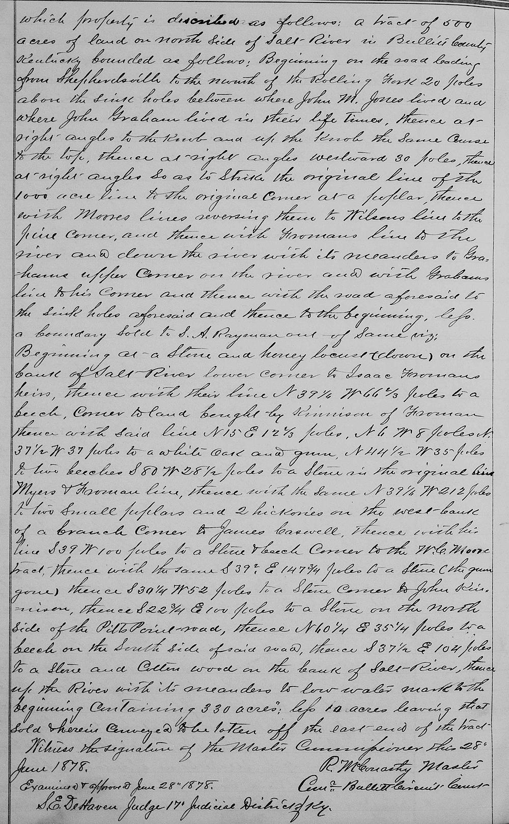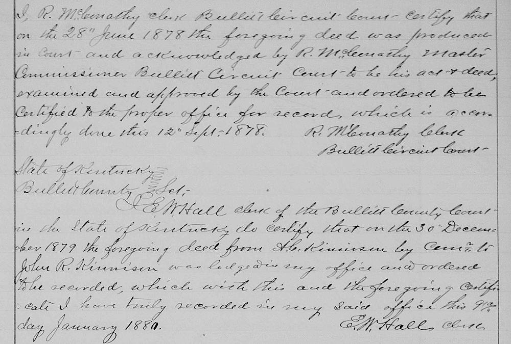
On 28 Jun 1878, by a Circuit Court order, the remainder of A. C. Kinnison's 500 acres, not already sold to Rayman, was ordered sold to pay a debt owed by A. C. Kinnison to his son who became the purchaser of the ground, and this deed was granted him.
Bullitt County Deed Book W, Pages 361-363
Whereas on 6th April 1878 a judgment was rendered by the Bullitt Circuit Court in the suit of John R. Kinnison against A. C. Kinnison directing the master commissioner to sell so much of a certain tract of land herein after described as might be necessary to raise the money therein adjudged, and on the 25th June 1878 said commissioner filed his report of sale which was by the court confirmed and on 28th June 1878 it appearing from said report that the master commissioner after advertising the time, place, terms of sale and property to be sold as directed by the judgment did offer it to the highest bidder publicly at the courthouse door in Shepherdsville, Bullitt County, Kentucky on 20th May 1878 where John R. Kinnison, being in the highest and best bidder, bought the property herein conveyed at the price of $696.17 and the property was thereafter appraised at the sum of eight dollars per acre and said purchaser being the owner of the debt, the court on 28th day of June 1878 ordered the master commissioner to execute a property deed of conveyance.
Therefore, this indenture by A. C. Kinnison by R. McConathy, master commissioner, of the first part and John R. Kinnison of the second part. Witnesseth that in consideration of the premises and said purchase money, the first party doth convey unto the second party all his title to the property purchased as herein before set forth which property is described as follows: a tract of 500 acres of land on north side of Salt River in Bullitt County, Kentucky, bounded as follows.
Beginning on the road leading from Shepherdsville to the mouth of the Rolling Fork, 20 poles above the sink holes between where John M. Jones lived, and where John Graham lived in their lifetimes, thence at right angles to the knob and up the knob the same course to the top, thence at right angles, westward, 30 poles, thence at right angles, so as to strike the original line of the thousand acre line to the original corner at a poplar, thence with Moore's line reversing them to Wilson's line to the pine corner, and thence with Froman's line to the river and down the river with its meanders to Graham's upper corner on the river and with Graham's line to his corner and thence with the road aforesaid to the sink aforesaid and thence to the beginning, less a boundary sold to S. A. Rayman out of same, viz.
Beginning at a stone and honey Locust (down) on the bank of Salt River, lower corner to Isaac Froman's heirs, thence with their line North 39 1/4° West 66 2/3 poles to a beech, corner to land bought by Kinnison of Froman, thence with said line North 15° East 12 2/3 poles, North 6° West 8 poles, North 37 1/2° West 37 poles to a white oak and gum, North 44 1/2° West 35 poles to two beeches, South 80° West 28 1/2 poles to a stone in the original Myers and Froman line, thence with the same North 39 1/4° West 212 poles to two small poplars and two hickory on the west bank of a branch, corner to James Caswell, thence with his line South 39° West 100 poles to a stone and beech, corner to the W. C. Moore tract, thence with the same South 39 1/2° East 147 3/4 poles to a stone (the gum gone), thence South 30 1/4° West 52 poles to a [stone, thence south 39° west 29 poles to a stone,] corner to John Kinnison, thence South 22 3/4° East 100 poles to a stone on the north side of the Pitt's Point Road, thence North 60 1/4° East 35 1/4 poles to a beech on the south side of side road, thence South 37 1/2° East 104 poles to the stone and cottonwood on the bank of Salt River, thence up the river with it meanders to low water mark to the beginning, containing 330 acres less 10 acres, leaving that sold and herein conveyed to be taken off the east end of the tract.
Witness the signature of the master commissioner this 28th June 1878. (signed) R. McConathy, master commissioner, Bullitt Circuit Court. Examined and approved, June 28th 1878. S. E. Dehaven, Judge, 17th Judicial District of Kentucky.


If you, the reader, have an interest in any particular part of our county history, and wish to contribute to this effort, use the form on our Contact Us page to send us your comments about this, or any Bullitt County History page. We welcome your comments and suggestions. If you feel that we have misspoken at any point, please feel free to point this out to us.
The Bullitt County History Museum, a service of the Bullitt County Genealogical Society, is located in the county courthouse at 300 South Buckman Street (Highway 61) in Shepherdsville, Kentucky. The museum, along with its research room, is open 10 a.m. to 4 p.m. Monday through Friday. Saturday appointments are available by calling 502-921-0161 during our regular weekday hours. Admission is free. The museum, as part of the Bullitt County Genealogical Society, is a 501(c)3 tax exempt organization and is classified as a 509(a)2 public charity. Contributions and bequests are deductible under section 2055, 2106, or 2522 of the Internal Revenue Code. Page last modified: 04 Sep 2025 . Page URL: bullittcountyhistory.org/bchistory/ackinnison-jrkinnison2.html