
On 20 Mar 1784, Thomas Whitledge surveyed 500 acres on the south side of Salt River for Edward Truman, an assignee of Robert Forsyth who was an assignee of Charles Eskridge. This tract was said to be about four miles upstream from the "garrison," perhaps referring to Mud Garrison near Bullitt's Lick. Then on 25 Jan 1785, Truman assigned the survey to Thomas Whitledge who obtained a deed to it on 14 Aug 1786. He then sold 100 acres off it to Benjamin Stansbury on 12 Jun 1792.
Survey
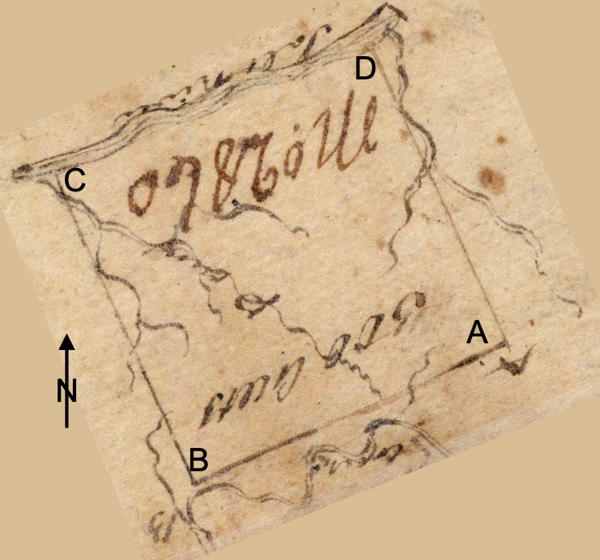
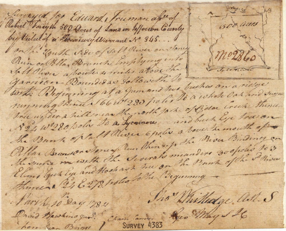
Surveyed for Edward Truman assignee of Robert Forsyth 500 acres of land in Jefferson County by virtue of a treasury warrant No. 345 on the south side of Salt River on Stoney Run or Pillar Branch emptying into Salt River about 4 miles above the garrison. Bounded as followeth, to wit. Beginning at [A] a gum and two beeches on a ridge, running thence South 66° West 285 poles to [B] a white oak and sugar tree under a hill near the north fork of Cedar Creek, thence North 24° West 280 poles to [C] a sycamore and buckeye tree on the bank of Salt River six poles above the mouth of Pillar Branch or Stoney Run, thence up the river binding on the same with the several meanders 300 poles to [D] three elms, buckeye and hoop ash on the bank of said river, thence South 24° East 278 poles to the beginning. March 20th day 1784. Thomas Whitledge, assistant surveyor. David Hawkins Jr. & Thronton Briggs, chain carriers.
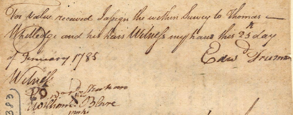
For value received, I assign the within survey to Thomas Whitledge and his heirs. Witness my hand this 25th day of January 1785. (signed) Edward Truman. Witnesses: Edward Shankam(?) and William (his X mark) Blare
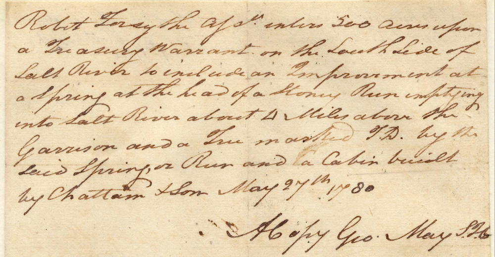
Robert Forsythe the assignee enters 500 acres upon a treasury warrant on the south side of Salt River to include an improvement at a spring at the head of a stoney run emptying into Salt River about 4 miles above the garrison and a tree marked T.D. by the said spring or run and a cabin built by Chattam & son May 27th 1780. (a copy) George May, surveyor for Jefferson County.
Deed
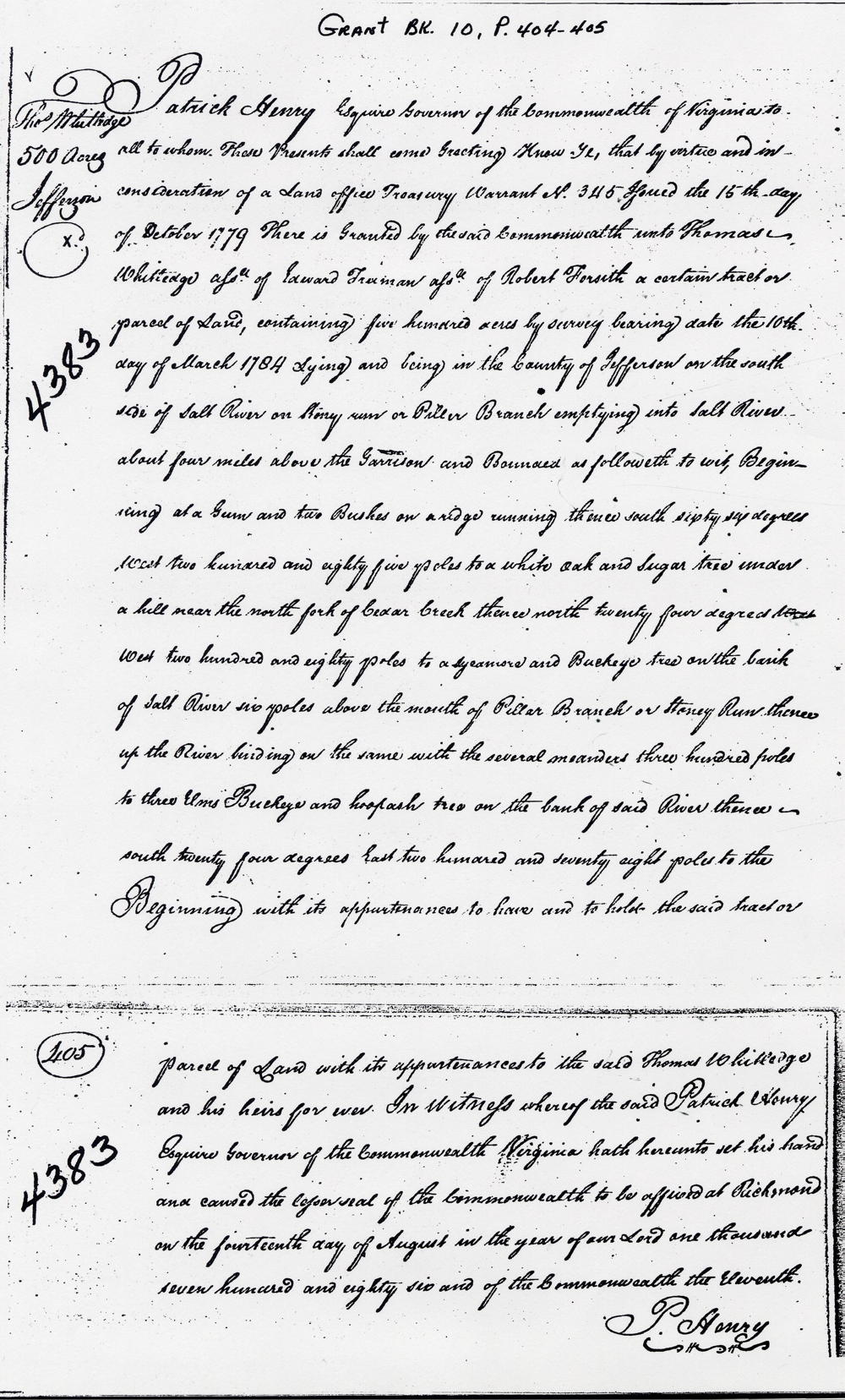
Virginia Grant Book 10, Pages 404-405
Patrick Henry Esquire, Governor of the Commonwealth of Virginia, to all to whom these presents shall come, greeting. Know ye that by virtue and in consideration of a land office treasury warrant number 345 issued the 15th day of October 1779, there is granted by the said Commonwealth unto Thomas Whitledge, assignee of Edward Truman, assignee of Robert Forsith, a certain tract or parcel of land containing 500 acres by survey bearing date the 10th day of March 1784, lying and being in the County of Jefferson on the south side of Salt River on Stony Run or Piller Branch, emptying into Salt River about four miles above the garrison, and bounded as followeth to wit. Beginning at a gum and two beeches on a ridge, running thence South 66° West 285 poles to a white oak and sugar tree under a hill near the north fork of Cedar Creek, thence North 24° West 280 poles to a sycamore and buckeye tree on the bank of Salt River six poles above the mouth of Pillar Branch or Stoney Run, thence up the river binding on the same with the several meanders 300 poles to three elms, buckeye and hoop ash on the bank of said river, thence South 24° East 278 poles to the beginning with its appurtenances to have and to hold the said tract or parcel of land with its appurtenances to the said Thomas Whitledge and his heirs forever. In witness whereof the said Patrick Henry Esquire, Governor of the Commonwealth of Virginia, hath hereunto set his hand and caused the lesser seal of the Commonwealth to be affixed at Richmond on the 14th day of August in the year of our Lord 1786, and of the Commonwealth the 11th. (signed) P. Henry
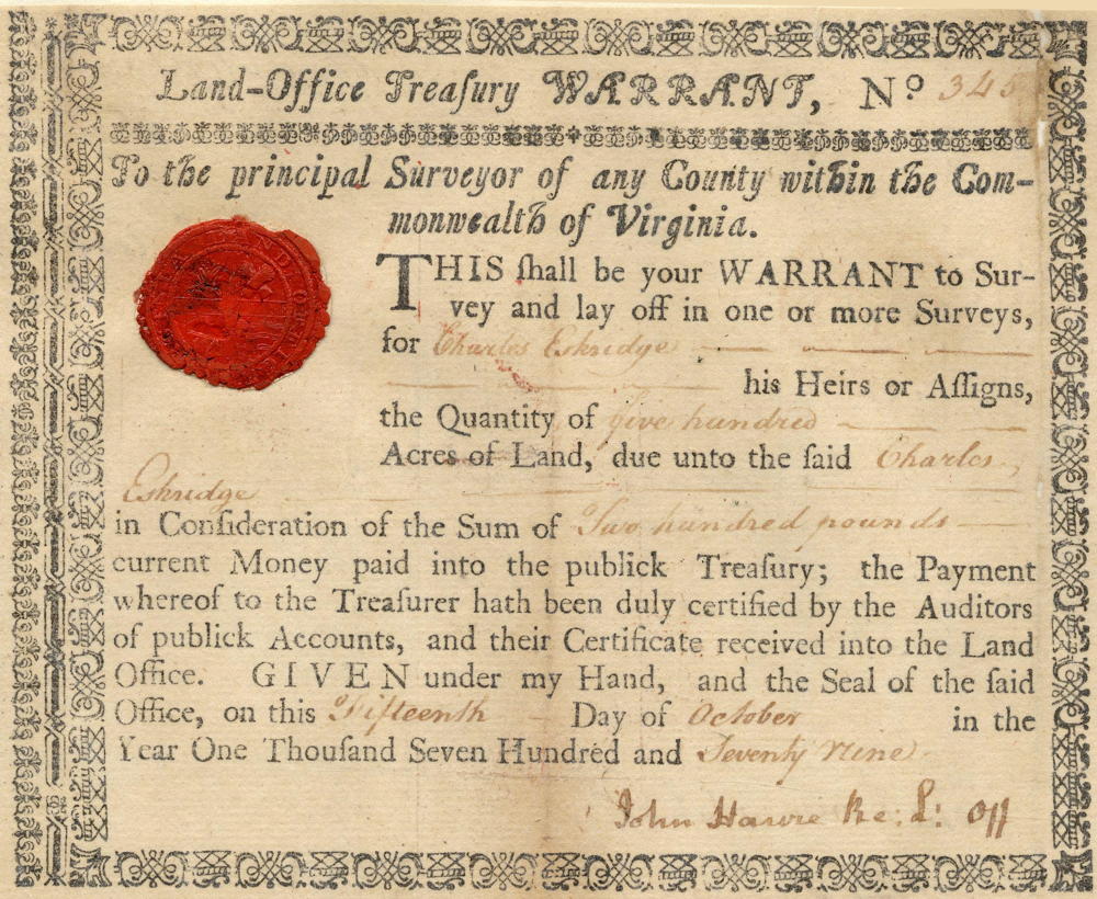
Warrant
If you, the reader, have an interest in any particular part of our county history, and wish to contribute to this effort, use the form on our Contact Us page to send us your comments about this, or any Bullitt County History page. We welcome your comments and suggestions. If you feel that we have misspoken at any point, please feel free to point this out to us.
The Bullitt County History Museum, a service of the Bullitt County Genealogical Society, is located in the county courthouse at 300 South Buckman Street (Highway 61) in Shepherdsville, Kentucky. The museum, along with its research room, is open 10 a.m. to 4 p.m. Monday through Friday. Saturday appointments are available by calling 502-921-0161 during our regular weekday hours. Admission is free. The museum, as part of the Bullitt County Genealogical Society, is a 501(c)3 tax exempt organization and is classified as a 509(a)2 public charity. Contributions and bequests are deductible under section 2055, 2106, or 2522 of the Internal Revenue Code. Page last modified: 21 Apr 2026 . Page URL: bullittcountyhistory.org/bchistory/4383-whitledge.html