
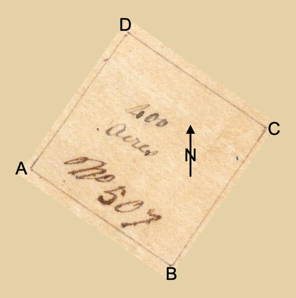
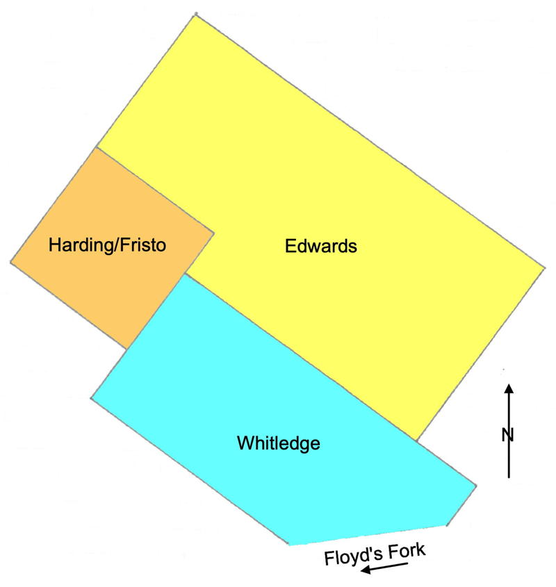
On 10 Dec 1782, John Ray surveyed 400 acres for Thomas Harding that was located on the west side of the Buffalo road leading from the blue licks to Floyd's fork in northern Bullitt County. This was #14 on the 1811 plat drawing by James Shanks, Bullitt County Surveyor, which is described on another page. Harding signed the tract over to John Fristo on 20 Dec 1784, and Fristo received a deed for this tract on 4 Jan 1786. Below is a rotated drawing of the plat on the left, and a drawing showing Harding's tract in relation to those of John Edwards and William Whitledge as described in the surveys.
Survey
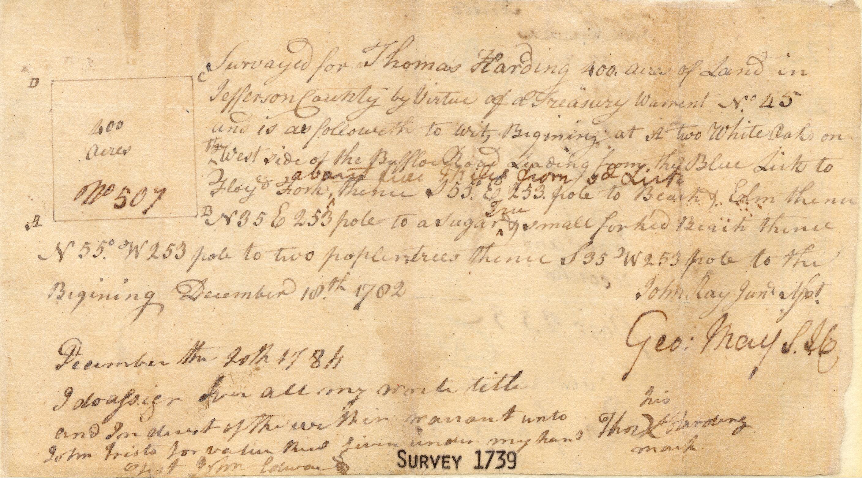
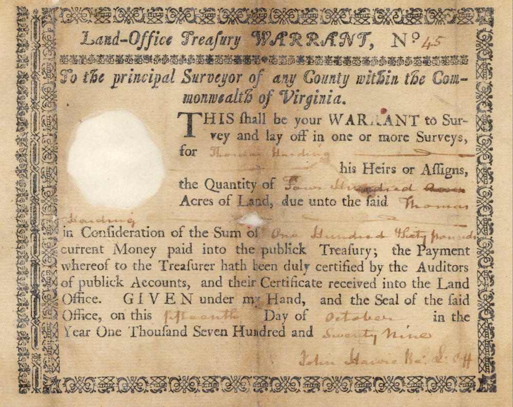
Surveyed for Thomas Harding 400 acres of land in Jefferson County by virtue of a treasury warrant No. 45 and is as follows to wit. Beginning at [A] two white oaks on the west side of the Buffalo road leading from the blue licks to Floyd's fork about five miles from said lick, thence S 55° E 253 poles to [B] a beech & elm, thence N 35° E 253 poles to [C] a sugar tree & small forked beech, thence N 55° W 253 poles to [D] two poplars, thence S 35° W 253 poles to the beginning. December 10th 1782. John Ray, surveyor.
December the 20th 1784. I do assign over all my write, title and interest of the within warrant unto John Fristo for value received. Given under my hand. (signed) Thos (his X mark) Harding. Teste: John Colware.
Deed
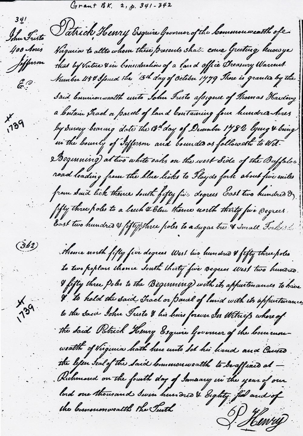
Virginia Grant Book 2, Page 341-2
Patrick Henry Esquire, Governor of the Commonwealth of Virginia, to all to whom these presents shall come, greeting. Know ye that by virtue and in consideration of a land office treasury warrant number 45 & issued the 15th day of October 1779, there is granted by the said Commonwealth unto John Fristo, assignee of Thomas Harding, a certain tract or parcel of land containing 400 acres by survey bearing date the 18th day of December 1782, lying and being in the county of Jefferson and bounded as followeth to wit. Beginning at two white oaks on the west side of the Buffalo road leading from the blue licks to Floyd's fork about five miles from said lick, thence South 55° East 253 poles to a beech & elm, thence North 35° East 253 poles to a sugar tree & small forked elm(?), thence North 55° West 253 poles to two poplars, thence South 35° West 253 poles to the beginning with its appurtenances to have and to hold the said tract or parcel of land with its appurtenances to the said John Fristo & his heirs forever. In witness whereof the said Patrick Henry Esquire, Governor of the Commonwealth of Virginia, hath here unto set his hand and caused the lesser seal of the said Commonwealth to be affixed at Richmond on the 4th day of January in the year of our Lord 1786 and of the Commonwealth the 10th. (signed) P. Henry
Warrants
If you, the reader, have an interest in any particular part of our county history, and wish to contribute to this effort, use the form on our Contact Us page to send us your comments about this, or any Bullitt County History page. We welcome your comments and suggestions. If you feel that we have misspoken at any point, please feel free to point this out to us.
The Bullitt County History Museum, a service of the Bullitt County Genealogical Society, is located in the county courthouse at 300 South Buckman Street (Highway 61) in Shepherdsville, Kentucky. The museum, along with its research room, is open 10 a.m. to 4 p.m. Monday through Friday. Saturday appointments are available by calling 502-921-0161 during our regular weekday hours. Admission is free. The museum, as part of the Bullitt County Genealogical Society, is a 501(c)3 tax exempt organization and is classified as a 509(a)2 public charity. Contributions and bequests are deductible under section 2055, 2106, or 2522 of the Internal Revenue Code. Page last modified: 21 Apr 2026 . Page URL: bullittcountyhistory.org/bchistory/1739-fristo.html