The following article by Charles Hartley originally appeared in The Courier-Journal on 21 Sep 2014. It is archived here with additional information for your reading enjoyment.

"Possession is nine-tenths of the law." Like most such statements, it isn't always true. For example, consider the early days in Kentucky when surveyors were tramping through the woods, marking trees, and measuring boundaries for land claimed by those who had purchased land office treasury warrants or obtained land grants for military service.
While the surveyors did a remarkably good job of plotting boundary lines, these surveys had a habit of overlapping one another, with multiple claims being made on choice locations. Determining whose claim was best usually became a matter for the courts to decide, and that process was often slow and confusing.
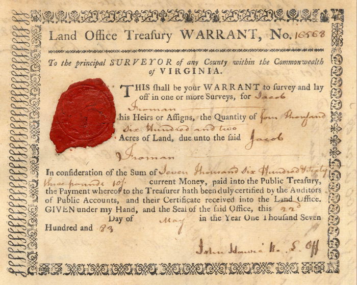
Take for example the case of Jacob Froman. According to Robert McDowell's research, on September 13, 1780, Jacob laid claim to 1000 acres on the north side of Salt River, just below William Christian's "Bullitt's Lick" tract. Then he added another 670 acres to that survey in January 1784.
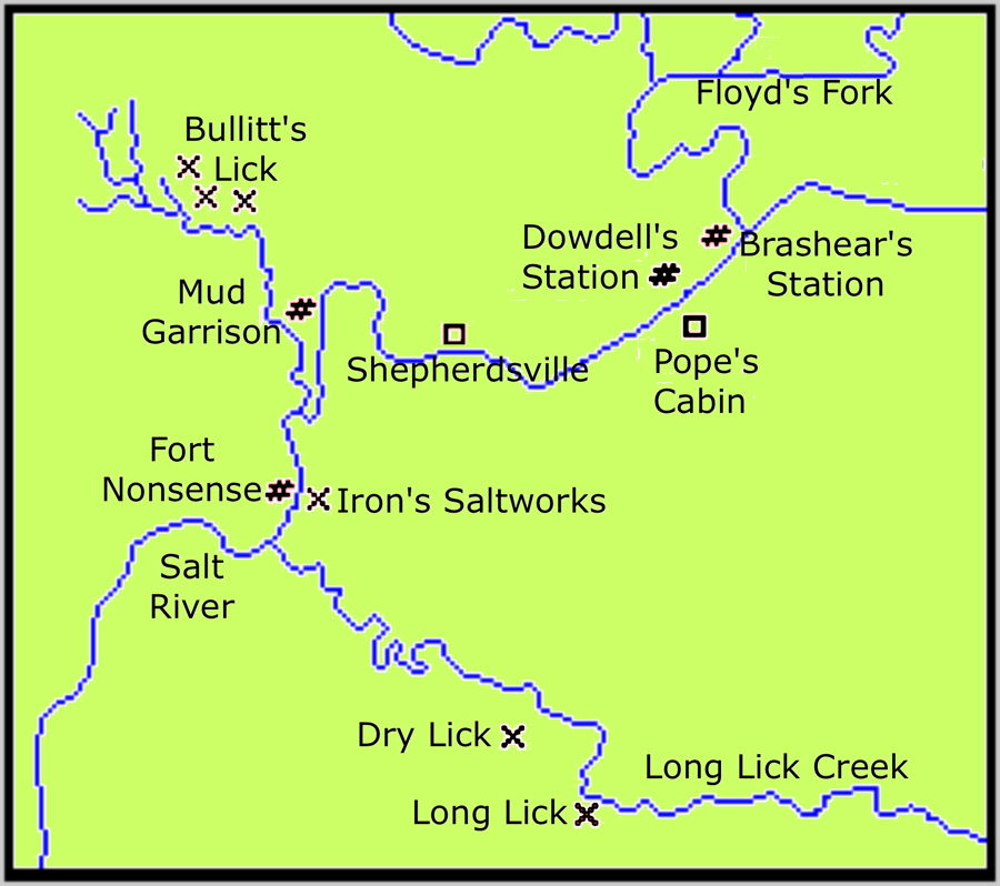
Salt had been discovered along Long Lick Creek by this time, and folks, traveling between the licks, often followed a bison track that forded Salt River below the mouth of Bullitt's Lick. This track passed through Jacob Froman's claim, and it appears that he built a rude fort on the north bank of Salt River, about a quarter mile upstream from the mouth of Long Lick Creek.
However, a man named William Farmer had entered 700 acres on Salt River opposite the mouth of Long Lick Creek on June 29, 1780, and his claim, which included the fort site, lay wholly within Froman's claim. Since his claim was made almost three months before Froman's first claim, his was ultimately ruled superior.

In later documents and depositions for various court cases, that fort was called "Froman's Folly" or "Fort Nonsense," clearly showing what others thought of Forman's mistake.
Another example was that of Charles Broughton who was one of a number of men who laid claim to the land around the salt springs on Long Lick Creek. Broughton went ahead and built a saltworks on the site, the first one on Long Lick Creek.
Unfortunately for him, Parmenas Briscoe, a hunter at Brashear's Station, had recognized the importance of the salt springs about the same time as Broughton, and both had located an entry around it on the same day. However, Broughton's survey of 250 acres was not completed and dated until October 27, 1785, while Briscoe's survey of 400 acres, which included almost all of Broughton's claim, was dated July 24, 1784.
When Henry Crist and Solomon Spears obtained Briscoe's 400 acre claim in August 1786, the writing was on the wall for Broughton. Crist and Spears pressed their claim to the saltworks, and Broughton was forced to give it up.
All was not lost for Broughton however. He had also claimed 500 acres downstream from his other claim, and here he located another vein of salt water by sinking a well away from the creek itself. This became known as the Dry Lick. Broughton was back in the salt-making business. He and his heirs, the Shains, continued to make salt at that location for the duration of the trade.
These are but two of the many examples of land disputes that would make their way into the courts. More than a quarter century later it would take the collective memories of a score of veteran pioneers, including Squire Boone, to relocate the pathway of the old Wilderness Road between Bullitt Lick and Louisville. Without their knowledge of its location, the title to thousands of acres lay in the balance.
Read old (and not so old) deeds with their boundaries marked by the locations of trees, rocks, stakes in the road, and other such impermanent things, and you can understand just how difficult it was in those bygone days to determine exactly who possessed what land.
Copyright 2014 by Charles Hartley, Shepherdsville KY. All rights are reserved. No part of the content of this page may be included in any format in any place without the written permission of the copyright holder.
The Bullitt County History Museum, a service of the Bullitt County Genealogical Society, is located in the county courthouse at 300 South Buckman Street (Highway 61) in Shepherdsville, Kentucky. The museum, along with its research room, is open 10 a.m. to 4 p.m. Monday through Friday. Saturday appointments are available by calling 502-921-0161 during our regular weekday hours. Admission is free. The museum, as part of the Bullitt County Genealogical Society, is a 501(c)3 tax exempt organization and is classified as a 509(a)2 public charity. Contributions and bequests are deductible under section 2055, 2106, or 2522 of the Internal Revenue Code. Page last modified: 12 Sep 2024 . Page URL: bullittcountyhistory.org/memories/myland.html