
The following article by Charles Hartley originally appeared in The Courier-Journal on 26 Jun 2013. It is archived here with additional information for your reading enjoyment.
Have you ever found an arrowhead? It is really quite amazing how many projectile points (for arrows, darts, spears, etc.) have been found over the years.
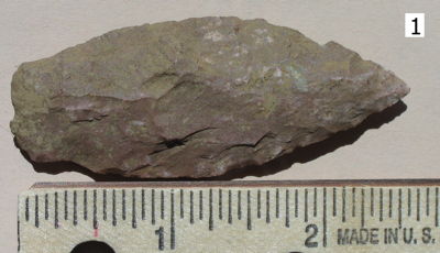
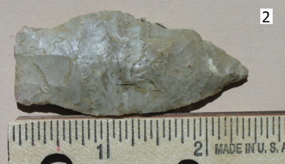
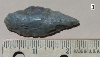
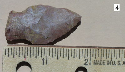
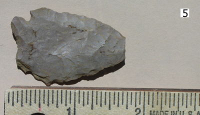
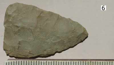
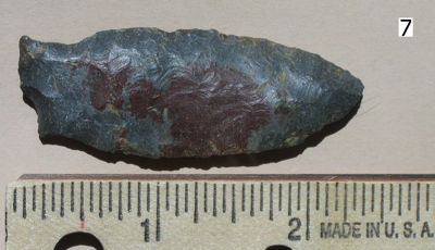
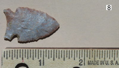
About forty years ago, I was helping to turn some ground for a garden spot when I spotted one. We kept looking, and by the time we were finished we had found eight different ones in various conditions. As you can see from the pictures included here, some were roughly shaped, while a few were finely chipped. Recently, I've been thinking about them and speculating about why they were there in that particular spot, waiting to be found.
This garden plot was about 50 by 50 feet. It was located on a ridge area above Floyd's Fork, and we speculate that the site might have been a favorite camping spot for Indians. The rough condition of some of these suggests that they were discarded as unsuitable. I can almost see the hunters sitting around their campfire, chipping away, and perhaps in disgust tossing aside their mistakes.
This site lies between the Fork to the north and the high ground to the south, along which it is generally thought that the buffalo path, later considered part of the Wilderness Road, ran on its way to the salt licks to the west of Shepherdsville. Today Highway 44 seems to generally follow the same path, and the garden plot site lies less than a half mile north of it.
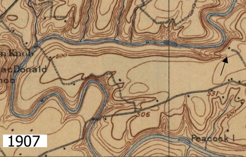
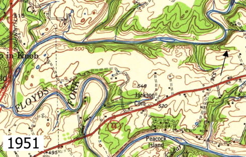
Follow Highway 44 westward today and when you come to the Floyd's Fork bridge you are likely not on the old buffalo path. The modern bridge is located south of where the road used to cross the fork, as can be seen on the two maps shown here. The 1907 map shows where the road ran then; the 1951 map shows it in its current route. The arrow drawn on each map indicates the general location of the garden spot.
It is also possible that the buffalo path had more than one branch, and that one branch came through or very close to the place where the points were found.
At any rate, game of all kinds might have passed this way, either along the buffalo path or down the valley of the fork. It would certainly have made this a good location to camp while hunting.
We know that by the time many of our ancestors were venturing into Kentucky, most of it was unoccupied except by hunting parties of Indians. The salt licks attracted the wildlife which attracted the hunters who left behind our projectile points. But just when were they here? And how old are these artifacts? I really don't know. Perhaps by displaying them here, some knowledgeable person can tell us more about them. If you have information about these, please contact us by using the "Contact Us" link at the top of this page.
At any rate, in a place where historical artifacts are scarce, it's nice to have something in hand to help us remember the past.
Copyright 2013 by Charles Hartley, Shepherdsville KY. All rights are reserved. No part of the content of this page may be included in any format in any place without the written permission of the copyright holder.
The Bullitt County History Museum, a service of the Bullitt County Genealogical Society, is located in the county courthouse at 300 South Buckman Street (Highway 61) in Shepherdsville, Kentucky. The museum, along with its research room, is open 10 a.m. to 4 p.m. Monday through Friday. Saturday appointments are available by calling 502-921-0161 during our regular weekday hours. Admission is free. The museum, as part of the Bullitt County Genealogical Society, is a 501(c)3 tax exempt organization and is classified as a 509(a)2 public charity. Contributions and bequests are deductible under section 2055, 2106, or 2522 of the Internal Revenue Code. Page last modified: 12 Sep 2024 . Page URL: bullittcountyhistory.org/memories/arrows.html