
It appears from this deed, that Adam Shepherd's hold on his father's 900 and 600 acre surveys bordering Salt River had been forfeited by court order some time before 1803, and William Pope had purchased the land at public sale ordered by the District Court of Kentucky. Pope and Shepherd may have had some kind of arrangement, for by this deed Pope returned ownership of part of these tracts to Shepherd's daughters Sally and Charlotte Shepherd in March 1827.
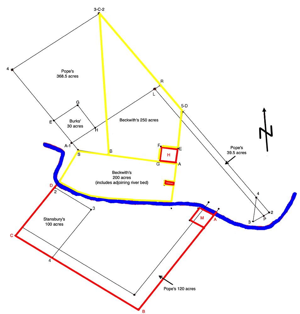
This deed includes a drawn plat that shows the location of who owned various parts of these two tracts. We have included here a version of that drawn plat.
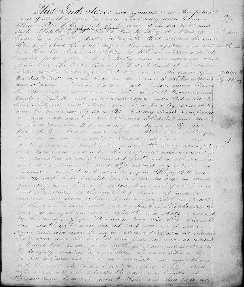
Deed
Bullitt County Deed Book F, Pages 290-293
This indenture and agreement made this 15th day of March 1827 between William Pope of the county of Jefferson of the one part and Sally Shepherd and Charlotte Shepherd of Bullitt County, all of the state of Kentucky, of the other part. Witnesseth that whereas the said Pope on or about the first day of January 1803 purchased at public by William Adkin a deputy marshall for the district of Kentucky under two executions which issued from the clerk's office of the District Court of the United States for the District of Kentucky, one in the name of Heathcot F. Dall and the other in the name of William Taylor against Adam Shepherd, the one tract of 900 acres, the other of 600 acres, both on Salt River in said county of Bullitt and entered, surveyed and patented to Peter Shepherd, and whereas since said sale by said Akins and the purchase by said Pope sundry parts and parcels of land was sold by said Adam Shepherd and deeds on either relinquishments have been made by said Pope for parts of said lands and the said Pope being willing to convey to the said Sally and Charlotte all the remaining parts of said two tracts of land with the foregoing exceptions and reservations and with the exceptions and reservations now hereafter expressed and set forth out of the 600 acre survey the said Pope reserves and retains 120 acres to adjoin Honey's and Brend's surveys with lines parallel to the said surveys an equal quantity on each and to adjoin the land of Maraman and Stansbury as claimed by them out of said 600 acres survey, 39 1/2 acres out of the 900 acre survey back of Shepherdsville and adjoining McGee's survey agreeably to a plat made out by the surveyor of Bullitt County and also 368 1/2 acres out of said 900 acres to adjoin Beckwith's 250 acres, Burks' 30 acres and the line of said 900 acres next to Bullitt's Lick as also appears by the plat annexed hereto with the foregoing reservations and exceptions the said William Pope for himself and his heirs doth covenant and agree to and with the said Sally and Charlotte that he and they will warrant and defend the same 600 and the same 900 acres to them and their heirs or so much thereof as was purchased by him at the sale aforesaid, but it is the understanding that the said Pope and his heirs are not to be answerable in any way of defect in title, he only relinquishes to them all right, title and claim which he acquired by the purchase aforesaid, subject to the exceptions and reservations contained in this deed; nor is this deed to have any effect until they convey and cause to be conveyed unto said Pope by deed with quit claim and relinquishment of dower by the heirs of Adam Shepherd or such of them as are of age all the right, title and claim which they may have in and to the 120 acres, 39 1/2 acres, and 368 1/2 acres as before reserved to said Pope. In witness whereof the said William Pope hath set his hand and seal the day and year first above written. (signed) William Pope. Teste: Benjamin Chapeze, Thomas Q. Wilson.
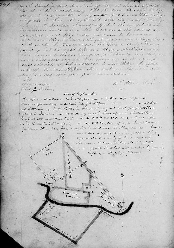
Notes of Explanation
The [A 1] and Salt River and No. 2, [No. 3 & 2 C] and No. 4, E, & [A 1] represents Shepherd's 900 acre survey on the north side of Salt River.
The A, B, C, D in red lines and Salt River represents Shepherd's 600 acre survey on the south side of Salt River.
The A & Salt River and D. S. A. edged with yellow represent Beckwith and Grayson's 200 acre tract.
The [A 1] E. G. H. and [A 1] represent Burks' 30 acres.
The square H in red lines represents Jones' 10 acres.
The oblong square bounded in red lines represents the graveyard.
The square M bounded by red lines represents Maraman's 10 acres.
The triangle Nos. 3, 4 and 2 bounded with black lines and marked P represents Griffin's or Mocaby's 6 3/4 acres.
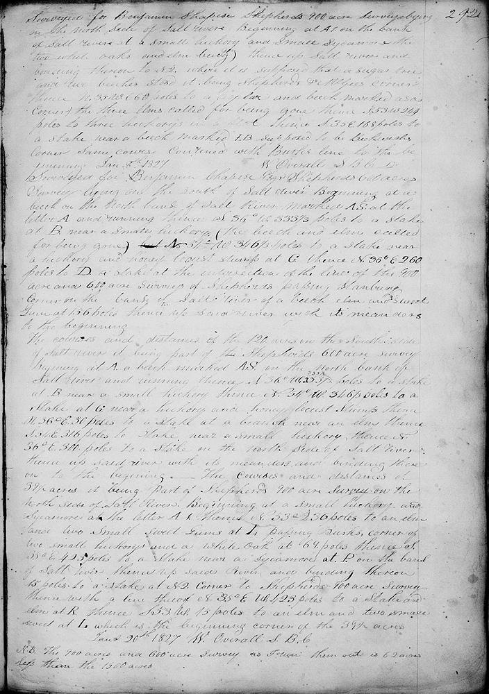
Surveyed for Benjamin Chapeze Shepherd's 900 acre survey lying on the north side of Salt River. Beginning at A1 on the bank of Salt River at a small hickory and small sycamore and two white oaks and elm trees, thence up Salt River and binding thereon to No. 2 where it is supposed that a sugar tree and two beeches stood, it being Shepherd's and McGee's corner, thence N 35° W 660 poles to a poplar and beech marked as a corner, the three elms called for being gone, thence S 53° W 249 poles to three hickory's in a flat, thence S 35° E 168 poles to a stake near a beech marked I.B., supposed to be Beckwith's corner, same course continued with Burk's line to the beginning. January 8th 1827.
W. Overall, SBC. Surveyed for Benjamin Chapeze said Shepherd's 600 acre survey lying on the south of Salt River, beginning at a beech on the north bank of Salt River marked A.S. at the letter A, and running thence S 36° W 333 1/3 poles to a stake at B near a small hickory (the beech and elm called for being gone), N 54° W 346 1/3 poles to a stake near a hickory and hony locust stump at G, thence N 36° E 260 poles to D, a stake at the intersection of the line of the intersection of the 900 acre and 600 acre surveys of Shepherd, passing Stansbury's corner on the bank of Salt River of a beech, elm and sweet gum at 156 poles, thence up said river with its meanders to the beginning.
The courses and distances of the 120 acres on the south side of Salt River, it being part of Shepherd's 600 acre survey. Beginning at A, a beech marked A.S. on the north bank of Salt River and running thence S 36° W 333 1/3 poles to a stake at B near a small hickory, thence N 54° W 346 1/3 poles to a stake at G near a hickory and honey locust stump, thence N 36° E 30 poles to a stake at a branch near an elm, thence S 54° E 316 poles to a stake near a small hickory, thence N 36° E 300 poles to a stake on the north side of Salt River, thence up Salt River with its meanders and binding thereon to the beginning.
The courses and distances of 39 1/2 acres, it being part of Shepherd's 900 acre survey on the north side of Salt River. Beginning at a small hickory and sycamore at the letter A-1, thence N 53° 236 poles to an elm and two small sweet gums at L, passing Burks' corner of two small hickorys and a white oak at 69 poles, thence S 35° E 423 poles to a stake near a sycamore at P on the bank of Salt River, hence up said river and binding thereon 15 poles to a stake at No. 2, corner to Shepherd's 900 acre survey, thence with a line thereof N 35° E (W) 423 poles to a stake and elm at R, thence S 53 W 15 poles to an elm and two small sweet [gum] at L which is the beginning corner of the 39 1/2 acres.
January 20th 1827. W. Overall, S.B.C.
N.B. The 900 acre and 600 acre survey as to run them out is 62 acres less than the 1500 acres.
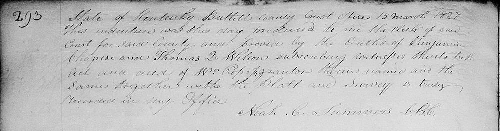
State of Kentucky, Bullitt County Court Office, 15 March 1827 This indenture was this day produced to me the clerk of said court for said county and proved by the oaths of Benjamin Chapeze and Thomas Q. Wilson, subscribing witnesses thereto to be the act and deed of William Pope Jr., grantor therein nameds and the same together with the plat and survey is truly recorded in my office. (signed) Noah C. Summers, C.B.C.
If you, the reader, have an interest in any particular part of our county history, and wish to contribute to this effort, use the form on our Contact Us page to send us your comments about this, or any Bullitt County History page. We welcome your comments and suggestions. If you feel that we have misspoken at any point, please feel free to point this out to us.
The Bullitt County History Museum, a service of the Bullitt County Genealogical Society, is located in the county courthouse at 300 South Buckman Street (Highway 61) in Shepherdsville, Kentucky. The museum, along with its research room, is open 10 a.m. to 4 p.m. Monday through Friday. Saturday appointments are available by calling 502-921-0161 during our regular weekday hours. Admission is free. The museum, as part of the Bullitt County Genealogical Society, is a 501(c)3 tax exempt organization and is classified as a 509(a)2 public charity. Contributions and bequests are deductible under section 2055, 2106, or 2522 of the Internal Revenue Code. Page last modified: 04 Sep 2025 . Page URL: bullittcountyhistory.org/bchistory/pope-shepherdsisters.html