
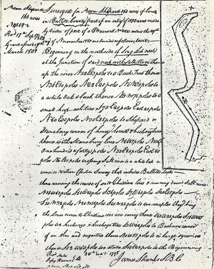
On 29 Nov 1785, Adam Shepherd paid James Shanks to survey 160 acres that included the bed of Salt River from the mouth of Long Lick Creek upstream to the upper corner of William Christian's 1000 acre Bullitt's Lick tract, then crossing the river and running downstream to the beginning. There is some question whether he was able to maintain his claim on this part of the river.
Survey
Deed
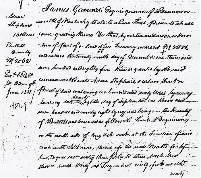
James Garrard Esquire, Governor of the Commonwealth of Kentucky, to all to whom these presents shall come, greeting. Know ye that by virtue and in consideration of part of a land office treasury warrant No. 21887 and entered the 29th day of November 1785, there is granted by the said Commonwealth unto Adam Shepherd a certain tract or parcel of land containing 160 acres by survey bearing date the 28th day of September 1798, lying and being in the County of Bullitt and bounded as followeth, to wit.
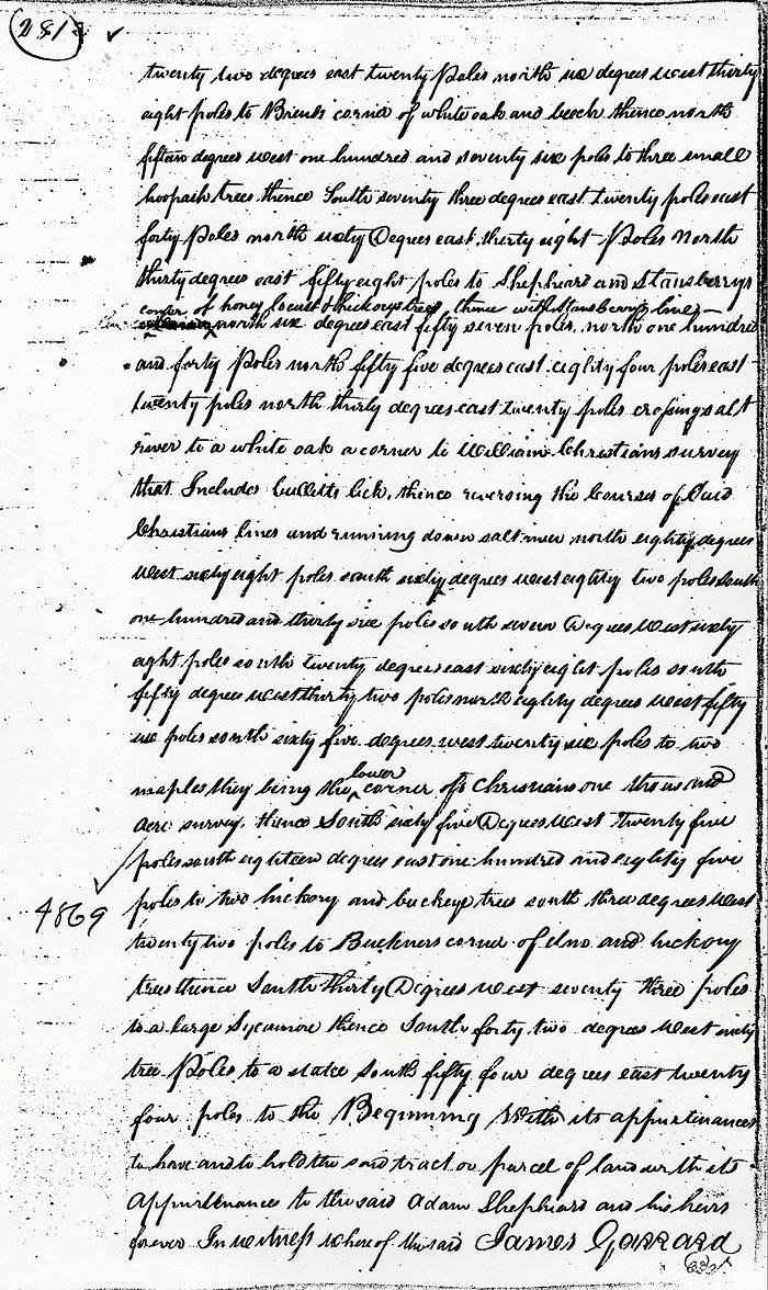
Beginning on the north side of Long Lick Creek at the junction of said creek with Salt River, thence up the river North 42° East 63 poles to three beech trees, thence North 36° East 60 poles, North 22° East 20 poles, North 6° West 38 poles to Brent's corner of white oak and beech, thence North 15° West 176 poles to three small hoopash trees, thence South 73° East 20 poles East 40 poles, North 60° East 38 poles, North 30° East 58 poles to Shepherd and Stanberry's corner of honey locust & hickory trees, thence with Stansberry's line North 6° East 57 poles, North 140 poles, North 55° East 84 poles East 20 poles, North 30° East 20 poles crossing Salt River to a white oak, a corner to William Christian's survey that includes Bullitt's Lick, thence reversing the courses of said Christian's lines and running down Salt River North 80° West 68 poles, South 60° West 82 poles, South 136 poles, South 7° West 68 poles, South 20° East 68 poles, South 50° West 32 poles, North 80° West 56 poles, South 65° West 26 poles to two maples they being the lower corner of Christian's 1000 acre survey, thence South 65° West 25 poles, South 18° East 185 poles to two hickory and buckeye trees, South 3° West 22 poles to Buckner's corner of elm and hickory trees thence South 30° West 73 poles to a large sycamore thence South 42° West 63 poles to a stake, South 54° East 24 poles to the Beginning with its appurtenances, to have and to hold the said tract or parcel of land with its appurtenances to the said Adam Shepherd and his heirs forever. In witness whereof the said James Garrard.
If you, the reader, have an interest in any particular part of our county history, and wish to contribute to this effort, use the form on our Contact Us page to send us your comments about this, or any Bullitt County History page. We welcome your comments and suggestions. If you feel that we have misspoken at any point, please feel free to point this out to us.
The Bullitt County History Museum, a service of the Bullitt County Genealogical Society, is located in the county courthouse at 300 South Buckman Street (Highway 61) in Shepherdsville, Kentucky. The museum, along with its research room, is open 10 a.m. to 4 p.m. Monday through Friday. Saturday appointments are available by calling 502-921-0161 during our regular weekday hours. Admission is free. The museum, as part of the Bullitt County Genealogical Society, is a 501(c)3 tax exempt organization and is classified as a 509(a)2 public charity. Contributions and bequests are deductible under section 2055, 2106, or 2522 of the Internal Revenue Code. Page last modified: 21 Apr 2026 . Page URL: bullittcountyhistory.org/bchistory/ok4869-shepherd.html