
On 29 Dec 1797, James Shanks led a survey team that included John Essery as the marker, and John Samuels and James Essery as chain carriers, to survey 200 acres of land for John Carr on the north side of the Rolling Fork, and adjacent to Cuthbert Harrison's 5000 acre tract. Carr received a deed for the tract on 6 May 1800. The tract would be sold to Isaac Larue of Hardin County on 25 Jul 1799 in the names of John Carr and John Essery.
Survey
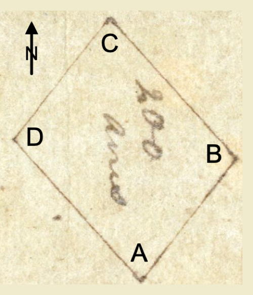
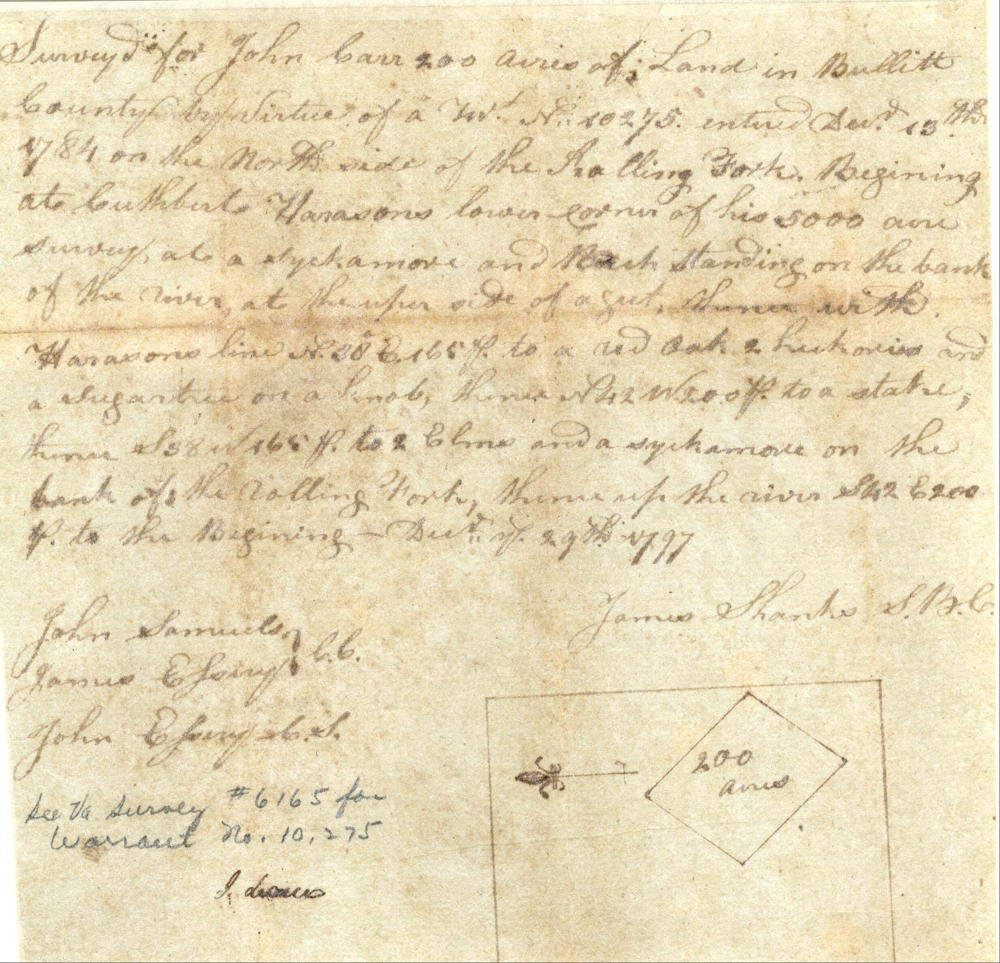
Surveyed for John Carr 200 acres of land in Bullitt County by virtue of a treasury warrant number 10275 entered December 13, 1784 on the north side of the Rolling Fork. Beginning at Cuthbert Harrison's lower corner of his 5000 acres survey at [A] a sycamore and beech standing on the bank of the river at the upper side of a gut, thence with Harrison's line North 38° East 165 poles to [B] a red oak, 2 hickories and a sugar tree on a knob, thence North 42° West 200 poles to [C] a stake, thence South 38° West 165 poles to [D] 2 elms and a sycamore on the bank of the Rolling Fork, thence up the river South 42° East 200 poles to the beginning. December 29th 1797. James Shanks, surveyor. John Samuels & James Essery, chain carriers. John Essery, C.S.
Deed
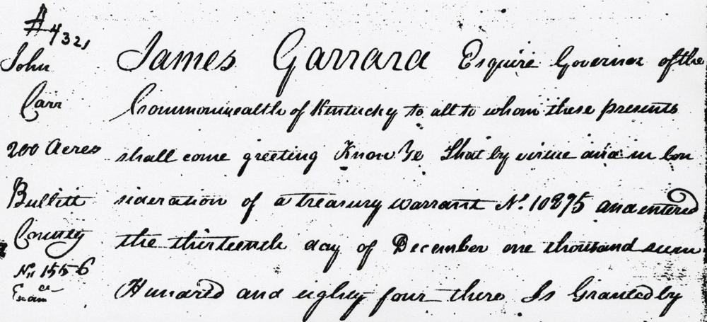
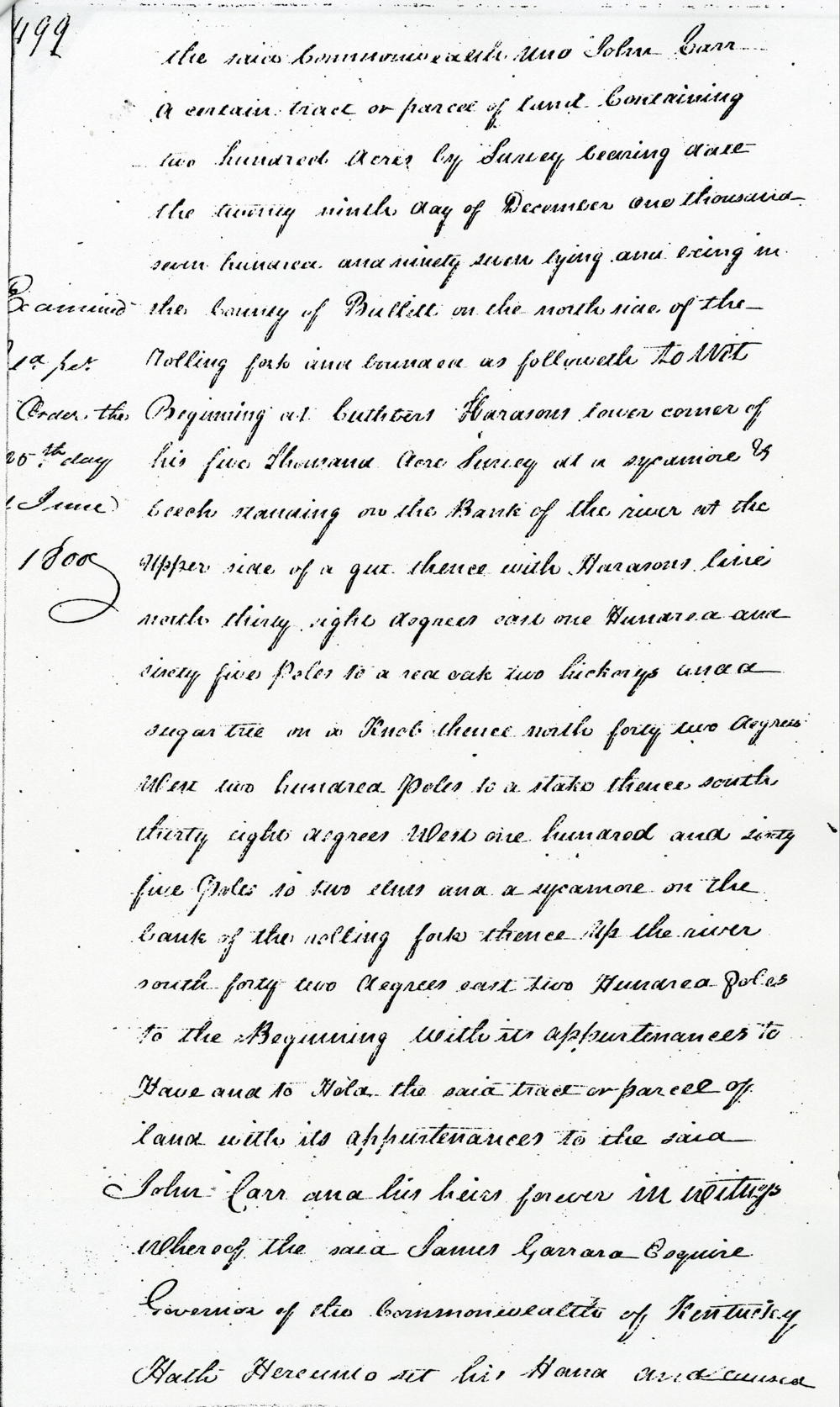
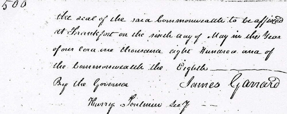
James Garrard Esquire, Governor of the Commonwealth of Kentucky, to all to whom these presents shall come, greeting. Know ye that by virtue and in consideration of a treasury warrant No. 10275 and entered the 13th day of December 1784, there is granted by the said Commonwealth unto John Carr a certain tract or parcel of land containing 200 acres by survey bearing date the 29th day of December 1797, lying and being in the County of Bullitt on the north side of the Rolling Fork and bounded as followeth, to wit. Beginning at Cuthbert Harrison's lower corner of his 5000 acre survey at a sycamore and beech standing on the bank of the river at the upper side of a gut, thence with Harrison's line North 38° East 165 poles to a red oak, 2 hickories and a sugar tree on a knob, thence North 42° West 200 poles to a stake, thence South 38° West 165 poles to 2 elms and a sycamore on the bank of the Rolling Fork, thence up the river South 42° East 200 poles to the beginning with its appurtenances to have and to hold the said tract or parcel of land with its appurtenances to the said John Carr and his heirs forever. In witness whereof the said James Garrard Esquire, Governor of the Commonwealth of Kentucky, hath hereunto set his hand and caused the seal of the said Commonwealth to be affixed at Frankfort on the 6th day of May in the year of our Lord 1800 and of the Commonwealth the 8th. (signed) James Garrard
If you, the reader, have an interest in any particular part of our county history, and wish to contribute to this effort, use the form on our Contact Us page to send us your comments about this, or any Bullitt County History page. We welcome your comments and suggestions. If you feel that we have misspoken at any point, please feel free to point this out to us.
The Bullitt County History Museum, a service of the Bullitt County Genealogical Society, is located in the county courthouse at 300 South Buckman Street (Highway 61) in Shepherdsville, Kentucky. The museum, along with its research room, is open 10 a.m. to 4 p.m. Monday through Friday. Saturday appointments are available by calling 502-921-0161 during our regular weekday hours. Admission is free. The museum, as part of the Bullitt County Genealogical Society, is a 501(c)3 tax exempt organization and is classified as a 509(a)2 public charity. Contributions and bequests are deductible under section 2055, 2106, or 2522 of the Internal Revenue Code. Page last modified: 21 Apr 2026 . Page URL: bullittcountyhistory.org/bchistory/ok4321-carr.html