
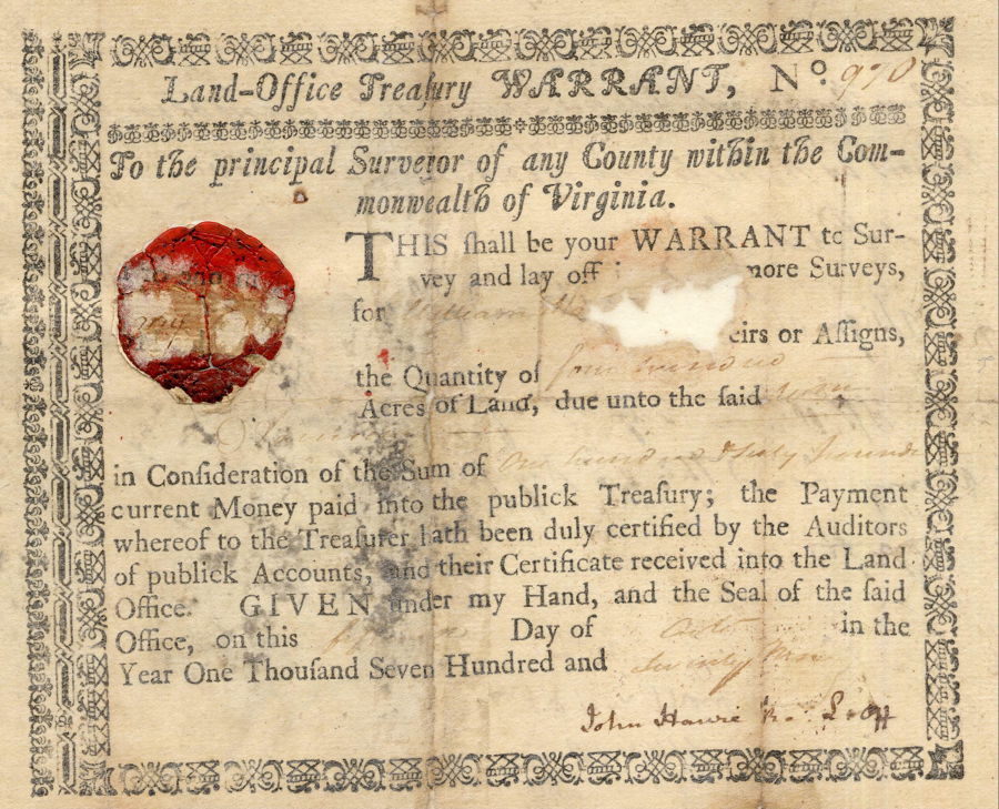
Nicholas Brashear, son of William Brashear, patented the 400 acre tract where Brashear's Station stood near the juncture of Salt River and Floyd's Fork. According to these records, It was based on a Virginia Treasury Warrant #970 that was initially sold to William Harrison. This first image is torn where the name would be.
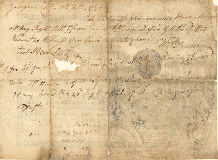
This next image shows the backside of the warrant, and indicates that it was transferred to Henry Beeson on 11 Feb 1780, and then from him to William Brashear on 25 Apr 1780.
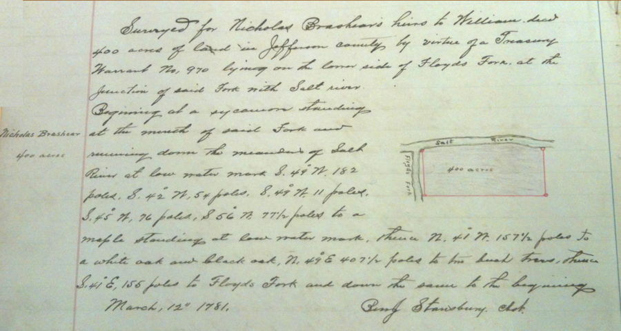
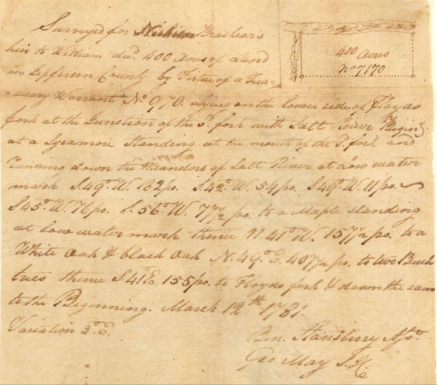
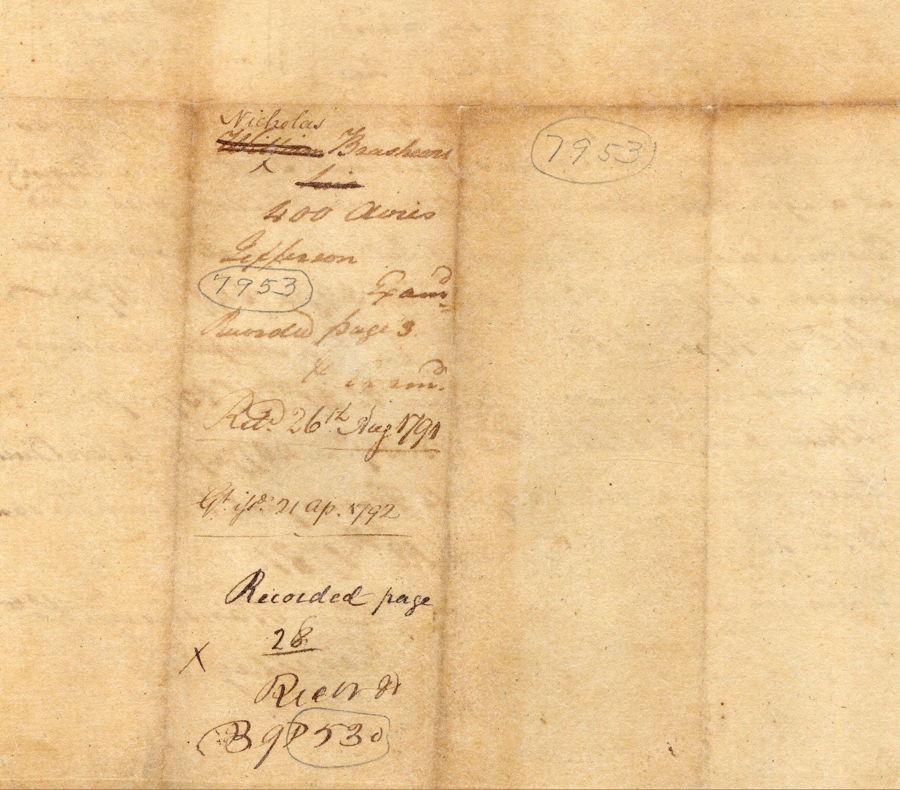
Below is a transcription of the survey followed by digital images of the original plat and description drawn by Ben Stansbury on 12 Mar 1781. The first image comes from Bullitt County Plat Book I. The next one is the original survey. Note that William's son Nicholas' name is written in. The backside is shown next. Note that this plat was drawn facing the south instead of the north, so Brashear's land was on the north side of Salt River and west side of Floyd's Fork.
Survey
Surveyed for Nicholas Brashears heir to William dec'd 400 acres of land in Jefferson County by virtue of a treasury warrant No. 970 lying on the lower side of Floyd's Fork at the junction of the said fork with Salt River. Beginning at a sycamore standing at the mouth of the said fork and running down the meanders of Salt River at low water mark S 49° W 182 poles, S 42° W 54 poles, S 49° W 11 poles, S 45° W 76 poles, S 56° W 77 1/2 poles to a maple standing at low water mark, thence N 41° W 157 1/2 poles to a white oak & black oak, N 49° E 407 1/2 poles to two beech trees, thence S 41° E 155 poles to Floyd's Fork & down the same to the beginning. March 12th 1781. Variation 3° E. (signed) Ben Stansbury, Assistant Surveyor. George May, S.J.C.
Although Stansberry completed the survey in 1781, it was not until 1792 that Brashear's patent was granted. A digital image of that patent, as written in Grant Book 16, pages 176-177, is shown below. Beneath it is a transcription of the patent.
Deed
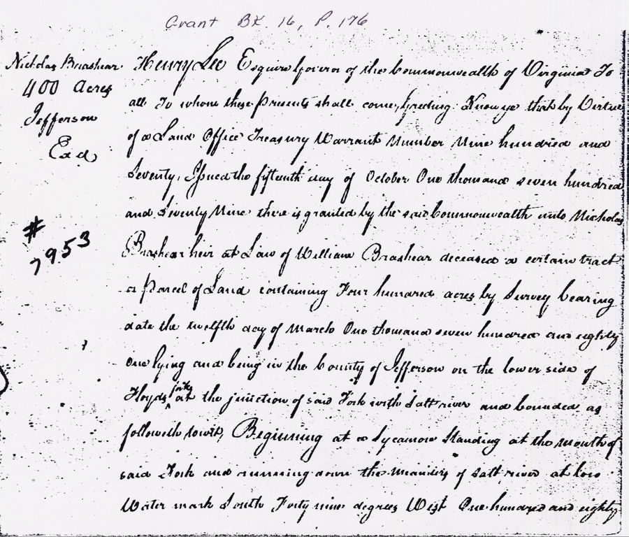
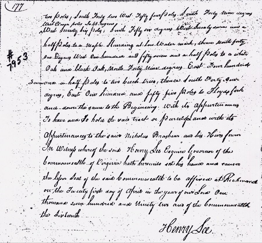
Henry Lee Esquire governor of the Commonwealth of Virginia to all to whom these presents shall come, greeting. Know ye that by virtue of a Land Office Treasury Warrant number nine hundred and seventy, issued the fifteenth day of October One thousand seven hundred and seventy-nine there is granted by the said Commonwealth unto Nicholas Brashear heir at law of William Brashear deceased a certain tract or parcel of land containing four hundred acres by survey bearing date the twelfth day of March one thousand seven hundred and eighty and lying and being in the County of Jefferson on the lower side of Floyds Fork at the junction of said Fork with Salt river and bounded as followeth towit, Beginning at a Sycamore standing at the mouth of said Fork and running down the meander of Salt river at low water mark South Forty nine degrees West one hundred and eighty two poles, South Forty two West Fifty four poles, South Forty nine degrees west eleven poles So. 45 degrees west seventy six poles, South fifty six degrees West seventy seven and a half poles to a maple standing at low water mark, thence north forty one degrees west one hundred and fifty seven and a half poles to a white oak and black oak, North forty nine degrees East four hundred seven and a half poles to two beech trees thence South Forty one degrees East one hundred and fifty-five poles to Floyds Fork and down the same to the Beginning. With its appurtenances to have and to hold the said tract or parcel of land with its appurtenances to the said Nicholas Brashear and his heirs forever. In witness whereof the said Henry Lee Esquire governor of the Commonwealth of Virginia hath hereunto set his hand and caused the seal of the said Commonwealth to be affixed at Richmond on the twenty first day of April in the year of our Lord one thousand seven hundred and ninety-two and of the Commonwealth the sixteenth.
Henry Lee
If you, the reader, have an interest in any particular part of our county history, and wish to contribute to this effort, use the form on our Contact Us page to send us your comments about this, or any Bullitt County History page. We welcome your comments and suggestions. If you feel that we have misspoken at any point, please feel free to point this out to us.
The Bullitt County History Museum, a service of the Bullitt County Genealogical Society, is located in the county courthouse at 300 South Buckman Street (Highway 61) in Shepherdsville, Kentucky. The museum, along with its research room, is open 10 a.m. to 4 p.m. Monday through Friday. Saturday appointments are available by calling 502-921-0161 during our regular weekday hours. Admission is free. The museum, as part of the Bullitt County Genealogical Society, is a 501(c)3 tax exempt organization and is classified as a 509(a)2 public charity. Contributions and bequests are deductible under section 2055, 2106, or 2522 of the Internal Revenue Code. Page last modified: 12 Sep 2024 . Page URL: bullittcountyhistory.org/bchistory/nicholasbrashearpatent.html