
John Edward King and wife sold this tract to William King on 22 Aug 1797. The deed was recorded in Nelson County.
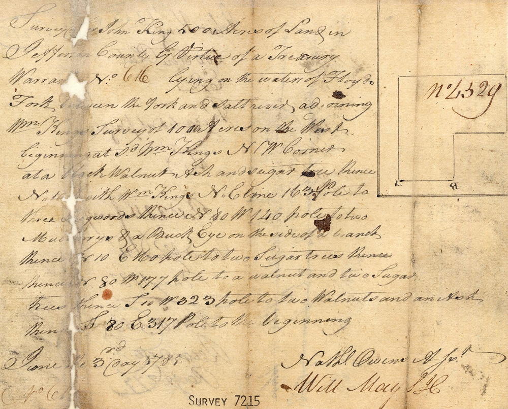
Survey
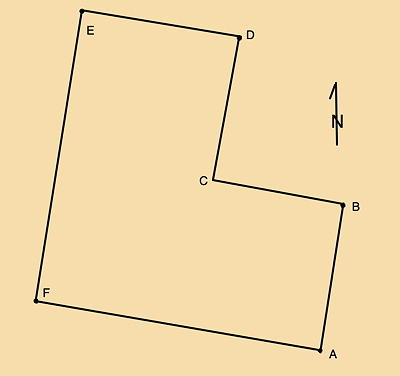
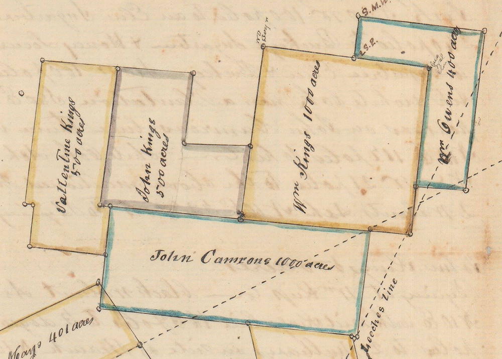
Surveyed for John King 500 acres of land in Jefferson County by virtue of a treasury warrant No. 616, lying on the waters of Floyd's Fork between the fork and Salt River adjoining William King's survey of 1000 acres on the west beginning at [A] said William King's NW corner at a black walnut, ash and sugar tree, thence N 10° E with William King's NE line 163 1/2 pole to [B] three dogwoods, thence N 80° W 140 poles to [C] two mulberrys and a buckeye on the side of a branch, thence N 10° E 160 poles to [D] two sugar trees, thence N 80° W 177 poles to [E] walnut and two sugar trees, thence S 10° W 323 poles to [F] two walnuts and an ash, thence S 80° E 317 poles to the beginning.
Deed
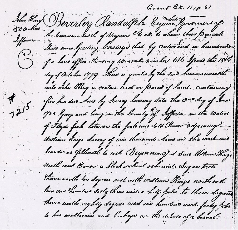
Virginia Grant Book 11, Page 61
Beverley Randolph Esquire, Lieutenant Governor of the Commonwealth of Virginia to all to whom these presents shall come, greeting. Know ye that by virtue and in consideration of a land office treasury warrant number 616 issued the 15th day of October 1779 there is granted by the said Commonwealth unto John King a certain tract or parcel of land containing 500 acres by survey bearing date the 3rd day of June 1785, lying and being in the county of Jefferson on the waters of Floyd's Fork between the fork and Salt River adjoining William King's survey of 1000 acres on the west and bounded as followeth to wit.
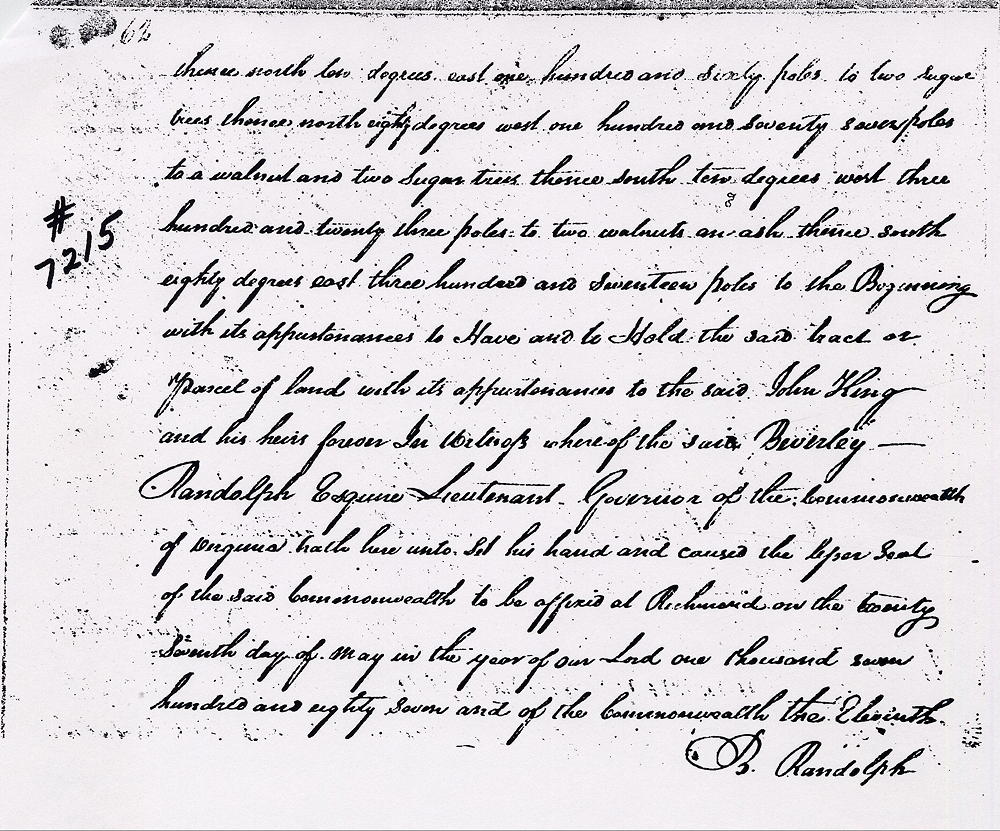
Beginning at said William King's northwest corner, a black walnut, ash and sugar tree, thence North 10° East with William King's northeast line 163 1/2 pole to three dogwoods, thence North 80° West 140 poles to two mulberrys and buckeye on the side of a branch, thence North 10° East 160 poles to two sugar trees, thence North 80° West 177 poles to a walnut and two sugar trees, thence South 10° W 323 poles to two walnuts an ash, thence South 80° East 317 poles to the beginning with its appurtenances to have and to hold the said tract or parcel of land with its appurtenances to the said John King and his heirs forever.
In witness whereof the said Beverley Randolph Esquire, Lieutenant Governor of the Commonwealth of Virginia hath hereunto set his hand and caused the lesser seal of the said Commonwealth to be affixed at Richmond on the 27th day of May in the year of our Lord 1787, and of the Commonwealth the 11th. (signed) B. Randolph
If you, the reader, have an interest in any particular part of our county history, and wish to contribute to this effort, use the form on our Contact Us page to send us your comments about this, or any Bullitt County History page. We welcome your comments and suggestions. If you feel that we have misspoken at any point, please feel free to point this out to us.
The Bullitt County History Museum, a service of the Bullitt County Genealogical Society, is located in the county courthouse at 300 South Buckman Street (Highway 61) in Shepherdsville, Kentucky. The museum, along with its research room, is open 10 a.m. to 4 p.m. Monday through Friday. Saturday appointments are available by calling 502-921-0161 during our regular weekday hours. Admission is free. The museum, as part of the Bullitt County Genealogical Society, is a 501(c)3 tax exempt organization and is classified as a 509(a)2 public charity. Contributions and bequests are deductible under section 2055, 2106, or 2522 of the Internal Revenue Code. Page last modified: 17 Mar 2026 . Page URL: bullittcountyhistory.org/bchistory/john-king-survey2.html