
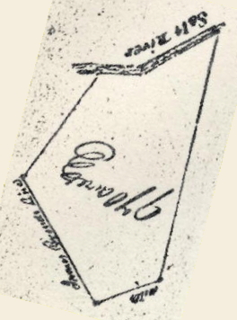
James Honey had 970 acres surveyed by Benjamin Stansbury on 17 Apr 1781 that lay to the southeast of Peter Shepherd's 600 acre tract on south side of Salt River. It also adjoined the survey of James Brend on the west. The transcribed survey and deed are below. The survey drawing is rotated here to show its approximately directions.
This land would later come into the hands of William Hay of Fayette County and would be sold by him to William Pope Jr., as shown on another page.
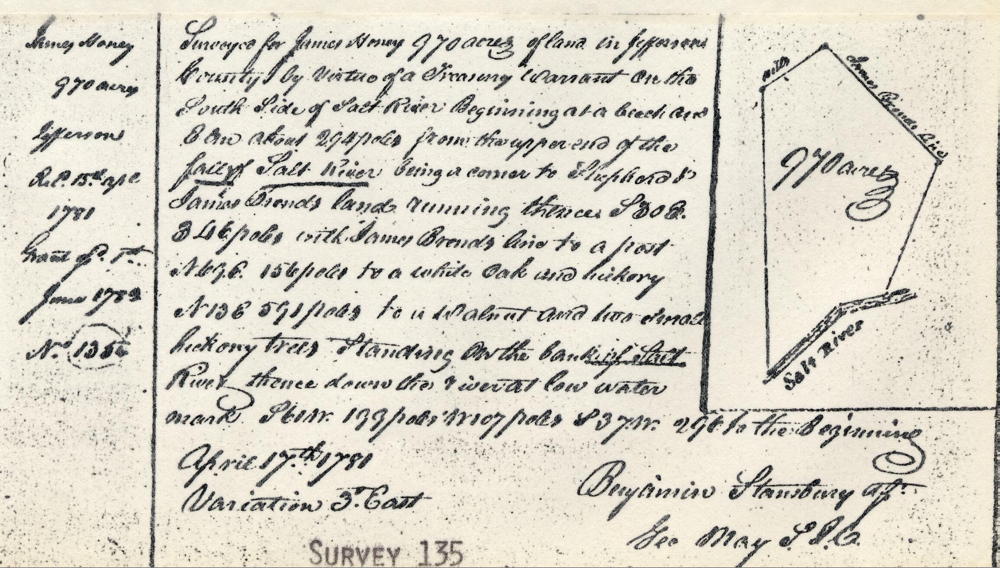
Survey
Surveyed for James Honey 970 acres of land in Jefferson County by virtue of a treasury warrant on the south side of Salt River, Beginning at a beech and elm about 294 poles from the upper end of the Fall of Salt River being a corner to Shepherd & James Brend's land, running thence S 30 E 346 poles with James Brend's line to a post, N 69 E 156 to a white oak and hickory N 13 E 591 poles to walnut and two small hickory trees standing on the bank of Salt River, thence down the river at low water mark S 60 W 199 poles, W 107 poles, S 37 W 296 to the beginning. April 17th, 1781. Variation 3 degrees East. (signed) Benjamin Stansbury, Assistant Surveyor
Deed
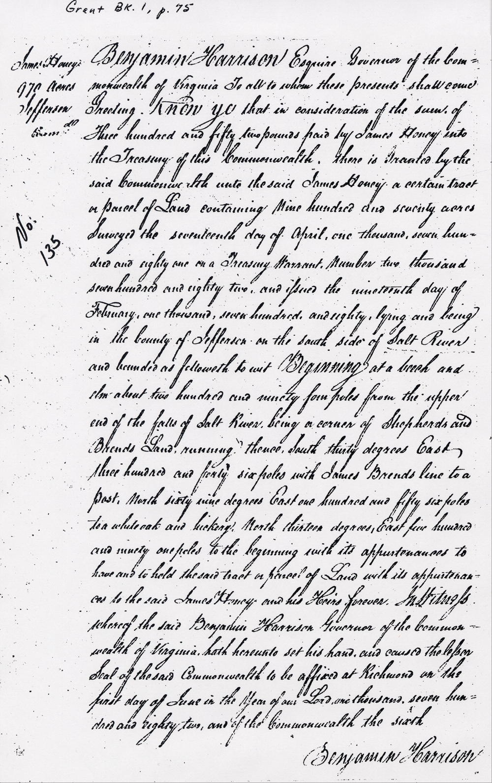
Virginia Grant Book 1, page 75
Benjamin Harrison Esquire, Governor of the Commonwealth of Virginia, to all to whom these presents shall come, greeting. Know ye that in consideration of the sum of three hundred and fifty two pounds paid by James Honey into the treasury of this Commonwealth there is granted by the said Commonwealth unto the said James Honey a certain tract or parcel of land containing nine hundred and seventy acres surveyed the seventeenth day of April, one thousand seven hundred and eighty one on a treasury warrant number two thousand seven hundred and eighty two, and issued the nineteenth day of February, one thousand seven hundred and eighty, lying and being in the County of Jefferson on the south side of Salt River and bounded as followeth, to wit. Beginning at a beech and elm about two hundred and ninety four poles from the upper end of the falls of Salt River, being a corner of Shepherds and Brends land running thence South thirty degrees East three hundred and forty six poles with James Brends line to a post, North sixty nine degrees East one hundred and fifty six poles to a white oak and hickory, North thirteen degrees East five hundred and ninety one poles to the beginning with its appurtenances to have and to hold the said tract or parcel of land with its appurtenances to the said James Honey and his heirs forever. In witness whereof the said Benjamin Harrison, Governor of the Commonwealth of Virginia, hath hereunto set his hand and caused the lesser seal of the said Commonwealth to be affixed at Richmond on the first day of June in the year of our Lord one thousand seven hundred and eighty two, and of the Commonwealth the sixth. (signed) Benjamin Harrison
If you, the reader, have an interest in any particular part of our county history, and wish to contribute to this effort, use the form on our Contact Us page to send us your comments about this, or any Bullitt County History page. We welcome your comments and suggestions. If you feel that we have misspoken at any point, please feel free to point this out to us.
The Bullitt County History Museum, a service of the Bullitt County Genealogical Society, is located in the county courthouse at 300 South Buckman Street (Highway 61) in Shepherdsville, Kentucky. The museum, along with its research room, is open 10 a.m. to 4 p.m. Monday through Friday. Saturday appointments are available by calling 502-921-0161 during our regular weekday hours. Admission is free. The museum, as part of the Bullitt County Genealogical Society, is a 501(c)3 tax exempt organization and is classified as a 509(a)2 public charity. Contributions and bequests are deductible under section 2055, 2106, or 2522 of the Internal Revenue Code. Page last modified: 12 Sep 2024 . Page URL: bullittcountyhistory.org/bchistory/james-honey.html