
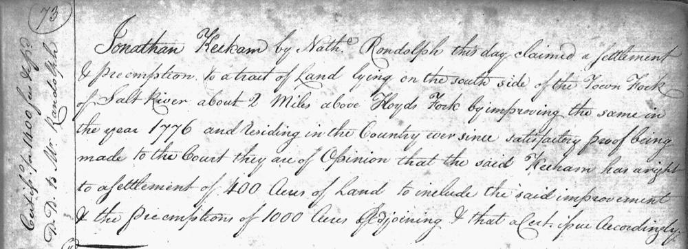
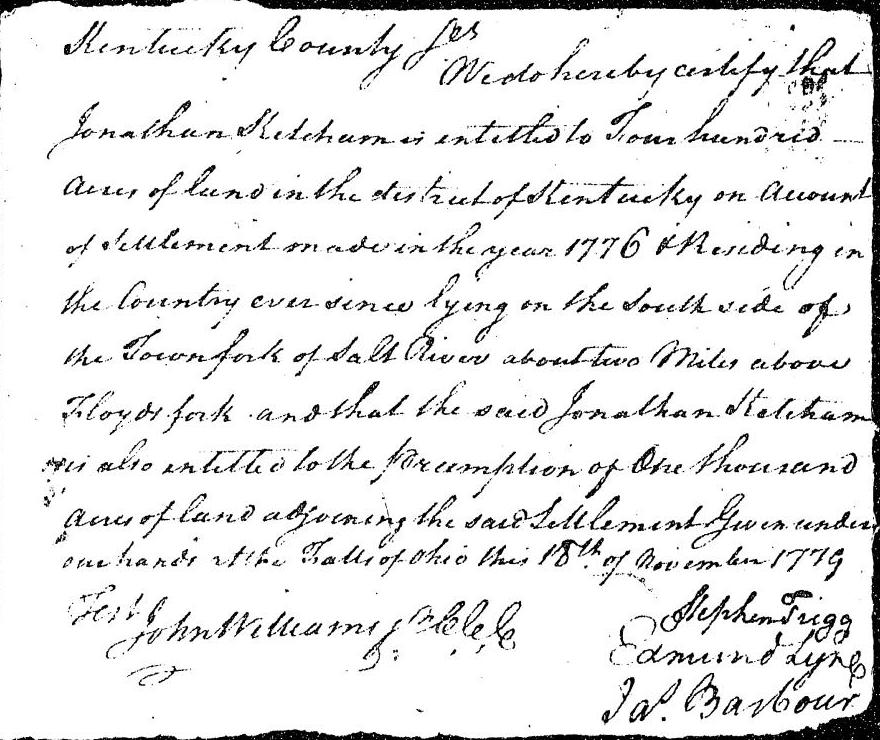
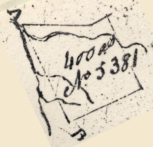
On 18 Nov 1779, Nathaniel Randolph, representing Jonathan Ketchum, appeared before the land commissioners then holding court at the Falls of the Ohio. Ketchum claimed to have made improvements in 1776 on a tract of land lying along Cedar Creek, south of the Salt River, and to have resided in the district of Kentucky since that time. Apparently the commissioners were satisfied with his proof, and granted him a settlement of 400 acres including his improvement, and gave him the right to purchase an additional 1000 acres adjoining it. This was entered in the their logbook, known as the Doomsday Book, on page 73, and issued him a certificate for the same, as shown below.
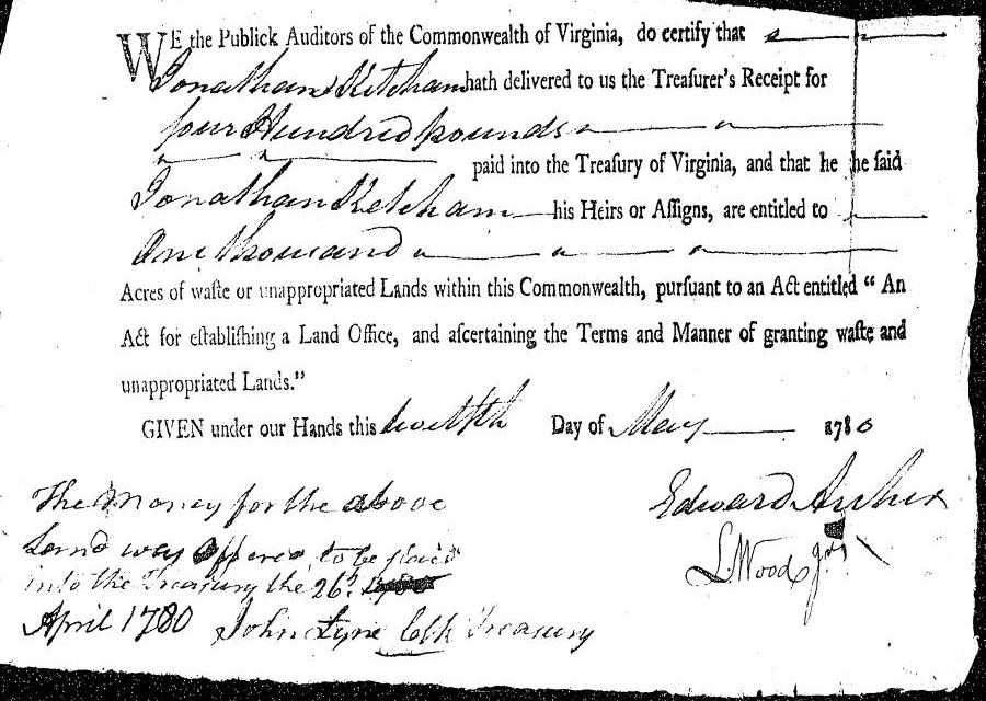
Ketchum then paid 400 pounds into the Virginia treasury on the 26th of April 1780, and received a warrant for the 1000 acres on 12 May 1780.
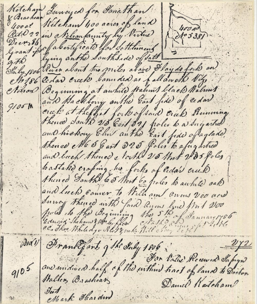
However, it was not until January 1786 that he was able to get his tracts of land surveyed, as shown below.
Surveys
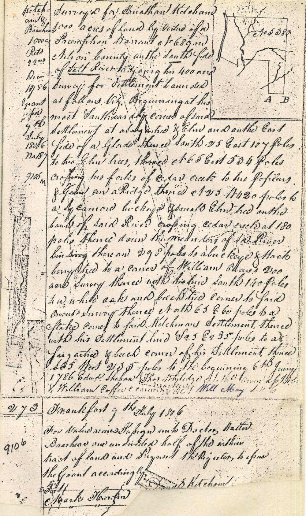
Surveyed for Jonathan Kitcham 400 acres of land in Nelson County by virtue of a certificate for settlement lying on the south side of Salt River about two miles above Floyd's Fork on Cedar Creek, bounded as followeth, viz, Beginning at a white walnut, black walnut and hackberry on the east side of Cedar Creek at the first fork of said creek, running thence South 25° East 321 poles to a sugar tree and elm on the east side of a glade, thence North 65° East 235 poles to a sugar tree and beech, thence North 25° West 235 poles to a stake crossing two forks of Cedar Creek, thence South 65° West 60 poles to a white oak and beech, corner to William Owens' 200 acre survey, thence with said Owens' line West 200 poles to the beginning the 5th of January 1786. Nathaniel Owen, surveyor. Edward Shehan & William Coffer, chain carriers. Thomas Whitledge, marker.
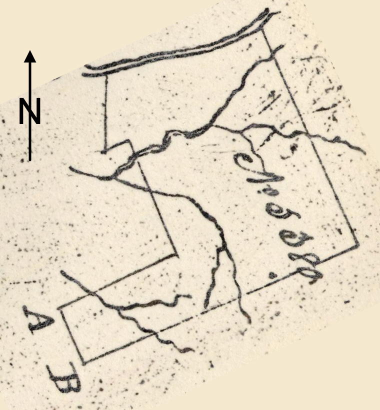
Surveyed for Jonathan Ketcham 1000 acres of land by virtue of a preemption warrant No. 679 in Nelson County on the south side of Salt River adjoining his 400 acre survey for settlement bounded as follows, viz. Beginning at his most southwardly corner of said settlement at a sugar tree and elm, and on the east side of a glade, thence South 25° East 107 poles to two elm trees, thence North 65° East 534 poles crossing two forks of Cedar Creek to two poplars & .. on a ridge, thence North 25° West 420 poles to a sycamore, buckeye & small elm tree on the bank of said river, crossing Cedar Creek at 180 poles, thence down the meanders of said river binding thereon 298 poles to a buckeye & hackberry tree to a corner of William Owens' 200 acre survey, thence with his line South 140 poles to a white oak and beech tree corner to said Owens' survey, thence North 65° East 60 poles to a stake, corner to said Ketchman's settlement, thence with his settlement line South 25° East 235 poles to a sugar tree & beech corner of his settlement, thence South 65° West 235 poles to the beginning. 6th January 1786. Nathaniel Owen, surveyor. Edward Shehan & William Coffer, chain carriers. Thomas Whitledge, marker.
Jonathan Ketchum apparently died before he was able to obtain a deed to his land, and it was 9 Jul 1806 before Daniel Ketchum, Jonathan's heir at law, was able to do so. By this time, Daniel had made an arrangement with Doctor Walter Brashear to share ownership in the 1400 acres, for it was deeded in both their names. The arrangement with Brashear was noted on the original surveys. The two deeds are shown below.
Deeds
Kentucky Grant Book 2, pages 195-196
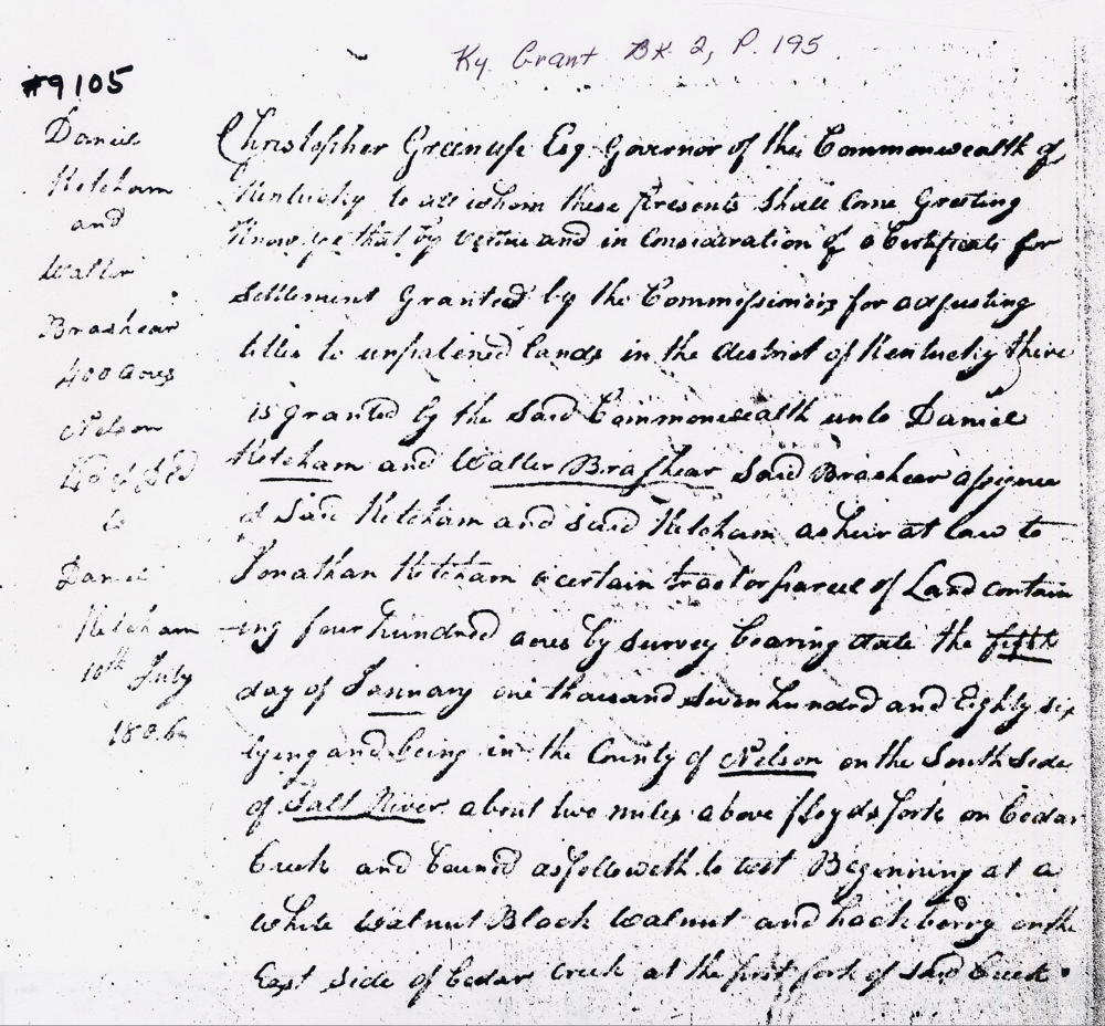
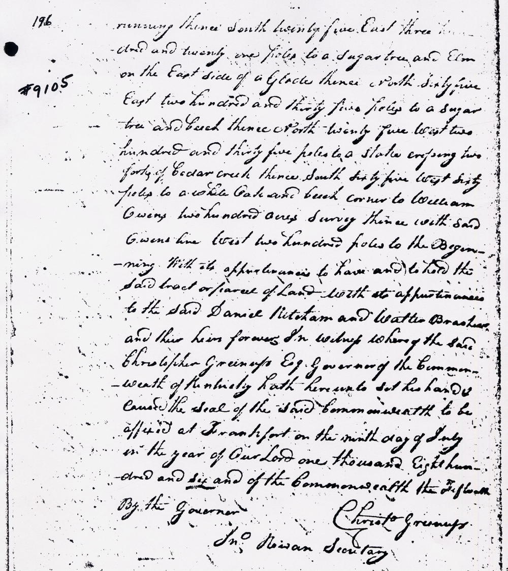
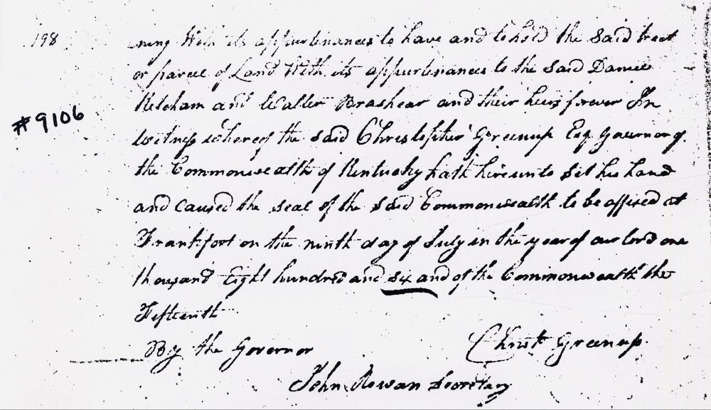
Christopher Greenup Esquire, Governor of the Commonwealth of Kentucky, to all whom these presents shall come, greeting. Know ye that by virtue and in consideration of a certificate for settlement granted by the commissioners for adjusting titles to unpatented lands in the district of Kentucky, there is granted by the said Commonwealth unto Daniel Ketcham and Walter Brashear, said Brashear assignee of said Ketcham and said Ketcham heir at law to Jonathan Ketcham, a certain tract or parcel of land containing 400 acres by survey bearing date the 5th day of January 1786, lying and being in the county of Nelson on the south side of Salt River about two miles above Floyd's Fork on Cedar Creek and bounded as followeth, to wit. Beginning at a white walnut, black walnut and hackberry on the east side of Cedar Creek at the first fork of said creek, running thence South 25° East 321 poles to a sugar tree and elm on the east side of a glade, thence North 65° East 235 poles to a sugar tree and beech, thence North 25° West 235 poles to a stake crossing two forks of Cedar Creek, thence South 65° West 60 poles to a white oak and beech, corner to William Owens' 200 acre survey, thence with said Owens' line West 200 poles to the beginning with its appurtenances to have and to hold the said tract or parcel of land with its appurtenances to the said Daniel Ketcham and Walter Brashear and their heirs forever. In witness whereof the said Christopher Greenup Esquire, Governor of the Commonwealth of Kentucky, hath hereunto set his hand and caused the seal of the said Commonwealth to be affixed at Frankfort on the 9th day of July in the year of our Lord 1806, and of the Commonwealth the 15th. (signed) Christopher Greenup.
Kentucky Grant Book 2, pages 197-198
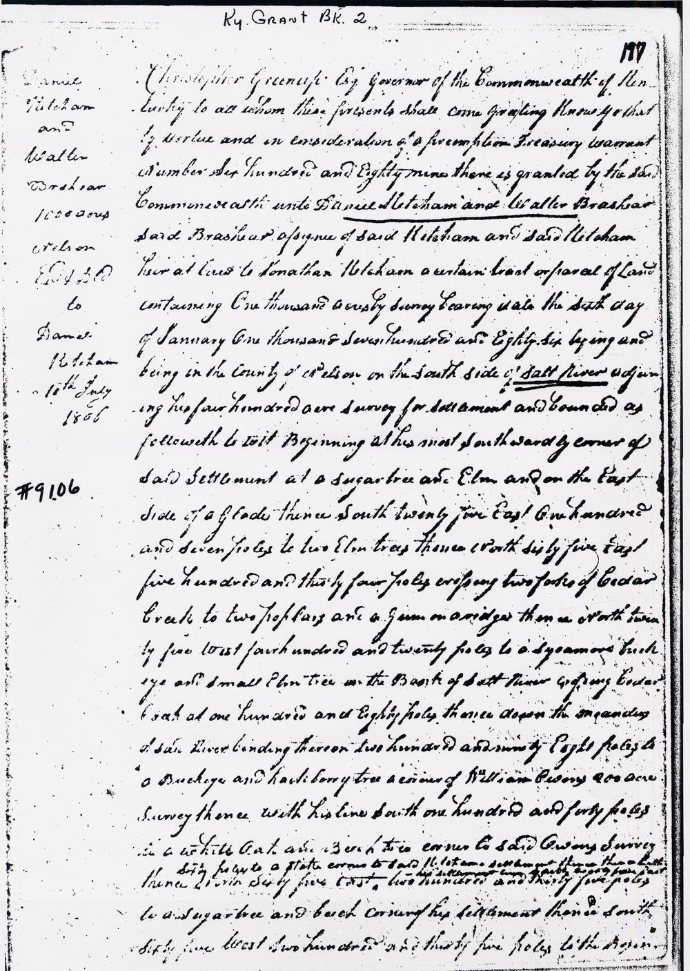
Christopher Greenup Esquire, Governor of the Commonwealth of Kentucky, to all whom these presents shall come, greeting. Know ye that by virtue and in consideration of a preemption treasury warrant number 689 there is granted by the said Commonwealth unto Daniel Ketcham and Walter Brashear, said Brashear assignee of said Ketcham and said Ketcham heir at law to Jonathan Ketcham, a certain tract or parcel of land containing 1000 acres by survey bearing date the 6th day of January 1786, lying and being in the county of Nelson on the south side of Salt River adjoining his 400 acre survey for settlement and bounded as followeth, to wit. Beginning at his most southwardly corner of said settlement at a sugar tree and elm, and on the east side of a glade, thence South 25° East 107 poles to two elm trees, thence North 65° East 534 poles crossing two forks of Cedar Creek to two poplars & a .. on a ridge, thence North 25° West 420 poles to a sycamore, buckeye & small elm tree on the bank of said river, crossing Cedar Creek at 180 poles, thence down the meanders of said river binding thereon 298 poles to a buckeye & hackberry tree to a corner of William Owens' 200 acre survey, thence with his line South 140 poles to a white oak and beech tree corner to said Owens' survey, thence North 65° East 60 poles to a stake, corner to said Ketchman's settlement, thence with his settlement line South 25° East 235 poles to a sugar tree & beech corner of his settlement, thence South 65° West 235 poles to the beginning with its appurtenances to have and to hold the said tract or parcel of land with its appurtenances to the said Daniel Ketcham and Walter Brashear and their heirs forever. In witness whereof the said Christopher Greenup Esquire, Governor of the Commonwealth of Kentucky, hath hereunto set his hand and caused the seal of the said Commonwealth to be affixed at Frankfort on the 9th day of July in the year of our Lord 1806, and of the Commonwealth the 15th. (signed) Christopher Greenup.
We have rotated the tract drawings for both tracts to orient them appropriately. They are not drawn to scale, but you should be able to see how they are joined together.
If you, the reader, have an interest in any particular part of our county history, and wish to contribute to this effort, use the form on our Contact Us page to send us your comments about this, or any Bullitt County History page. We welcome your comments and suggestions. If you feel that we have misspoken at any point, please feel free to point this out to us.
The Bullitt County History Museum, a service of the Bullitt County Genealogical Society, is located in the county courthouse at 300 South Buckman Street (Highway 61) in Shepherdsville, Kentucky. The museum, along with its research room, is open 10 a.m. to 4 p.m. Monday through Friday. Saturday appointments are available by calling 502-921-0161 during our regular weekday hours. Admission is free. The museum, as part of the Bullitt County Genealogical Society, is a 501(c)3 tax exempt organization and is classified as a 509(a)2 public charity. Contributions and bequests are deductible under section 2055, 2106, or 2522 of the Internal Revenue Code. Page last modified: 21 Apr 2026 . Page URL: bullittcountyhistory.org/bchistory/9105-ketchum.html