
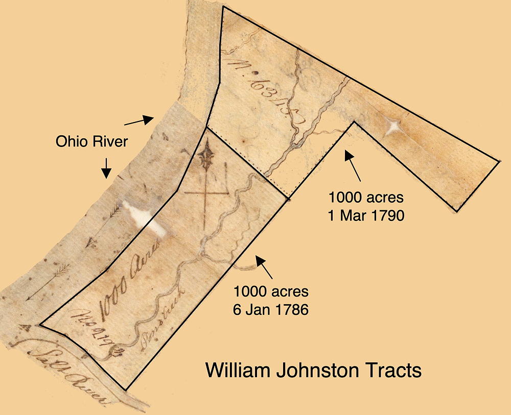
This is the second of two 1000 acre tracts patented to William Johnston as shown on this drawing. The tracts adjoined and lay along the Ohio River in what would later be parts of Jefferson and Bullitt Counties.
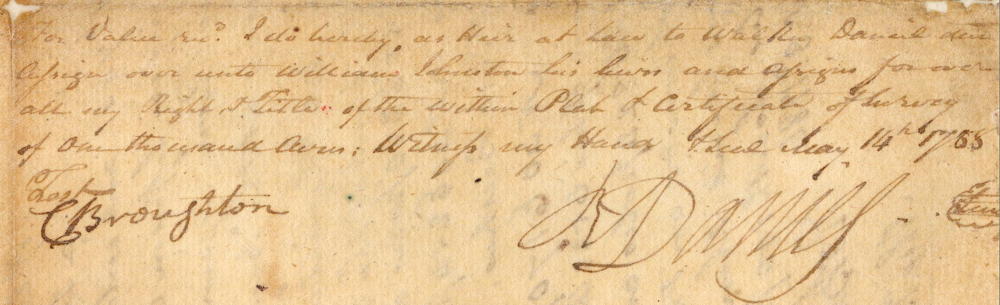
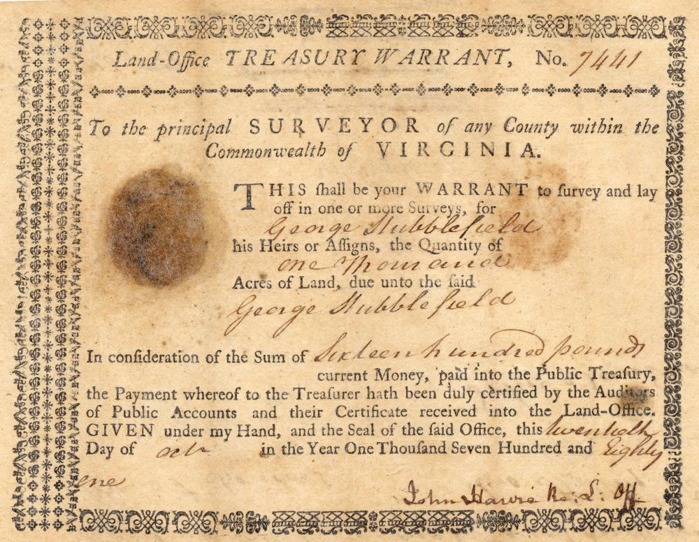
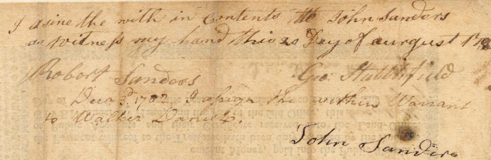
Using a treasury warrant in the name of George Hubblefield for 1000 acres that had been transferred first to John Sanders, and then to Walter Daniel, Robert Daniel, heir at law to the deceased Walker Daniel, hired Robert Breckinridge to survey 1000 acres located on the Ohio River, and including part of the waters of Pond Creek. The survey was completed on 3 Nov 1786. Then on 14 May 1788, Robert Daniel assigned the surveyed land to William Johnston who received a deed for it on 1 Mar 1790.
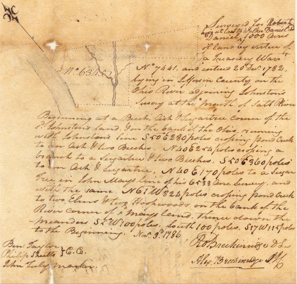
Survey
Surveyed for Robert Daniel, heir in law to Walker Daniel deceased, 1000 acres of land by virtue of a treasury warrant No. 7441 and entered 20 Dec 1782, lying in Jefferson County on the Ohio River adjoining Johnston's survey at the mouth of Salt River. Beginning at a beech, ash, and sugar tree corner of the said Johnston's land & on the bank of the Ohio, running with Johnston's line S 50° E 280 poles crossing Pond Creek to an ash & two beeches, N 40° E 254 poles crossing a branch to a sugar tree & two beeches, S 50° E 360 poles to an ash & sugar tree, N 40° E 170 poles to a sugar tree in John May's line of his 6522 acre survey and with the same N 61° W 824 poles crossing Pond Creek to two elms & two hoopwoods on the bank of the river, corner of said May's land, thence down the meanders S 5° W 100 poles, South 100 poles, S 17° W 115 poles to the beginning. Nov. 3rd 1786. Robert Breckinridge, surveyor. Ben Taylor & Philip Shults, chain carriers. John Tuley, marker.
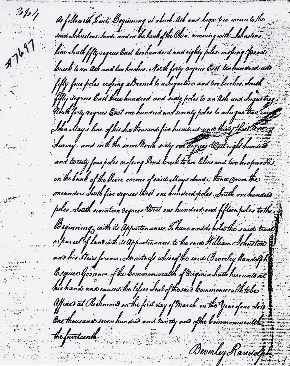
Deed
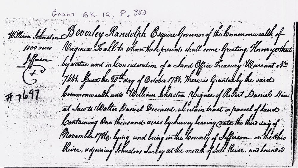
Virginia Grant Book 12, pages 383-4
Beverly Randolph Esquire, governor of the Commonwealth of Virginia, to all to whom these presents shall come, greeting. Know ye that by virtue and in consideration of a land office treasury warrant number 7441 issued the 20th day of October 1784, there is granted by the said Commonwealth unto William Johnston, assignee of Robert Daniel heir at law to Walter Daniel deceased, a certain tract or parcel of land containing 1000 acres by survey bearing date the third day of November 1786, lying and being in the county of Jefferson on the Ohio River adjoining Johnston's survey at the mouth of Salt River and bounded as followeth, to wit. Beginning at a beech, ash, and sugar tree corner to the said Johnston's land & on the bank of the Ohio, running with Johnston's line South 50° East 280 poles crossing Pond Creek to an ash & two beeches, North 40° East 254 poles crossing a branch to a sugar tree & two beeches, South 50° East 360 poles to an ash & sugar tree, North 40° East 170 poles to a sugar tree in John May's line of his 6533 acre survey and with the same North 61° West 824 poles crossing Pond Creek to two elms & two hoopwoods on the bank of the river, corner of said May's land, thence down the meanders South 5° West 100 poles, South 100 poles, South 17° West 115 poles to the beginning with its appurtenances to have and to hold the said tract or parcel of land with its appurtenances to the said William Johnston and his heirs forever. In witness whereof the said Beverly Randolph Esquire, Governor of the Commonwealth of Virginia hath hereunto set his hand and caused the lesser seal of the said Commonwealth to be affixed at Richmond on the first day of March in the year of our Lord 1790, and of the Commonwealth the 14th. (signed) Beverly Randolph
Warrant
If you, the reader, have an interest in any particular part of our county history, and wish to contribute to this effort, use the form on our Contact Us page to send us your comments about this, or any Bullitt County History page. We welcome your comments and suggestions. If you feel that we have misspoken at any point, please feel free to point this out to us.
The Bullitt County History Museum, a service of the Bullitt County Genealogical Society, is located in the county courthouse at 300 South Buckman Street (Highway 61) in Shepherdsville, Kentucky. The museum, along with its research room, is open 10 a.m. to 4 p.m. Monday through Friday. Saturday appointments are available by calling 502-921-0161 during our regular weekday hours. Admission is free. The museum, as part of the Bullitt County Genealogical Society, is a 501(c)3 tax exempt organization and is classified as a 509(a)2 public charity. Contributions and bequests are deductible under section 2055, 2106, or 2522 of the Internal Revenue Code. Page last modified: 21 Apr 2026 . Page URL: bullittcountyhistory.org/bchistory/7697-johnston.html