
On 18 Sep 1798, James Shanks surveys this small tract that lay north of Salt River and east of Floyd's Fork for Ben Pope who then assigned it to Joseph Ridgway as shown below. Ridgway then obtained his deed to the land on 5 Jun 1799.
Survey
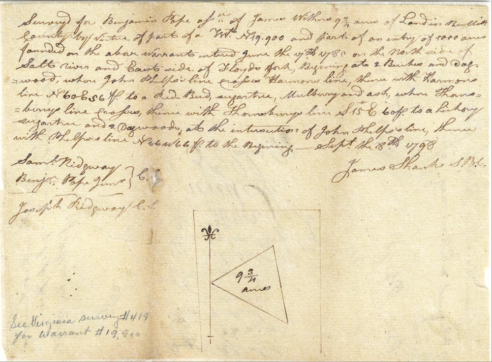
Surveyed for Benjamin Pope, assignee of James Withers, 9 3/4 acres of land in Bullitt County by virtue of part of a treasury warrant No. 19900, and part of an entry of 1000 acres founded on the above warrants entered June the 17th 1780 on the north side of Salt River and east side of Floyd's Fork.
Beginning at two beeches and dogwood where John Philips' line crosses Harmon's line, thence with Harmon's line North 60° East 56 poles to a redbud, sugar tree, mulberry and oak where Thornberry's line crosses, thence with Thornberry's line South 15° East 60 poles to a hickory, sugar tree and two dogwoods at the intersection of John Philips' line, thence with Philips' line North 66° West 66 poles to the beginning. September the 18th 1798. James Shanks, S.B.C.
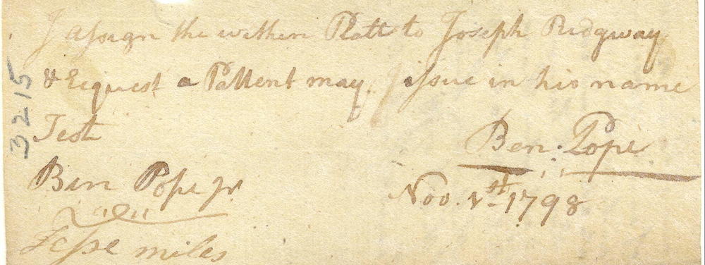
I assign the within plat to Joseph Ridgway and request a patent may issue in his name. (signed) Ben Pope, November 1, 1798.
Deed
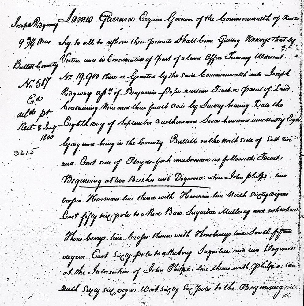
James Garrard Esquire, Governor of the Commonwealth of Kentucky, to all to whom these presents shall come, greeting. Know ye that by virtue and in consideration of part of a land office treasury warrant No. 19900 there is granted by the said Commonwealth unto Joseph Ridgway, assignee of Benjamin Pope a certain tract or parcel of land containing nine and three-fourth acres by survey bearing date the eighth day of September 1798, lying and being in the county of Bullitt on the north side of Salt River and east side of Floyd's Fork and bounded as followeth, to wit.
Beginning at two beeches and dogwood where John Philips' line crosses Harman's line, thence with Harman's line North 60° East 56 poles to a redbud, sugar tree, mulberry and oak where Thornberry's line crosses, thence with Thornberry's line South 15° East 60 poles to a hickory, sugar tree and two dogwoods at the intersection of John Philips' line, thence with Philips' line North 66° West 66 poles to the beginning with its appurtenances.
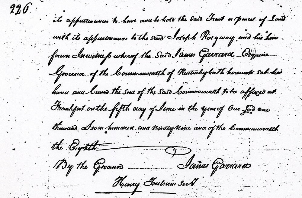
To have and to hold the said tract or parcel of land with its appurtenances to the said Joseph Ridgway and his heirs forever. In witness whereof the said James Garrard Esquire, Governor of the Commonwealth of Kentucky hath hereunto set his hand and caused the seal of the said Commonwealth to be affixed at Frankfort on the fifth day of June in the year of our Lord 1799, and of the Commonwealth the eighth. (signed) James Garrard
If you, the reader, have an interest in any particular part of our county history, and wish to contribute to this effort, use the form on our Contact Us page to send us your comments about this, or any Bullitt County History page. We welcome your comments and suggestions. If you feel that we have misspoken at any point, please feel free to point this out to us.
The Bullitt County History Museum, a service of the Bullitt County Genealogical Society, is located in the county courthouse at 300 South Buckman Street (Highway 61) in Shepherdsville, Kentucky. The museum, along with its research room, is open 10 a.m. to 4 p.m. Monday through Friday. Saturday appointments are available by calling 502-921-0161 during our regular weekday hours. Admission is free. The museum, as part of the Bullitt County Genealogical Society, is a 501(c)3 tax exempt organization and is classified as a 509(a)2 public charity. Contributions and bequests are deductible under section 2055, 2106, or 2522 of the Internal Revenue Code. Page last modified: 16 Apr 2024 . Page URL: bullittcountyhistory.org/bchistory/ok3215-ridgway.html