
James Shanks surveyed this tract of land for Abraham Hite on 18 Nov 1797, and Hite received his deed to the land on 11 Feb 1799. It was located at the southeast juncture of Rolling Fork and Salt River.
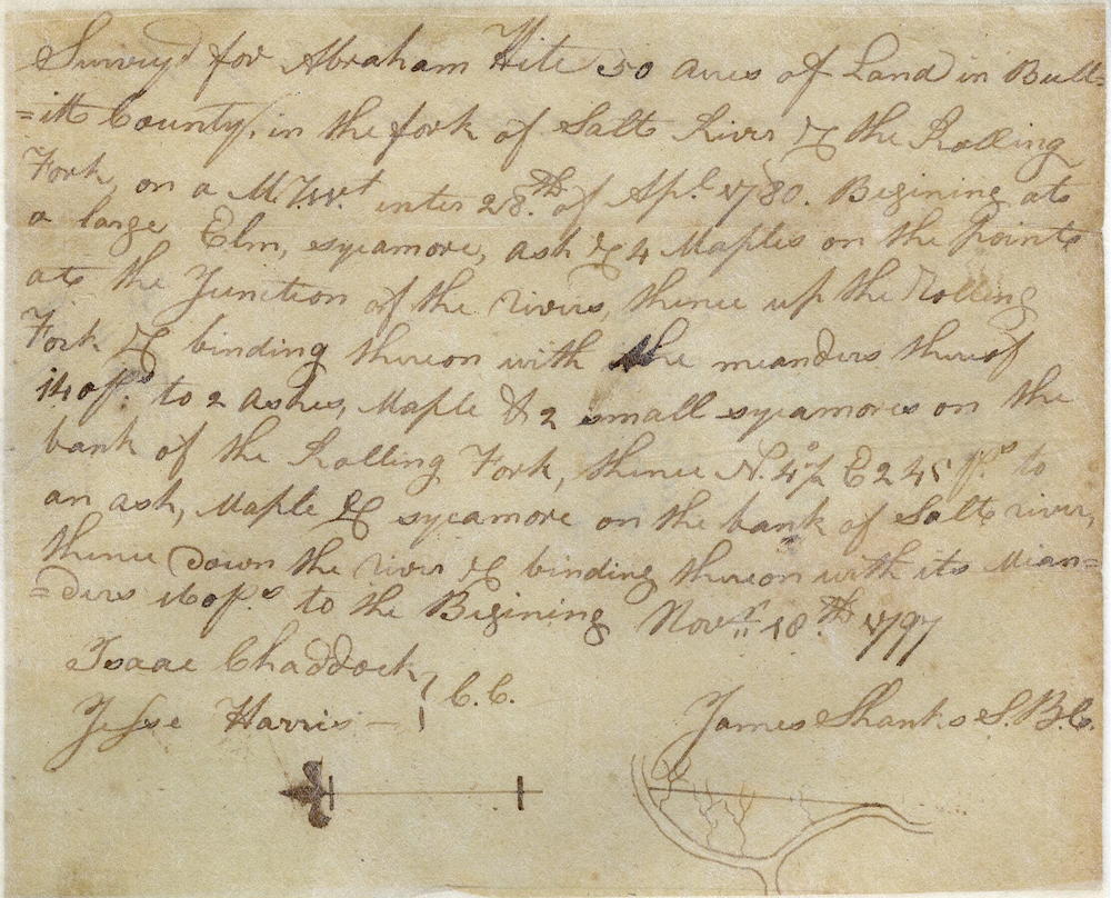
Survey
Surveyed for Abraham Hite 50 acres of land in Bullitt County in the fork of Salt River and the Rolling Fork on a military warrant entered 18th of April 1780. Beginning at a large elm, sycamore, ash and 4 maples on the point at the junction of the rivers, thence up the Rolling Fork and binding thereon with the meanders thereof 140 poles to 2 ashes, maple and 2 small sycamores on the bank of the Rolling Fork, thence North 4 1/2° East 245 poles to an ash, maple and sycamore on the bank of Salt River, thence down the river and binding thereon with its meanders 160 poles to the beginning. November 18th 1797. James Shanks, S.B.C.
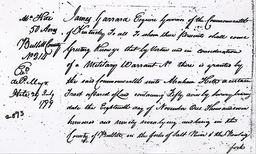
Deed
James Garrard Esquire, Governor of the Commonwealth of Kentucky, to all to whom these presents shall come, greeting. Know ye that by virtue and in consideration of a military warrant No. __ there is granted by the said Commonwealth unto Abraham Hite a certain tract or parcel of land containing fifty acres by survey bearing date the 18th day of November 1797 lying and being in the County of Bullitt in the forks of Salt River and the Rolling Fork and bounded as followeth, to wit.
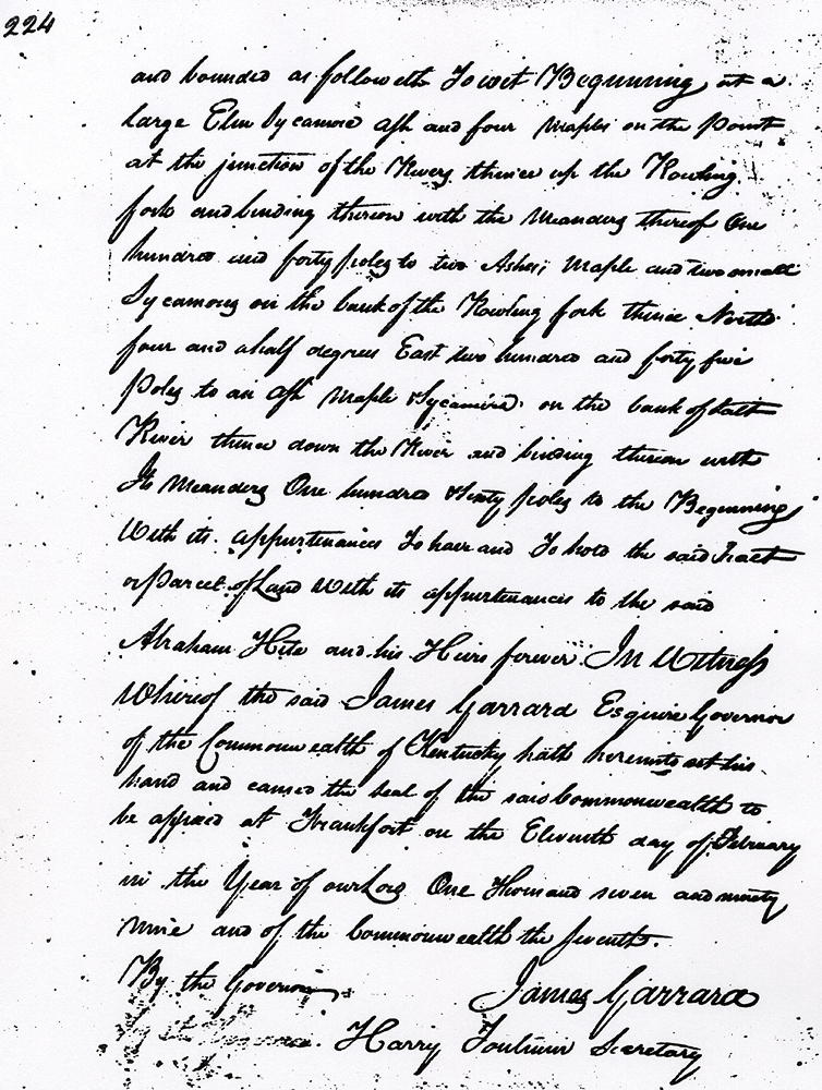
Beginning at a large elm, sycamore, ash and four maples on the point at the junction of the rivers, thence up the Rolling Fork and binding thereon with the meanders thereof 140 poles to two ashes, maple and two small sycamores on the bank of the Rolling Fork, thence North 4 1/2° East 245 poles to an ash, maple and sycamore on the bank of Salt River, thence down the river and binding thereon with its meanders 160 poles to the beginning with its appurtenances.
To have and to hold the said tract or parcel of land with its appurtenances to the said Abraham Hite and his heirs forever. In witness whereof the said James Garrard Esquire, Governor of the Commonwealth of Kentucky, hath hereunto set his hand and caused the seal of the said Commonwealth to be affixed at Frankfort on the 11th day of February in the year of our Lord 1799, and of the Commonwealth the seventh. (signed) James Garrard
If you, the reader, have an interest in any particular part of our county history, and wish to contribute to this effort, use the form on our Contact Us page to send us your comments about this, or any Bullitt County History page. We welcome your comments and suggestions. If you feel that we have misspoken at any point, please feel free to point this out to us.
The Bullitt County History Museum, a service of the Bullitt County Genealogical Society, is located in the county courthouse at 300 South Buckman Street (Highway 61) in Shepherdsville, Kentucky. The museum, along with its research room, is open 10 a.m. to 4 p.m. Monday through Friday. Saturday appointments are available by calling 502-921-0161 during our regular weekday hours. Admission is free. The museum, as part of the Bullitt County Genealogical Society, is a 501(c)3 tax exempt organization and is classified as a 509(a)2 public charity. Contributions and bequests are deductible under section 2055, 2106, or 2522 of the Internal Revenue Code. Page last modified: 12 Apr 2024 . Page URL: bullittcountyhistory.org/bchistory/ok2893-hite.html